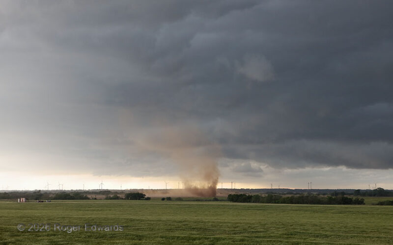
[Part 1 of 3] Blustery cold outflow surged across the plains, generating extra wind power in the background and a gustnado about a quarter mile out into the nearest wheat field. This was a visibly multiple-vortex circulation too, fairly intense for what it was, and probably capable of minor damage such as thrown light objects and removed siding or shingles. Yet even if it had done damage, it … [Read more...]
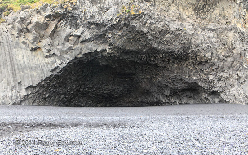
Halsanefshellir Basalt Cave
This photo cannot be taken anymore. In its accessible times, including 2014 when we were there, the legendary cave along Iceland's stunning southern coastline was far enough above the low-tide line to be accessible freely for most of most days, and even parts of others when wave action was high. Since, a combination of rockfalls and severe beach erosion have removed safe access, with ocean water … [Read more...]
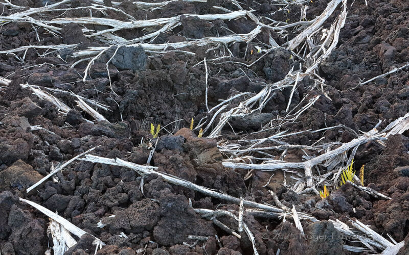
2018 East Rift Skeletons
Seven and a half years before, the last Kilauea East Rift eruption flushed the summit crater's magma toilet empty, and blew the downhill plumbing open at Leilani Estates. Weeks of resulting lava flows obliterated the eastern part of that settlement, and traveled east and southeast to the sea. This was the westernmost arm of those flows, a river of a'a lava that mowed down and torched the forest … [Read more...]
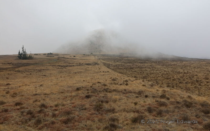
Fog Enshrouding Cinder Cone
The scene could be from northeastern New Mexico, or imaginations of fictional Middle Earth's drylands. Quite the contrast it always is, when fog rolls over semidesert scrubland. Magnify the notion when realizing this is on the tropical island of Hawaii. The landscape lies just over the ridge from the "wet side" facing the northeasterly tradewinds; however, on this day, south-southwest flow … [Read more...]
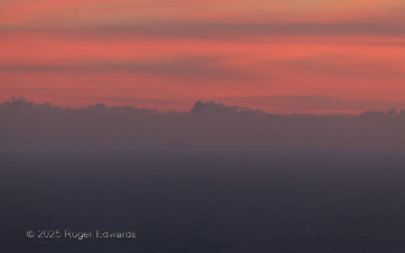
Colors of the Central Pacific
While driving up the Pali on Chain of Craters Road, after hiking around the coastal petroglyphs, a magical patch of the post-sunset sky popped into my peripheral vision, as if a thumbnail previewing a broadcast from a dreamscape. Beauty like this compels stopping and appreciation...and shooting! So many of my favorite skies are unplanned and opportunistic like that. From about a thousand feet … [Read more...]
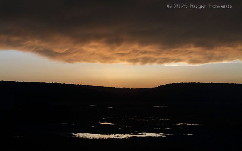
Mammatus over Oklahoma Hills
Under the very western edge of a large thunderstorm complex we had tangled with from different angles, a strip of mammatus finally came into view in the last possible sunset light. The understated, even slightly spooky scene unfolded for just a minute before puddle-strewn valley fields, then all the color vanished into the deepening night. 2 WSW Cabaniss OK (19 May 25) Looking NW 34.93 … [Read more...]
- « Previous Page
- 1
- 2
- 3
- 4
- 5
- 6
- …
- 418
- Next Page »