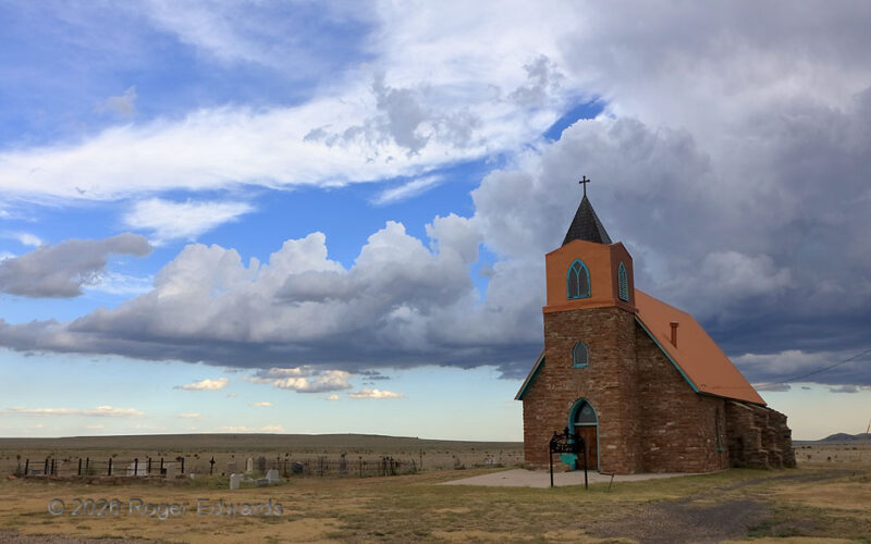
Where history, reverence, and beautiful sky converge, a moment in time arises like none other. That was true on this last day of my 2026 spring chase season in the old town of Bueyeros (“Ox Drivers” in Spanish), as a multicell storm with a pronounced flanking line built behind the 1894 Sacred Heart Catholic Church. Each substantial tower in the flanking line, from tip to storm, extended a little … [Read more...]
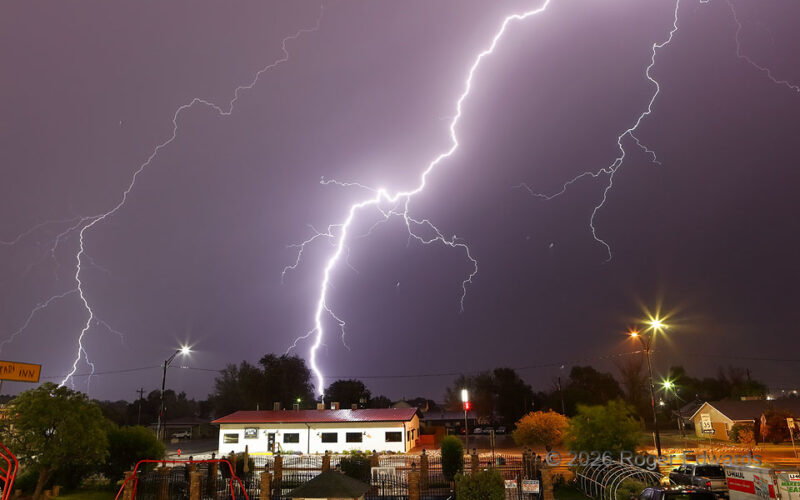
Lighting up Limon
Loudly rousing residents from restful slumber, a nearly hourlong barrage of wickedly bright, close lightning slammed down upon the High Plains town of Limon without mercy nor favor, courtesy of merging thunderstorms. The electrical attacks came in waves without any full intermission. On a few occasions, nearly simultaneous explosions of light and sound sent even hardcore storm observers diving … [Read more...]
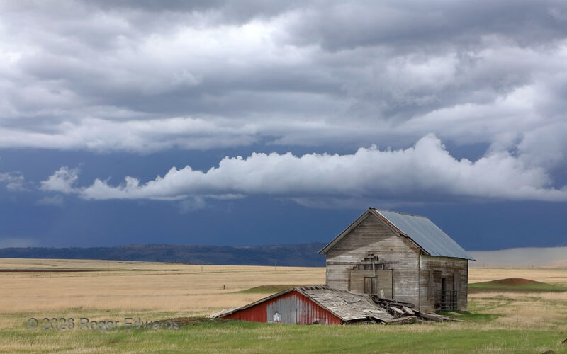
Time’s Passage on Johnson Mesa
Johnson Mesa is a remnant of the highest of the High Plains in New Mexico, occupying a tableland 8,600 ft above sea level where lava flowed into and solidified in a former valley of the "Dry" Cimarron River about 8 million years ago. Surrounding softer deposits wore away, leaving the basalt platform as a topographic high, though not as tall as Horseshoe Mesa in the background, along the Colorado … [Read more...]
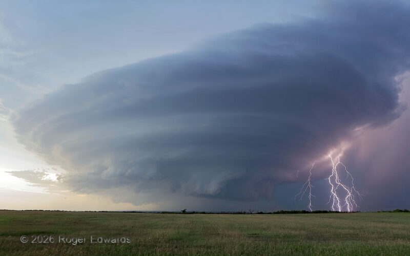
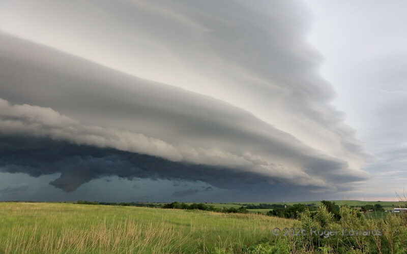
Sizzling Twilight Supercell
Power-pumping product of mergers with earlier forms of the storm, this twilight supercell churned deviantly down westernmost Oklahoma, blasting deadly electricity in any given direction. Even amid its fierce lightning barrages that sent observers scrambling back into their vehicles, the storm awed all who bore witness to its wondrously swirled form. Another storm with another wall cloud lurked … [Read more...]
Serrations over Striations
Sometimes, especially with heavy-precipitation and/or outflow-dominant storms, the most intricate and beautiful structures happen after the supercell stage. Such was true here, when a line-absorbed former supercell surged the entire complex forward, lifting layer upon layer over its cold pool in a deeply laminar, sometimes wavy pattern that still was convective down low. But for this storm’s … [Read more...]
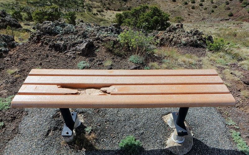
Lightning Damage to Plastic-Lumber Bench
High upon the hiking trail overlooking Capulin's volcanic crater, a plastic-lumber bench sits partly busted and melted by a lightning flash. Fortunately, no one was sitting there at the time. The damage has been left alone by park personnel, with nearby interpretive sign using this event to advise of lightning safety on the mountain. Aside from the obvious scar on one of the boards, the … [Read more...]
- 1
- 2
- 3
- …
- 418
- Next Page »