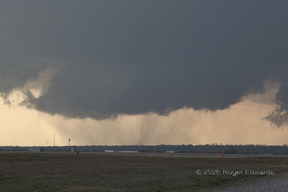
The OKC supercell of March 2026 had a broad and elongated cloud base, but no consistent and persistent areas of tight low-level cyclonic rotation. Instead, it kept cycling transient, small, moderate, fairly short-lived cyclonic-shear areas. Shortly after a younger circulation to the northeast looked threatening but weakened, an old shear zone intensified slightly and redeveloped this wall cloud, also with moderate rotation. However, this too spun down with no adverse effect. The wavy column that appears to be under it actually was a precipitation shaft just behind it in the hook region. Yes, the speck below the left-middle base of the wall cloud is a helicopter: a common sight around and even under supercell bases in central Oklahoma, from local TV outlets. Amazingly, as of this writing, none yet have crashed doing this in around 40 years of such flights.
Oklahoma City OK (10 Mar 26) Looking WSW
35.3928, -97.5834