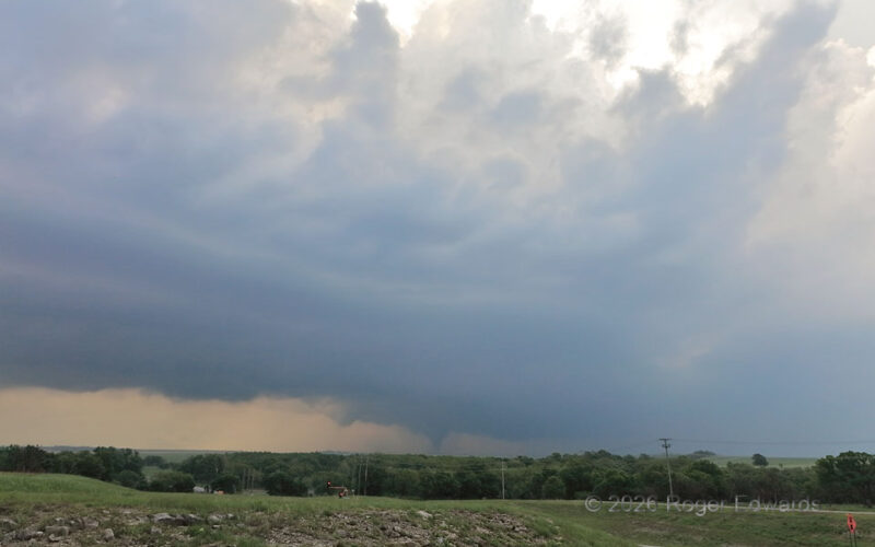
After shooting the broader view of the Shidler tornado, I switched to the zoom camera, which definitely came in handy on this day, not just for photographing the tornado, but for viewing changes in its visual structure at this distance. Here, it assumed its widest form -- a classical, tilted, thick "stovepipe" look. 2 SSE Shidler OK (26 Apr 26) Looking NNE 34.7462, -96.6524 … [Read more...]
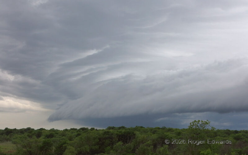
Undercutting the Anchor Storm
At the tail end of a squall line, an anchoring supercell that merged in with the line survived for a reasonably long time...until I showed up. Forthwith, the storms up the line shot out a belt of outflow, topped by a classic shelf cloud. The outflow undercut the supercell, and the entire line got messy for about an hour before backbuilding. We often see "Tail-End Charlie" storms attached to … [Read more...]
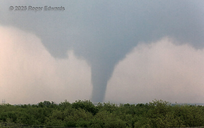
Shidler Cone and Towers
A young but mature supercell, with a large and promising updraft base, moving into progressively larger hodographs, took its sweet time to produce a tornado over the open country of the southwesternmost Flint Hills in Oklahoma. Yet finally it did, while moving into a large road void past Shidler. The mesocyclone was so strongly tilted that the tornado occurred in the main updraft, but vertcially … [Read more...]
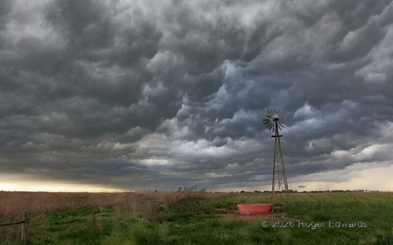
Oklahoma Outflow
After a well-organized gustnado ripped across a field a few miles to the north of here, from the same cold pool of outflow, the turbulent underbelly of the related shelf cloud, sometimes colloquially termed "whale's mouth" by storm observers, sharpened up over the darkened landscape with marvelous contrast and early golden-hour colors beginning to sift through. Fortunately, a most appropriate and … [Read more...]
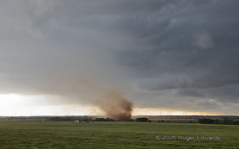
Gustnado Sequence 3
[Part 3 of 3] Within less than 30 seconds before dissipating, this gustnado assumed its broadest size, but also visibly weakened outside of one or two lingering subvortices, mainly the one now on the right edge of the dust plume. Though not as intense as a real tornado, such a vortex still contains rapid accelerations in small spaces. One would not want to try to walk through this without … [Read more...]
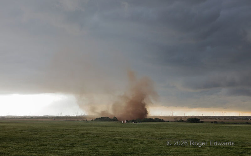
Gustnado Sequence 2
[Part 2 of 3] As the Drummond gustnado surged toward the ESE (roughly right to left), over the lifespan of about a minute, it kept a multivortex structure that was increasingly obscured in the dust from empty ground it would encounter along the edge of the wheat field. It also grew in width, while previously lofted dust tilted downshear (to the ESE, or left). This showed that, as we should … [Read more...]
- « Previous Page
- 1
- 2
- 3
- 4
- 5
- …
- 418
- Next Page »