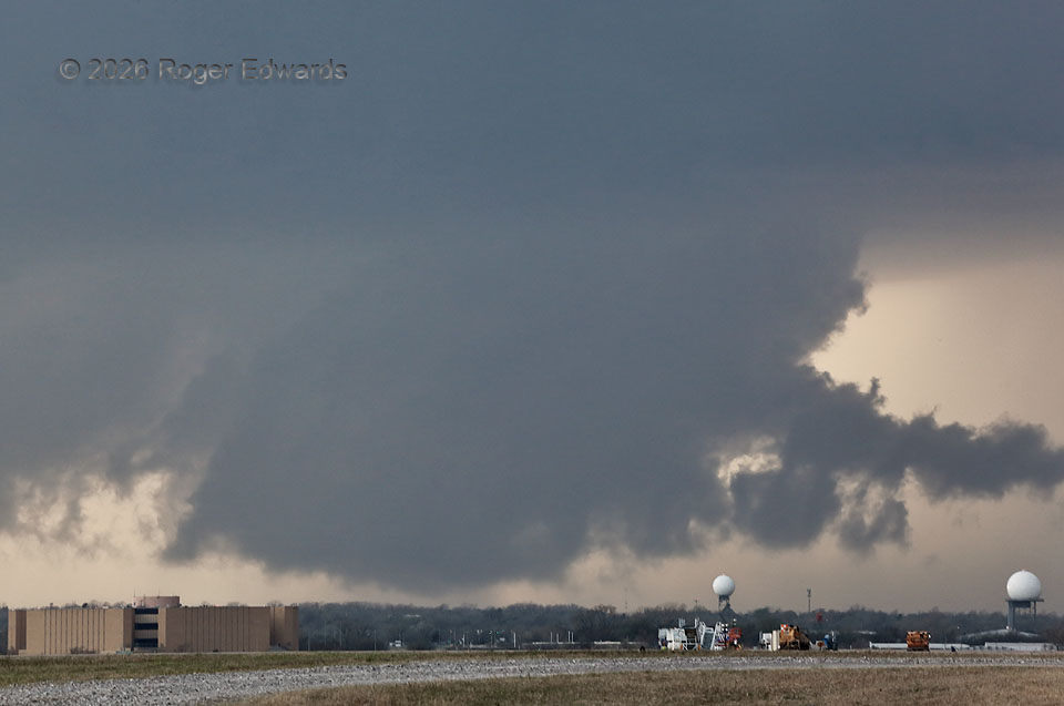
Ironically backdropping two radars — FAA units operating at OKC Will Rogers Airport — a moderately rotating wall cloud rises from very near ground level. Storm observers often call these “ground-scraping wall clouds.” No tornado was present in there, but a faint and wispy one could avoid visual detection without accessory effects such as power flashes. Monitoring this compelled some eyestrain, even looking through a zoom lens, but was necessary given the high stakes of a mesocyclone entering a heavily populated area. A streamer of rain-cooled air from the forward-flank/inflow interface streamed into the northeast side of the wall cloud, partly manifest as the tail at right. This circulation soon would weaken, while an older one just to its south-southwest temporarily tightened up again.
Oklahoma City OK (10 Mar 26) Looking WSW
35.3928, -97.5834