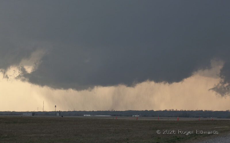
The OKC supercell of March 2026 had a broad and elongated cloud base, but no consistent and persistent areas of tight low-level cyclonic rotation. Instead, it kept cycling transient, small, moderate, fairly short-lived cyclonic-shear areas. Shortly after a younger circulation to the northeast looked threatening but weakened, an old shear zone intensified slightly and redeveloped this wall cloud, … [Read more...]
OKC “Ground Scraping” Wall Cloud
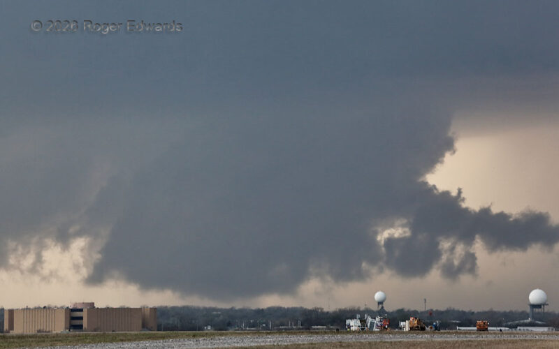
Ironically backdropping two radars -- FAA units operating at OKC Will Rogers Airport -- a moderately rotating wall cloud rises from very near ground level. Storm observers often call these "ground-scraping wall clouds." No tornado was present in there, but a faint and wispy one could avoid visual detection without accessory effects such as power flashes. Monitoring this compelled some … [Read more...]
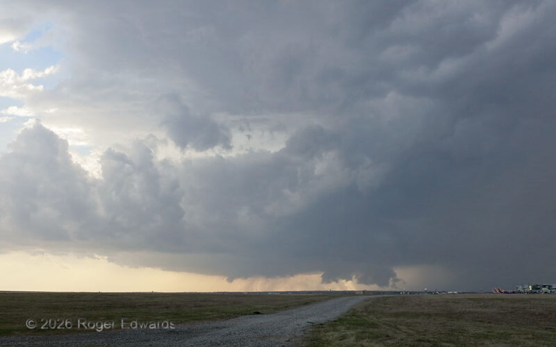
Classic Supercell near Airport
A strongly tilted, classic supercell approached Oklahoma City's airport from the southwest. The main OKC terminal is at lower far right. A Southwest Airlines plane barely beat the storm, taking off to the south (in the immediate inflow region) just a few minutes after this shot. Fortunately, it was about to circumnavigate the storm easily, based on a flight-tracking app. Fortunately, the core … [Read more...]
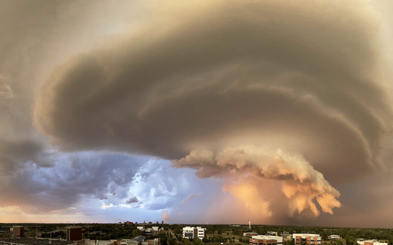
Battlestar Norman Supercell
[Click Image to Enlarge] The last storm and sunset I would see from this roof as an employee turned out to be the most striking and memorable of them all. Sweeping across the fall sunset sky from northwest to east, this astonishing supercell pulled a deep wall cloud and convection-topped rear-flank shelf through the sunset’s golden rays, presenting a scene that stunned all eyewitnesses. From up … [Read more...]
Outflow Hits Gas Flames
By the time this storm emerged again from the dust that cloaked it, outflow dominance had set in, and the supercell was surfing its own shelf cloud and gust front southeastward. [I had photographed another supercell's outflow effects from near this spot 17 years earlier.] At this moment, the associated wind shift was passing through a field of oil wells, including flaring chimneys for natural … [Read more...]
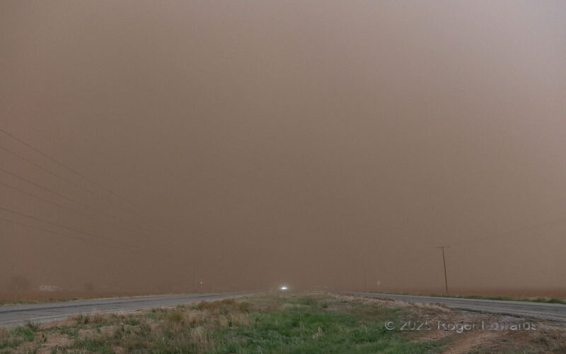
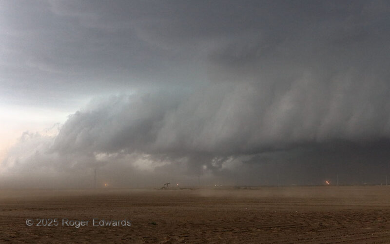
Tornadic Supercell in the Dust
See the spectacular and majestic tornadic supercell that was right down the road and moving toward us? No? Good, because we couldn't either. The only cloud we could see was the dust cloud, in roaring inflow winds lofting it from nearby dry, plowed fields, akin to a storm-scale Dust Bowl. Based on our sequence of stops and others' observations, dust was continuous in a plume hundreds of feet … [Read more...]
- « Previous Page
- 1
- …
- 4
- 5
- 6
- 7
- 8
- …
- 418
- Next Page »