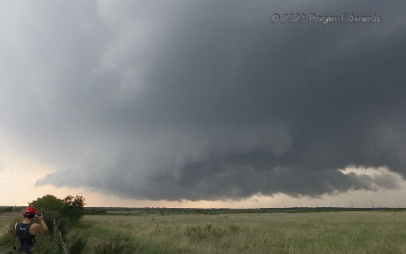
[Click Image to Enlarge] In panoramic shots, storms are closer than they appear, and this one was churning right down the highway toward me with the upper middle parts nearly overhead. This rather fast southeastward-moving storm, consistent with its deep turquoise innards, was dropping copious amounts of severe hail, and occasionally showing enough low-level rotation to make an observer … [Read more...]
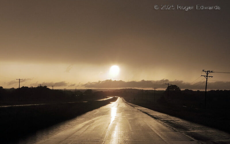
Wet Sun Breakout
After a chase involving a few wet, messy, low-contrast mesocyclones in difficult terrain (unfortunately, fairly common in eastern Oklahoma), we let the storms go once they started to line out and move into even worse terrain with bigger trees. The chase actually ended early enough for a buffet dinner in the trailing rain shield, and a start to the drive home before sunset. One stop along the way … [Read more...]
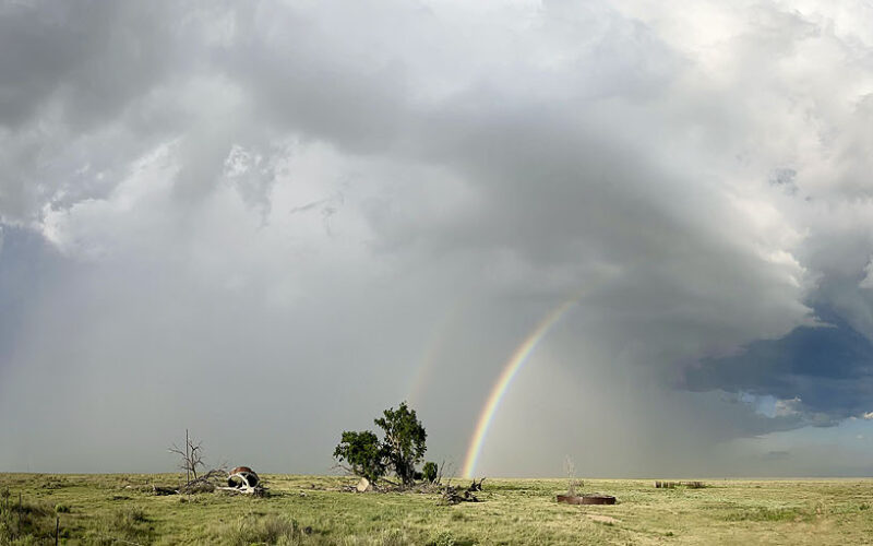
High-Plains Homestead with High-Based Storm
[Click Image to Enlarge] A former marginal supercell threw its greatest beauty into the sky as it moved into a less-favorable air mass and weakened, spawning a double rainbow beyond an abandoned and mostly collapse High Plains homestead. A panoramic sweep was needed to show the fullest possible view of this storm, though it cannot portray the cool outflow wind nor the fresh, earthy aroma of … [Read more...]
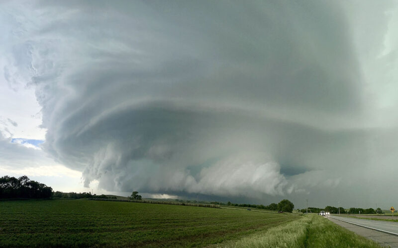
Big, Messy Mesocyclone
A low, ragged, broadly, moderately rotating, southeast-moving supercell base pulls tail clouds from the north (forward-flank) and south (inflow) sides, occasionally yielding a briefly tighter area of rotation that made us pay close watch beneath for debris spinups that never were seen. When the front part accelerated north, we thought tornadogenesis could be imminent, but within less than a … [Read more...]
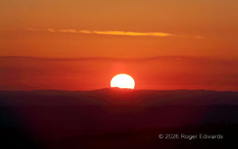
Southern Appalachians Sunset
[Part 2 of 2] The last sliver of the visible sun poked over mountains near the Alabama/Georgia border, and a wavy strand of haze still concentrated along the top of the boundary layer. Glare had dimmed enough to reduce the dynamic range and allow the rolling foreground terrain of the southern Appalachians to come out of hard shadow. With a deep zoom into the most colorful, reddened area around … [Read more...]
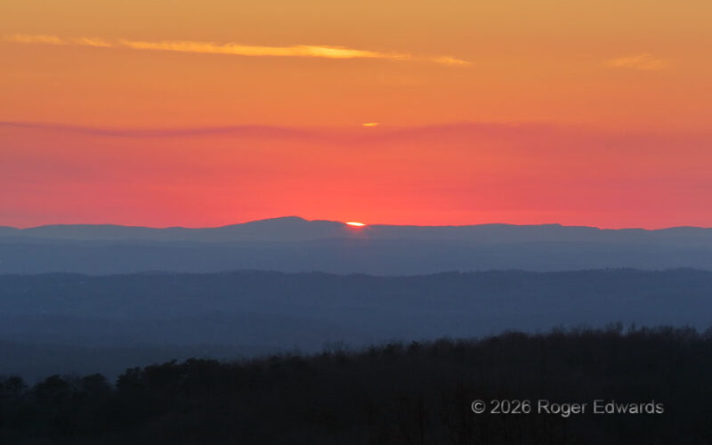
Georgia Sun Goin’ Down
[Part 1 of 2] Gazing to the horizon from the west slope of Burnt Mountain (which, by the way, I was glad to find unburned) offered what may be the best publicly available sunset view in north Georgia's steep hills and forests. Aside from a cirrus streak evolved from an old contrail, the most interesting feature was the way top of the boundary layer, marked by a layer of haze trapped at the … [Read more...]
- « Previous Page
- 1
- …
- 3
- 4
- 5
- 6
- 7
- …
- 418
- Next Page »