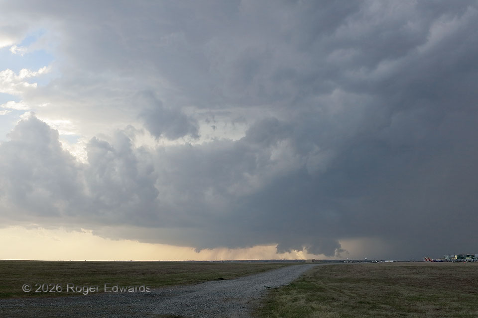
A strongly tilted, classic supercell approached Oklahoma City’s airport from the southwest. The main OKC terminal is at lower far right. A Southwest Airlines plane barely beat the storm, taking off to the south (in the immediate inflow region) just a few minutes after this shot. Fortunately, it was about to circumnavigate the storm easily, based on a flight-tracking app. Fortunately, the core and mesocyclone missed the airport, sparing grounded aircraft wind and hail damage that occurred elsewhere in the city. The ragged wall cloud just to the right of center occasionally showed moderate rotation, as did an occasional wall cloud from an older mesocyclone to its rear left (lower center of image). I’m not a big fan of storm chasing in a city, even if quite familiar, but it can be done. In areas with a lot of visual obstructions (terrain, trees, hills, urban buildings, etc.), positioning oneself on the opposite side of an airport or substantial lake from the storm affords some of the best views.
Oklahoma City OK (10 Mar 26) Looking WSW
35.3928, -97.5834