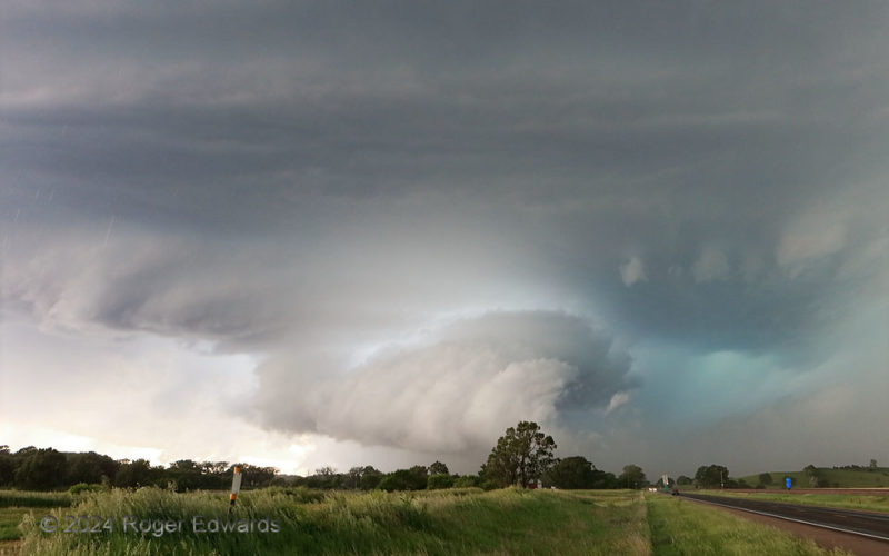
A product of the merger of two supercells west-northwest of Broken Bow this big, complex and quite severe supercell sported two mesocyclones, one nearly wrapped in rain to my south-southwest. This one, viewed from the "notch" inflow area just off the forward-flank core, drew a lot of hail-cooled air from that core (foggy, yellowish cast behind the road and trees to the right). It then condensed … [Read more...]
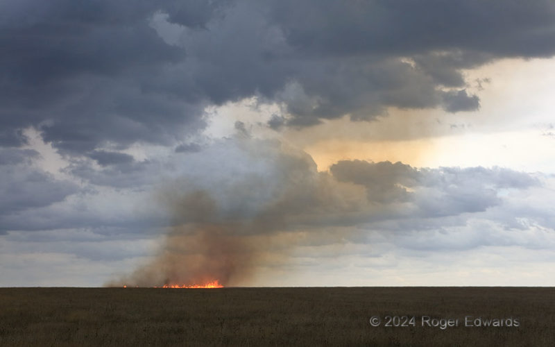
Lightning-Started Grass Fire
Before turning into a brilliantly glowing burner of multiple acres in strengthening storm-inflow winds, this fire was a slowly shifting ring of flaming grass, spreading out from its inches-wide source. Of course, when that "source" was a channel of lightning launched miles aloft, into the anvil of the storm, it only would be a surprise not to have a fire start. After seeing the channel … [Read more...]
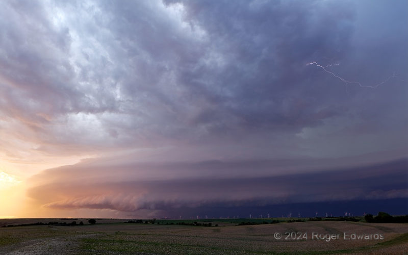
Twilight’s Ominous Beauty
Riveting and spectacular, outflow-dominant yet still supercellular, electrically hazardous but oddly calming, this twilight storm gathered sunset colors reflected from clouds to the south and interwove them artfully with cooler tones from the deeper shadows, all wrapped in a striated skirt of platy, laminar bands of air forced to lift above the shelf. This continually rumbling beauty advanced … [Read more...]
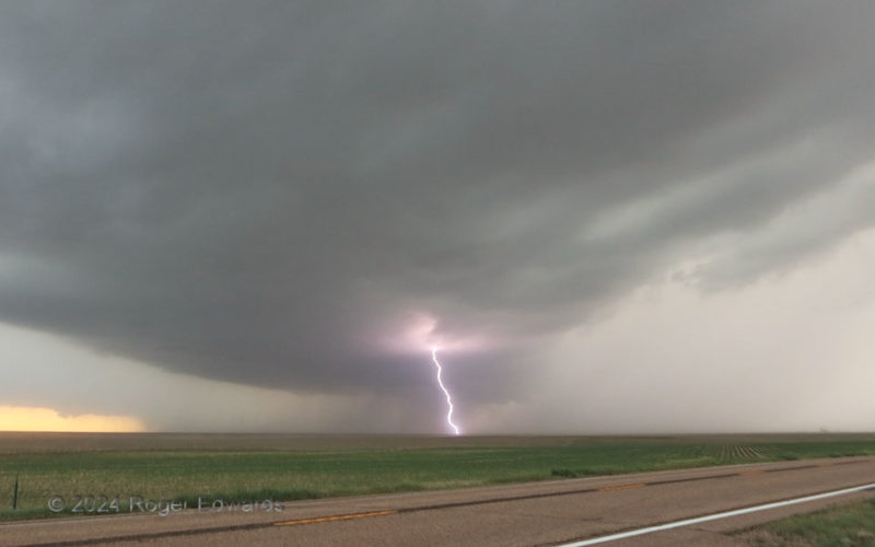
High Plains High Voltage
Funny it is, how often we frequent storm observers end up in some of the same places as before, hundreds of miles from home. Two years and four days prior, I photographed a sunset at the same pullout. This time, it made a great vantage for a few minutes of attempts to shoot bright, daytime lightning from a former supercell that was evolving into a small bow. Unlike an even older, more-distant … [Read more...]
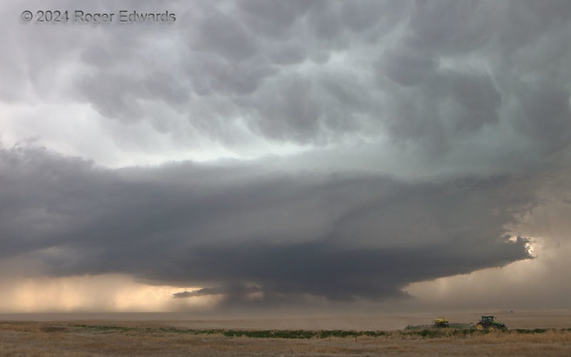
Sucking Dust on the Great Plains
Stunning in form on its own, this supercell north of Kit Carson sported a vast field of mammatus across the underside of the downshear anvil, near to far. Meanwhile, a wall cloud under the right base, and arcus cloud under the left, could be seen clearly, despite all the intervening blowing dust. Displacement of dust, sand and soil by wind is called an eolian process in geology. This counts! … [Read more...]
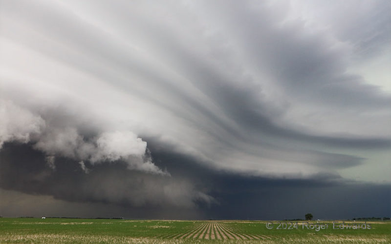
Plated Sky
An expansive, late-stage supercell strutted insistently across the Great Plains’ vast stage with one final, gaudy show, before getting absorbed in a broader band of thunderstorms. Dust rising into the wall cloud at lower middle showed the storm still had a surface-based updraft, though the cloud plates represented stable layers through which the storm’s rotating chimney of low pressure also was … [Read more...]
- « Previous Page
- 1
- …
- 49
- 50
- 51
- 52
- 53
- …
- 418
- Next Page »