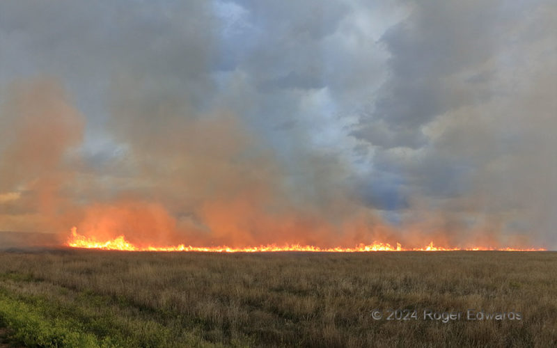
Ignited by an exceptionally potent lightning strike under a supercell's anvil, this Great Plains grass fire spread out in a ring at first, then got steered westward by strengthening inflow to the storm that caused it. Sparse, light rain falling from the anvil wasn't enough to stop this conflagration, and fire trucks already were on the way from the nearest towns about 20 miles away. I exited the … [Read more...]
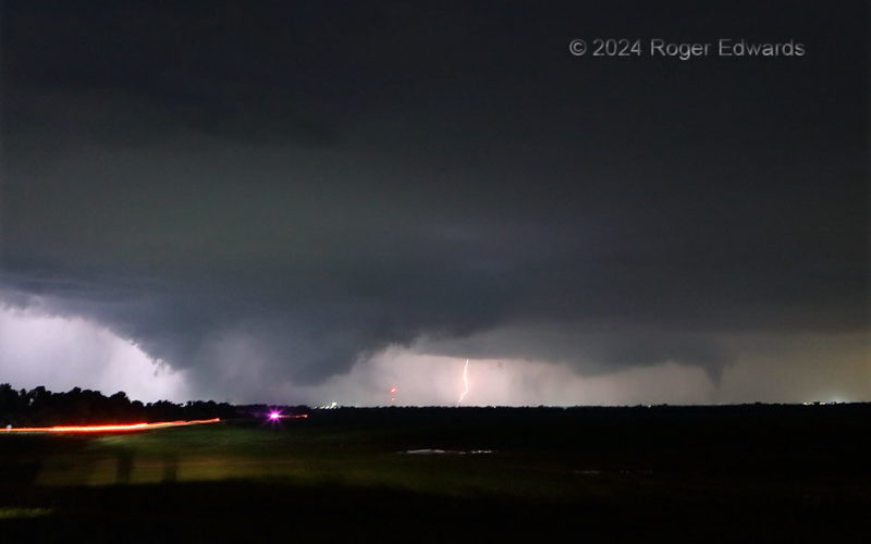
Pretornadic Wall Cloud and Separate Cone
Here we see the early stages of a cone tornado (right), and a rainy "bear's cage" wall cloud from a separate mesocyclone (left), bracketing a CG strike from the main core, all in the same large and complex supercell. Observation of the wall cloud in lightning and Union City town lights revealed that it was rotating. Meanwhile, as the cone moved away to the northeast, toward an area just west of … [Read more...]
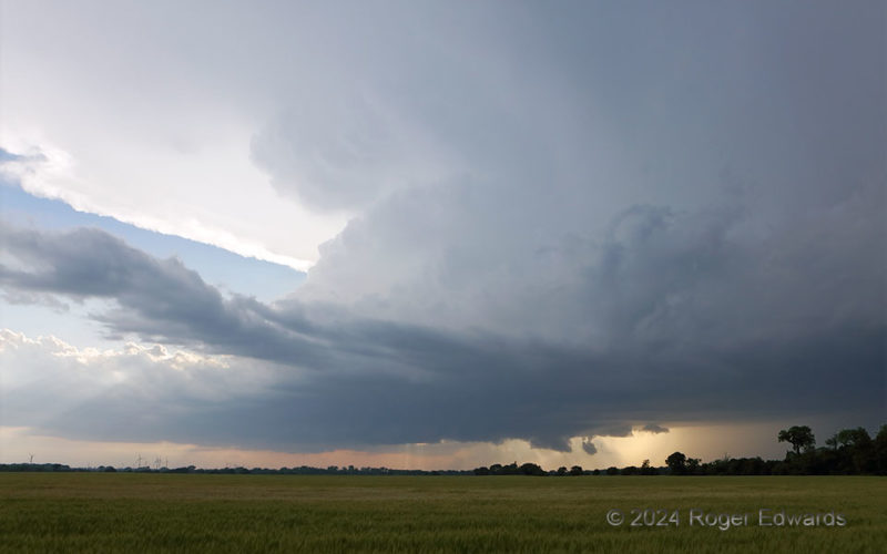
Classic Early-Stage Supercell
Seldom does a supercell look more like the classical textbook depiction than this. One clearly can see the wide updraft base across the lower middle (with small wall cloud), forward-flank core behind the trees at right, flanking line and tilted towers in the left middle half, an "inflow tail" spreading anvil above, and even overturning "knuckles" between the top of the flanking towers and anvil. … [Read more...]
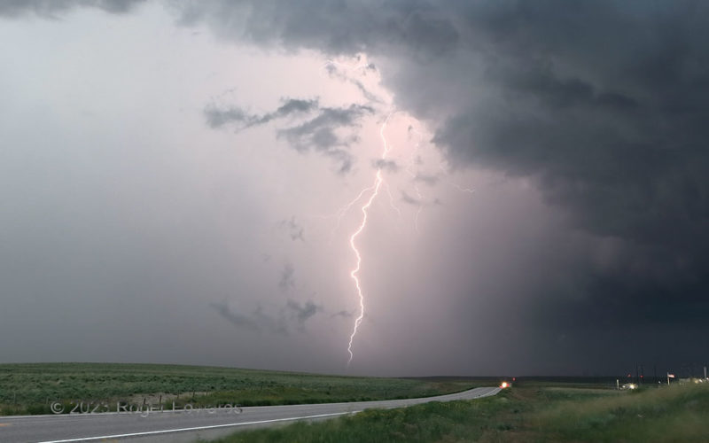
Charged Core
As the heavy-precip supercell progressed southeastward across northeast Colorado, on its journey from Nebraska to Nebraska, it hassled travelers at twilight with lightning, flooding rains and large hail. Most of the lightning was inside cores. A few flashes decorated the outer rim of the core, in this case the thick, rear-flank hook region, with the main low-level mesocyclone right down the … [Read more...]
Ribs Aloft
Two striking supercells can occupy different parts of the sky at the same time! In this case, an older storm was being absorbed into this one's forward flank (off view at right, but here's a look). This one already was producing a large amount of outflow, but managed t maintain enough surface-based inflow in its notch to the north to keep pounding along after the storm merger. Meanwhile, the … [Read more...]
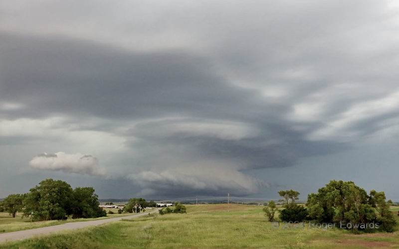
Supercell Absorption
Since I left Norman early that morning, I hadn't stepped foot out of the vehicle for more than about 10 minutes each, twice, to get gas and grab grub, while driving on the straightest path to this spot. The second half of that 8-hour trek, from just north of Salina to here, saw a supercell form midday, deep in the Sandhills, and wander east-southeastward, looking ever-more impressive on radar. … [Read more...]
- « Previous Page
- 1
- …
- 50
- 51
- 52
- 53
- 54
- …
- 418
- Next Page »