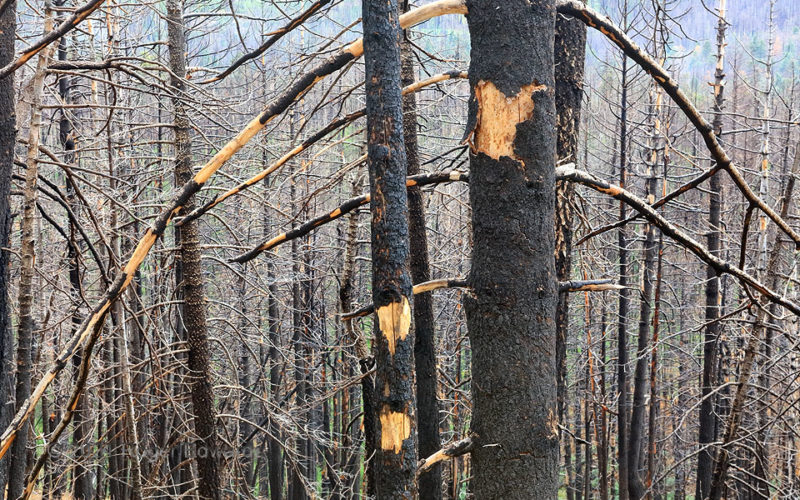
Four years after the "Fry Fire" in the Pinaleno Mountains rendered these trees as externally charred skeletons, bark was sloughing off to reveal unburned core wood beneath. Nonetheless, the fire clearly burned hot enough, long enough, to kill the living pipeline under the bark that takes water and nutrients up the trees. As this is a dry climate, with only enough winter snow to sustain a forest … [Read more...]
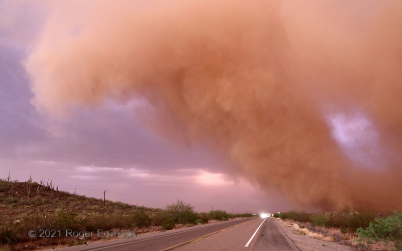
Sunset Dust Plume
A growing, sheared-over dust plume rose and arched over the highway from its roots a minute earlier as a "Desert Dust Bomb." Its particles reddened both by internal iron oxide and the filtered sunset light, the dust cloud presented a striking and peculiar sight to motorists on this stretch of highway. It was but the frontal lobe of an extensive haboob that had dusted Tucson and vicinity densely, … [Read more...]
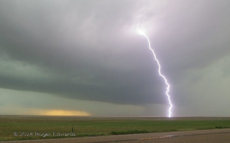
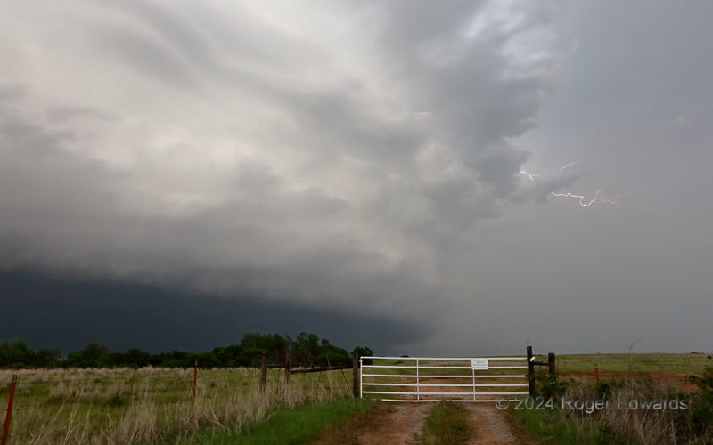
Close, Bright Boom
A formerly very dusty Colorado High Plains supercell and its expansive forward-flank core crept closer, losing structure but gaining electrical production. The storm already had blasted a bright one a few miles away, but with rain and small hail starting, this much closer and louder discharge would compel my exit from the spot! 6 W Cheyenne Wells CO (8 Jun 24) Looking SE 38.8126, … [Read more...]
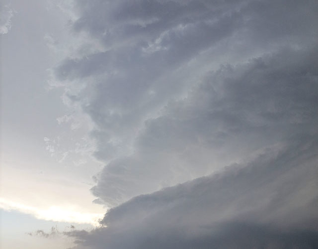
Supercell South Side
While a tornado was well underway in the main mesocyclone region (off screen to right), the south rim of the Midland/Odessa supercell offered a stunning wall of plated cloud structure. In fact, this part of the large and complex storm later separated from the original, tornadic area, and itself became a nontornadic right-mover. Even with an ongoing tornado that demanded close attention, it was … [Read more...]
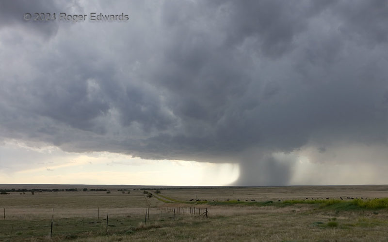
Supercellular Rain Foot
A supercell that I had been observing for a couple hours never changed its overall appearance much from this, except to widen and shrink its core on a few cycles. Here, an old forward-flank core at right was thinning, while a substantial but narrow dump (downburst) descended from the north rim of the mesocyclone region, complete with very nice rain foot. The foot probably was kicking out some … [Read more...]
Sparkling Marshall HP
An "HP Moose" of a supercell churned east-northeastward into an area where the only view into its "notch" region for tornado potential was on unsafe dirt and mud roads, so we paralleled it for a bit to appreciate the wide structure. Here, aside from flicking forth sparks in its wet vault (as such storms tend to do), the storm was absorbing other cells to its downshear and upshear sides, and … [Read more...]
- « Previous Page
- 1
- …
- 48
- 49
- 50
- 51
- 52
- …
- 418
- Next Page »