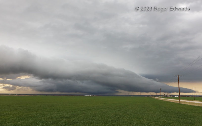
A long, graceful, gently sinuous shelf cloud rushed outward on rear-flank outflow that could penetrate the boundary layer. That outflow mainly came from the storm in middle background—one of a series of east-northeastward-moving supercells on this day that were undercut by a slow-moving cold front about the time they would mature. Even though I had light north winds at this location—ahead of … [Read more...]
Shelf to Farm
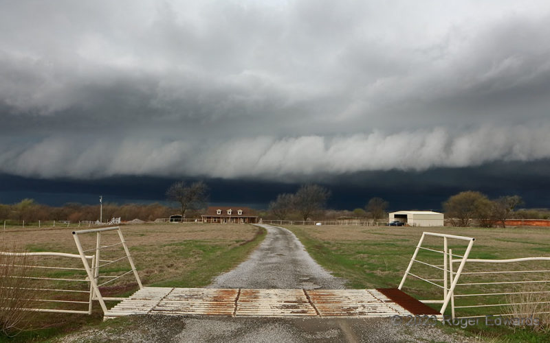
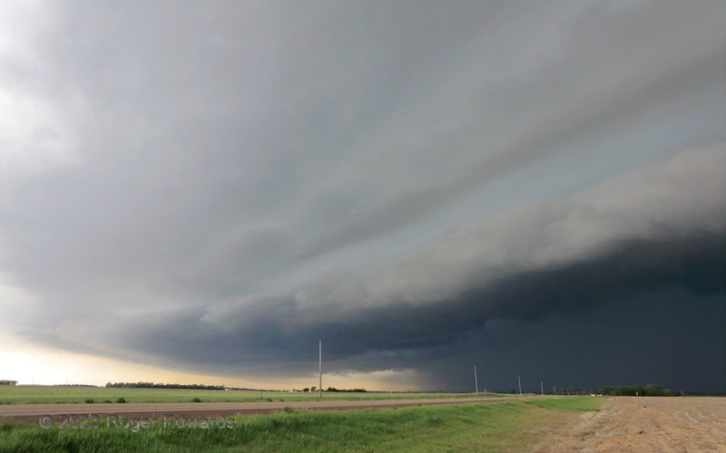
"Farm to shelf" is a concept involving the directional food-supply chain segment from growth to grocery store. "Shelf to farm" is when a shelf cloud heads toward a farm. Makes sense, right? Good! That's how it worked here, as a storm cluster that was evolving from a supercell upscale to a larger, organized convective complex started cranking outflow in high volume, with the shelf cloud as a … [Read more...]
Multi-Outflow Sundown
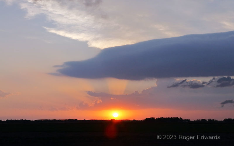
Outflow from two thunderstorm complexes already had settled in over the Edwards County region. That situaiton didn't prevent yet another storm (an elevated supercell) from forming to the right (north) in the sunset hour. Its shelf cloud trailed far past the rear-flank updraft area, and can be seen here in the sky foreground, blocking part of some crepuscular rays and the anvil cirrus. One … [Read more...]
Rush Sparks and Flash Flood 2
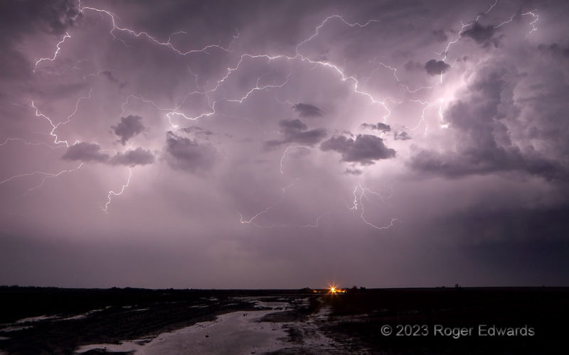
Elevated thunderstorms, built upon one outflow surge after another, continued to light up the sky across west-central Kansas. The storms fired spidery crawler lightning this way and that, to the delight of a shivering but satisfied storm photographer and meteorologist. Sometimes it's hard to imagine how an elevated updraft as small as the one at right could produce so much electricity, but the … [Read more...]
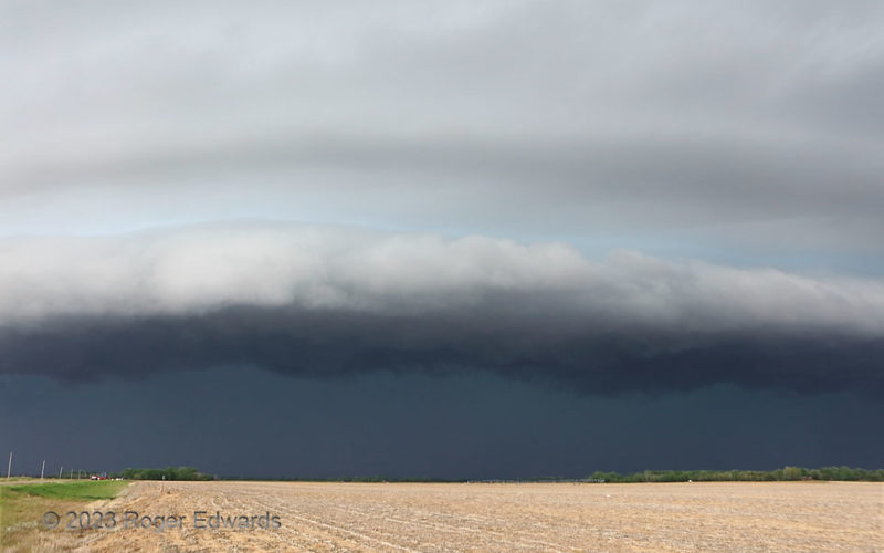
Stafford Blow: South
[Part 3 of 3] Being fresher development, this bowing storm complex had not yet built up enough of a cold pool to trail along outflow boundary of its own, well to the southwest. Instead its beautiful shelving was more symmetric from north to south. Compare this to the south view of a larger, severe bow echo from 12 years before. Somewhere slightly farther south of here lay the outflow boundary … [Read more...]
Stafford Blow: Middle
[Part 2 of 3] But for the stubbly tan soil, tree rows and grid-straight highway of west-central Kansas as a foreground, the central part of the onrushing St. John/Stafford bow could be confused for a scene from someone's overly active imagination of the atmosphere on a science-fiction world many light-years away. This storm layered outflow upon outflow, as it impinged on a slightly heated and … [Read more...]
- « Previous Page
- 1
- …
- 60
- 61
- 62
- 63
- 64
- …
- 418
- Next Page »