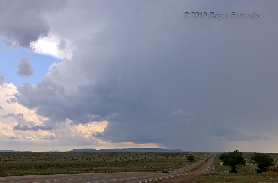
On the last day of my "normal" spring chase trip, one final supercell spun up along the intersection of outflow boundaries, over west-central New Mexico's mesalands. Promising as this scene may be, it represented the storm's peak; for soon it would ingest too much outflow air and wither slowly, while scooting eastward. Were it not for an unexpectedly active bonus pattern for northern Plains … [Read more...]
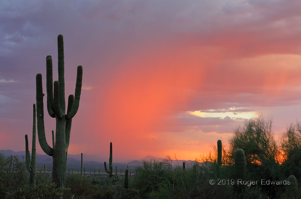
Sunset Saguaro Scene
Saguaro cacti, including one quite lofty, stately specimen, frame a brilliant sunset-lit core of rain over distant mountains, as seen from Saguaro National Park. At right, one sees a thin, orange-lit plume of virga—precipitation not reaching the ground (yet). A mature saguaro with more than one arm probably is in the 125–150-year-old range. The tall one here could be older, dating from well … [Read more...]
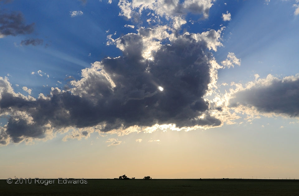
Cumulus Spotlight
One haggard clump of shallow convective clouds floated across the eastern Colorado sky behind a complex of thunderstorms. Being rather moisture-starved, these cumulus clouds entrained a good deal of dry air from their surroundings and sported ragged edges and holes—the most prominent of which cast a beam of sunlight directly at our spot for just a few seconds. An assortment of crepuscular rays … [Read more...]

Tipton Twisting
Some tornadoes never develop beneath a wall cloud, as with this event. After a three-way handoff involving the demise of this stout supercell's Luray tornado, and a brief interloper, the "Tipton" tornado formed tilted, then visually righted itself as a bent cone here, before quickly enlarging. In the meantime, it formed a fitting centerpiece for a fascinating whole-storm show, with rotation … [Read more...]
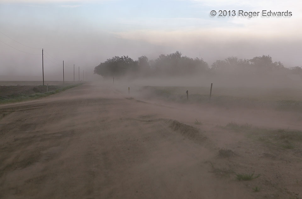
Outflow Dust Blast
With what soon became a tornadic supercell located over an hour to our north, moving away, and our storms further down the dryline in a phase of heaving severe downdraft winds well before themselves, it was a decidedly disappointing chase day. Still, this ranks as one of the fiercest outflow-dust events I've experienced, barely able to stand to shoot, interesting in its own right when subtracting … [Read more...]

Sunset Subset
What better way to accentuate an already magnificent, sky-sweeping, landscape-lightning sunset scene than to wait a couple minutes after the wide-angle shot for its deeper colors to simmer and warm a bit, then shoot an evolved and well-textured subset of it! Though I've seen it before in eastern-sky sunsets, somehow the altocumulus' magenta tones here stood out remarkably well amidst the sea of … [Read more...]
- « Previous Page
- 1
- …
- 201
- 202
- 203
- 204
- 205
- …
- 418
- Next Page »