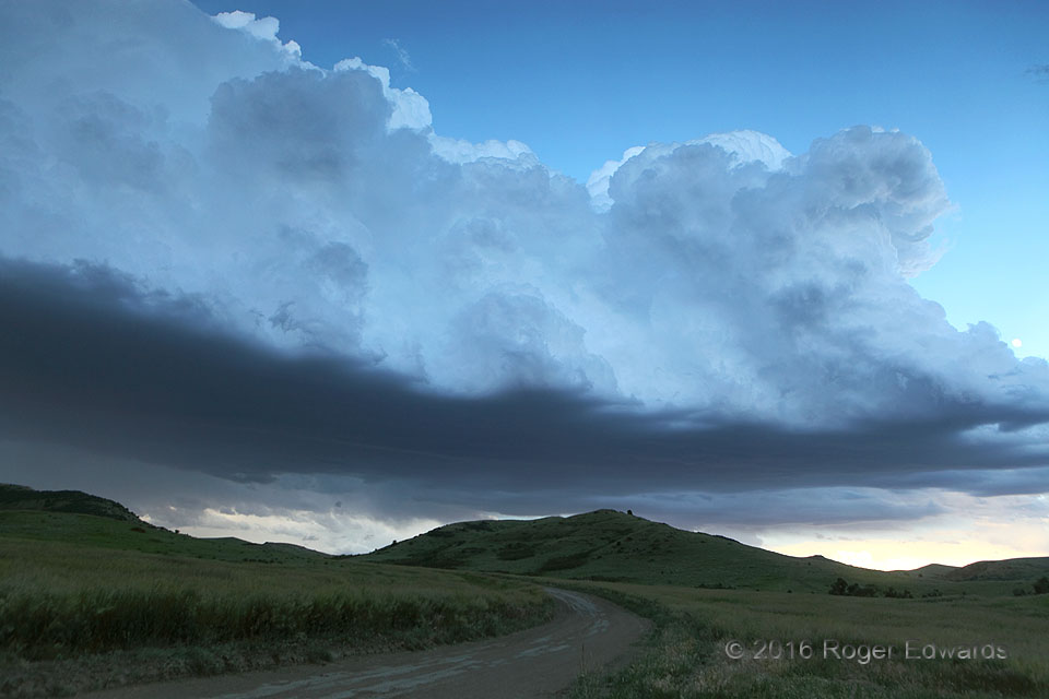
A flanking line of towering cumulus and cumulus congestus rose over a tail-end zone of low-level convergence that was attached to a supercell unseen at left (east), mainly beyond a rampart of high hills. Shadowed by the anvil of other storms forming on the Bighorn Mountains (unseen at right/west), these turrets assumed a cool bluish hue, reflecting part of the sky's tone from above. I love this … [Read more...]
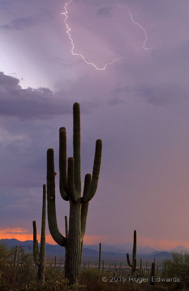
Crackling Arizona Sky
Following a wonderful sunset, the small, weak, diurnally heat-driven thunderstorm that framed these desert vistas had a few more flickers of in-cloud lightning to fling. This would be its last detectable electrical discharge; soon the storm would wither into remnant cloud wisps of twilight, as the evening cooled off the air and flipped off the convective switch. 13 WNW Tucson AZ (16 Jul 19) … [Read more...]

Downdrafts, Updrafts, Chaos!
This scene was every bit the chaotic, mysterious convective mess that it looks! About half an hour after staring downhill into the notch of a line-embedded supercell, the storm accelerated east-northeast. Here, its dense, rain-wrapped main mesocyclone lurked to the right, while small but intense updrafts developed over the rear-flank gust front across most of this view. A complicating factor: … [Read more...]
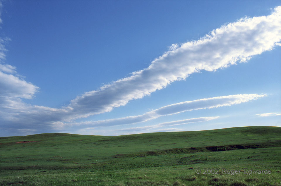
Altocumulus Lenticularis Undulatus
Wavy lenticular formations soared over the shortgrass prairie of Wind Cave National Park, on the southern periphery of the Black Hills. I don't know the cause for the constriction amidst each band; but it could be a slow-moving gravity wave or other subsident and nearly linear ripple running nearly perpendicular to the altocumulus wave train. 7 N Hot Springs SD (10 Jun 2) Looking SW 43.5501, … [Read more...]

Log Ice
As if prongs of the Abominable Snowman's frigid comb, a series of neatly arranged icicles clings to a log above the uncharacteristically chilled waters of Oklahoma's Lake Thunderbird. These formed when waves and spray splashed across mostly the far side of the log during temperatures well below freezing. After each wave, some water pouring off the log turned to ice before the next. 6 W Little … [Read more...]
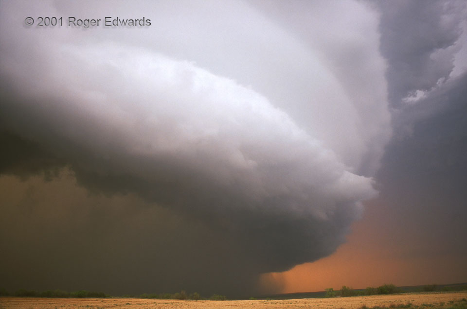
Texas-Sized HP
For ten hours, this legendary thunderstorm lumbered eastward across northwest Texas, extraordinarily long-lived even by supercellular standards. I was fortunate enough to witness it in some manner from just after birth to its demise after midnight. Though it produced a few very brief, small diurnal spin-ups (lame excuses for notches on the guns of a few over-exuberant "chasers"), the … [Read more...]
- « Previous Page
- 1
- …
- 194
- 195
- 196
- 197
- 198
- …
- 418
- Next Page »