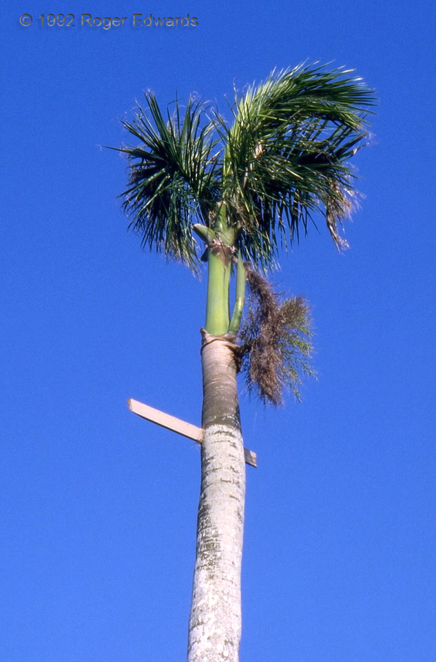
A 1X4 board penetrated the upper part of a royal palm, leading to one of my most prized and popular photos. Hurricane Andrew impaled the plank due E-W through the axis of the trunk, which was not significantly twisted. The palm almost certainly bent diagonally at a steep angle in eyewall winds analyzed at around 120 knots in the area--meaning that the board was either propelled downward and … [Read more...]
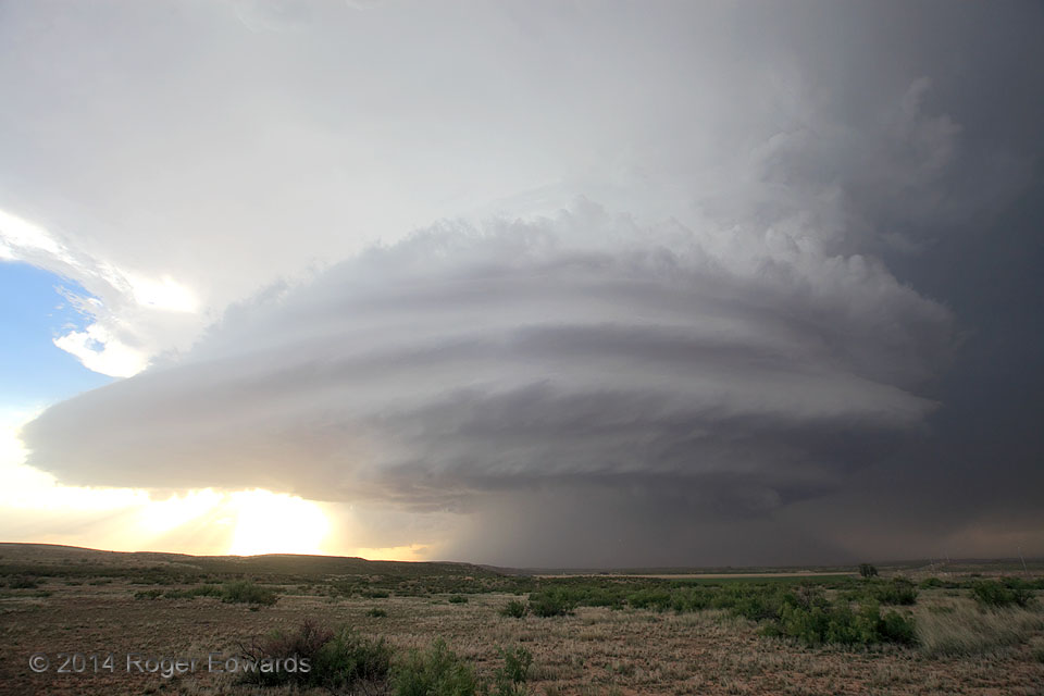
Roswell Mothership
When storm enthusiasts discuss such a fantastically supercellular sky, the word mothership often tumbles reverently through quivering lips. In this place, it has a little more meaning. Perhaps, when concerned citizens near Roswell saw oddly shaped, huge circular apparitions aloft that seemed positively alien in character, their gaze instead fell upon a colossal, chiseled, rotary cloud form such … [Read more...]
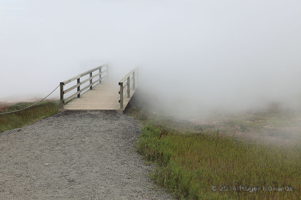
Geothermal Fog
On an already cool, damp day, it takes very little extra moisture to obscure the field of view. In this case, the source was a steam vent in the Gunnuhver geothermal area, its well-defined plume of effluent wafting across the land to create this extraordinary visibility gradient at the surface. This doesn't fit the commonly known fog types: radiation, advection, or precipitation. Instead it is … [Read more...]
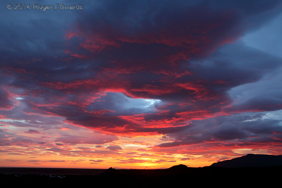
Hofsvik Red Ring
On just our second evening in Iceland, the sky blazed for over an hour with a slowly evolving and utterly stunning sunset--one of the top few most beautiful that I've ever witnessed. The protracted light show peaked at just the right time to cast in flaming hues a remarkable ring of cloud material surrounding a tilted, clear tube of sky. With the flow on those levels being easterly, off the … [Read more...]
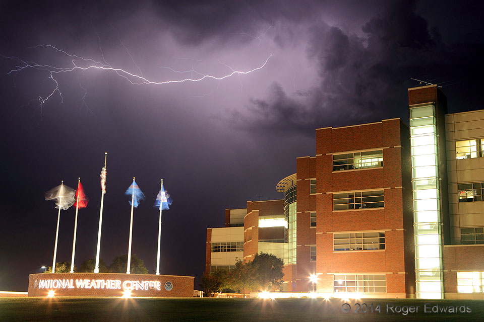
NWC Lightning
An elevated thunderstorm flings a filament of electricity across the overnight sky, and above the American nucleus of severe-storms research and prediction. Norman, OK (2 Oct 14) Looking SE 35.1825, -97.4405 … [Read more...]
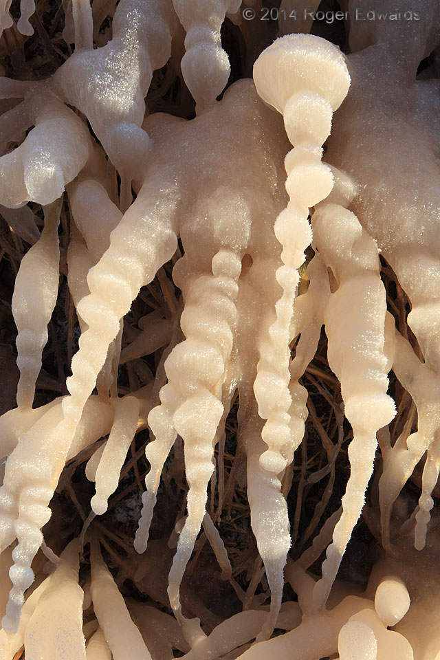
Alien Ice
Nodular ice encases lakeshore grass during a cold-air outbreak. A special and uncommon sequence of circumstances set this up: a north-facing shore of a warm lake with reddish muddy water, hit by an intense cold front with winds strong enough to make splashing waves and launch spray, and temperatures cold enough to flash-freeze it in layers along the blades of grass--all with a thin crust of rime … [Read more...]