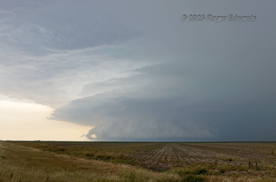
This was a day for messy supercells: first a complex and beastly storm in Motley and Dickens Counties that ultimately undercut itself with outflow and gusted out, then after about an hour and a half of transit to its north and east, this big, heavy-precip stack of wildness in the distance of Haskell County, on the southern end of what by then was a large cluster of storms. Long ago I nicknamed … [Read more...]
Complicated Supercell
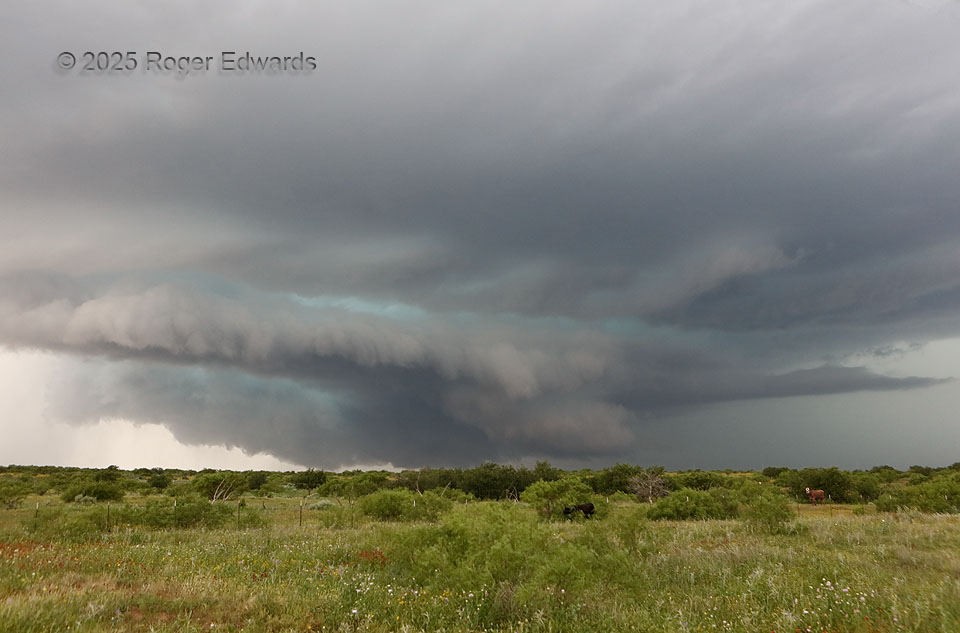
A complex supercell that already had done one prominent mesocyclone jump (to a new occlusion point) was in the process of another here. This was quite evident once we navigated a gnarly but passable dirt road southeastward to avoid the forward-flank core, then zigzagged back southwest into the updrafts' broader path. A wildflower-festooned foreground field was a nice touch; it soon would take a … [Read more...]
Mesocyclone Jump
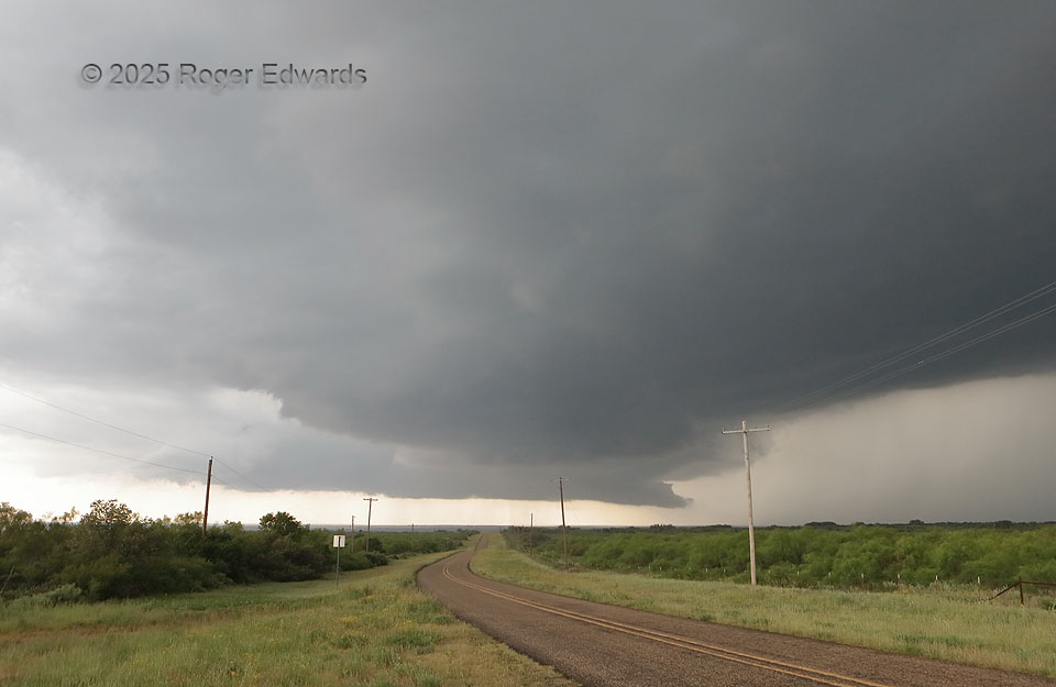
Here is an entry that is more educational than photogenic, but I'm including it because of the valuable lesson. It involves one supercell, two mesocyclones, and a distressing situation for all storm observers piddling around under the far one! This sturdy and mature supercell, right as it was entering a substantial void of paved roads, "jumped mesocyclones" to a new occlusion point along the … [Read more...]
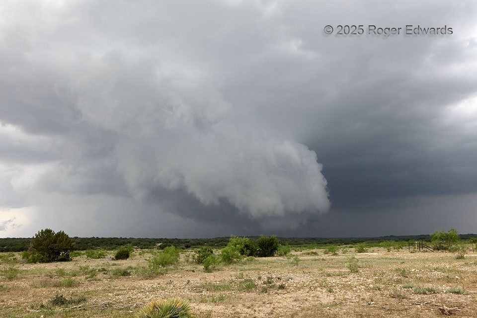
Organizing Edwards Plateau Mesocyclone
A young supercell, its mesocyclone finally getting well-organized, sported a nice, two-tiered wall cloud with scuddy, shelfy characteristics on the near front side. The heart of the low-level mesocyclone was at distant rear, beyond the limestone ridge. Between the choppy terrain and common presence of scrubby mesquite and cedar trees 10 to 20 feet high, lowest-layer storm viewing on the Edwards … [Read more...]
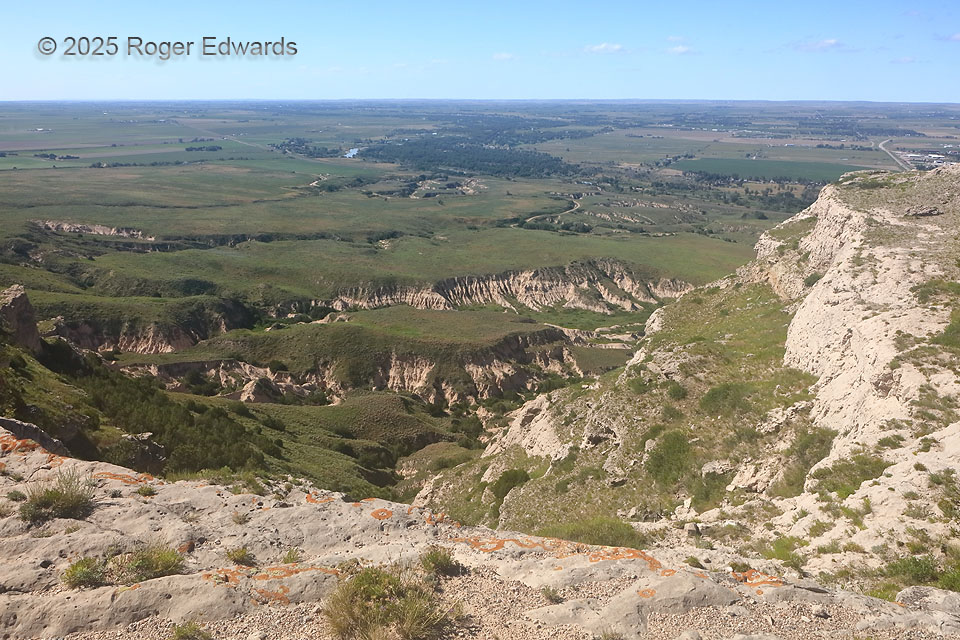
Scotts Bluff Drainage Vista
This time, we had to hike up Scotts Bluff because the road was closed for repairs. That's OK, because it was an off day from chasing, so we (a tour group I was leading) had plenty of time in the area before spending the high in Alliance. Only a few of us made the steep trek, while others picnicked and/or relaxed at the bottom. This view was well worthwhile, as it is when driving and strolling … [Read more...]
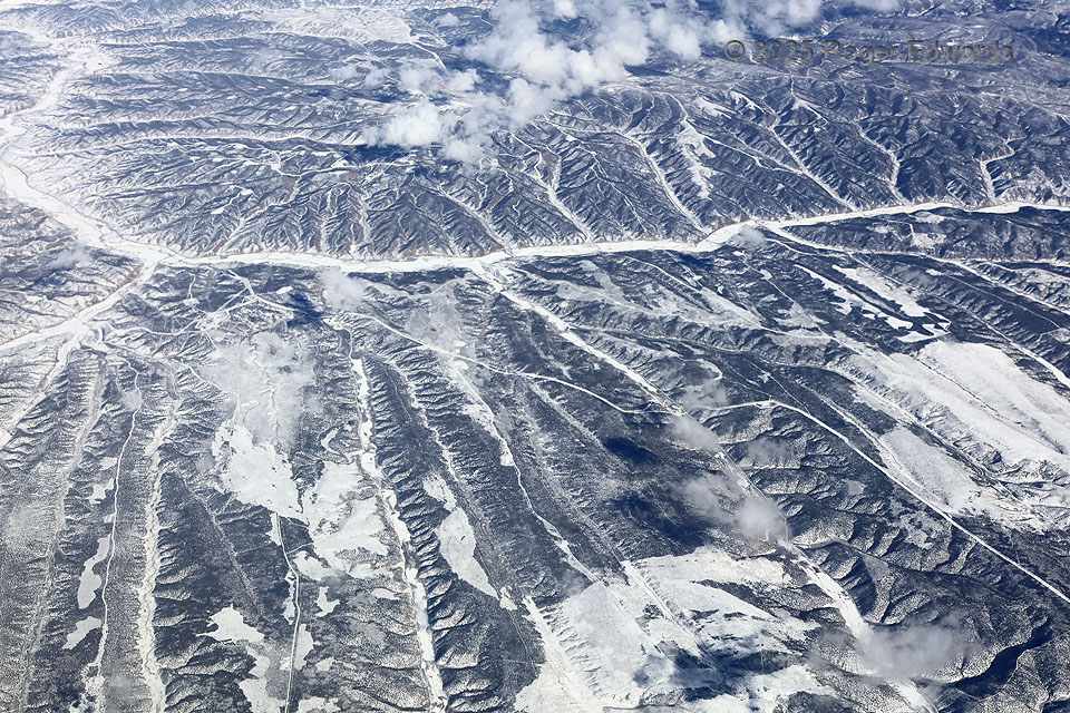
Wintertime Drainage Pattern
Piceance Creek and its tributaries have carved a set of nearly parallel canyons, rugged yet intricate in form, across the northeastern Colorado Plateau of northwestern Colorado, southwest of Meeker. Snowfall in the areas between the scrubby forests made even the smallest drainages pop with contrast on what had to be a frigid winter day "down there," as seen from the comfort of "up there." … [Read more...]
- « Previous Page
- 1
- …
- 5
- 6
- 7
- 8
- 9
- …
- 413
- Next Page »