This vastly reaching, branching flash over west Texas—a few inches thick and many miles long—very briefly but instantly heated the air in its entire channel to a roughly 50,000-degree (F) plasma. That explosive condition created the loud, bumpy, rumbling and rolling sound wave we know as thunder. Imagine sticks of dynamite daisy-chained together in a wiggly pattern for miles, but set off all at … [Read more...]
Midlevel Sunset Tower
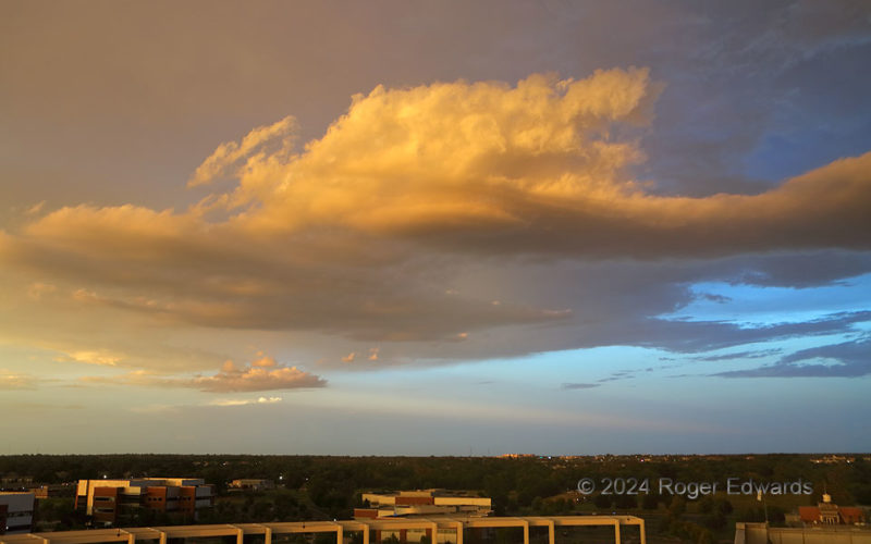
Viewed from high atop the National Weather Center, the sunset in the west was pretty, as they often are in these parts. One easily could have gotten fixated on that, and missed this even more brilliant and peculiar formation lighting up the eastern sky! A ragged midlevel convective tower (altocumulus castellanus) still had enough strength to force some lift through stable layers near its base, … [Read more...]
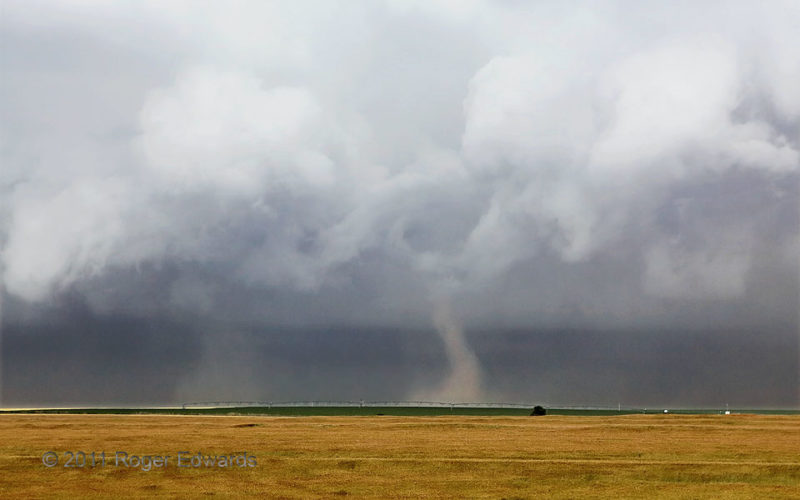
Forward-Flank Tornadoes
This storm, which I intercepted just south of the Kansas/Nebraska line already hours into its morning-to-midday trek across western Kansas, truly was one of the strangest supercells I've ever witnessed, as it moved from left to right (SSW-NNE). Not only did it yield a series of big tornadoes in the main mesocyclone region (one of which I sometimes could see as a rain-wrapped wedge), it spun up … [Read more...]
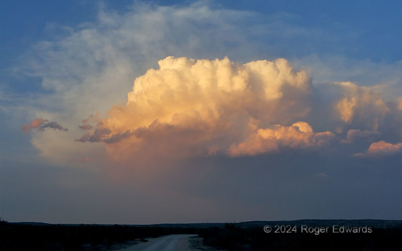
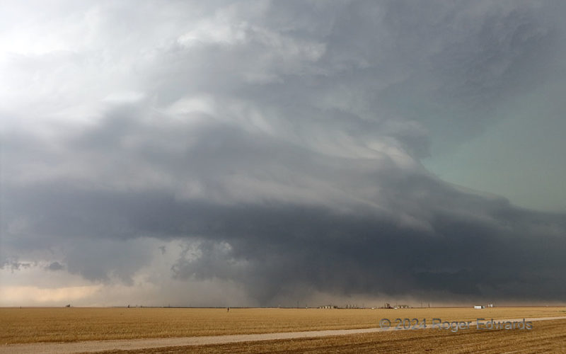
Lofty Rankin
A formerly tornadic, twin-supercell complex shed the first storm, as the second continued on a south-southeastward charge, from the southernmost Great Plains of the Permian Basin into the northwestern fringes of the Edwards Plateau. That second supercell met its demise at sunset north of Rankin, dropping its last precip and putting on a colorful display in the process, to mark a splendid finish … [Read more...]
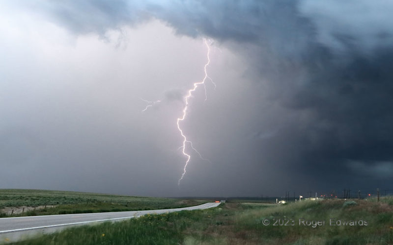
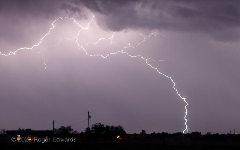
Edge Flash
A formerly tornadic supercell that developed in Wyoming, crossed a small part of Nebraska, became tornadic, crossed a lot of northeastern Colorado, and was headed for Nebraska again, became heavy-precip in character and sparked prolifically along the way. This flash traveled along the very edge of the rear-flank hook core from the cloud base almost to the ground, then went inside the rain … [Read more...]
Early Midland Tornado and Supercell
Our first clean view of what became an EF3 tornado, under what was becoming a striking display of storm structure, emerged from behind a gap in a streamer of forward-flank outflow dust. As I could see cleanly under the rotating wall cloud a couple minutes before, this tornado was no more than about a minute old here. Under the broader base, a tail cloud in the deep right background collected a … [Read more...]
- « Previous Page
- 1
- …
- 39
- 40
- 41
- 42
- 43
- …
- 413
- Next Page »