Taking this shot from a public right-of-way, I still couldn't help but notice the lit, occupied mobile home serving as a farmhouse, and wondering what the occupant was thinking about all the flickering and noise outside. Valuable and welcomed west Texas rain? Static-causing, loud nuisance to TV watching? Danger to electronics within and livestock without? All of the above? The storm formed … [Read more...]
Prairie Storm Looming
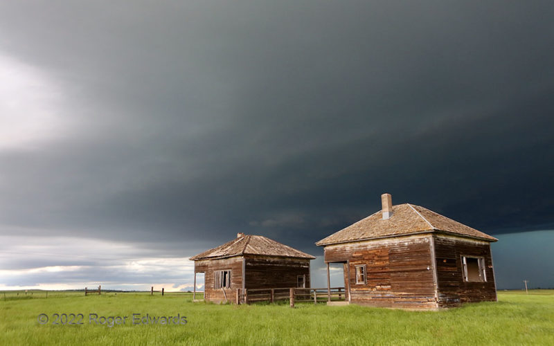
Looming darkly over a couple abandoned South Dakota schoolhouses, a big supercell base casts an ominous pall over the landscape, while a wall cloud gathers (behind the gap between the buildings). Despite the size and obvious great depth of this growing storm, it would fail to produce a tornado before being overtaken by a raging complex. That trailing activity evolved from an earlier supercell … [Read more...]
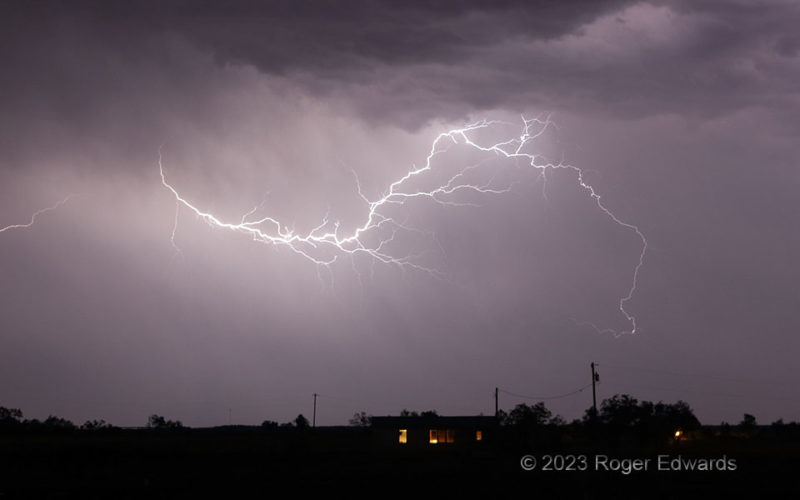
CGs through a Downburst
From within, lightning conspired with external twilight to illuminate a blue-hour thunderhead in western Kansas, near "Weskan" of course. Here, a downburst descended from the backside, hit ground and took off horizontally, forming a rain foot through which the bottom of the left flash penetrated. Though the preceding step leader travels faster than wind, it can be blown, and the leftward-tilted … [Read more...]
White Scud, Dark Background
An early-morning thunderstorms complex retreated to the southeast and east, leaving behind a fresh pool of outflow, crowned with fractocumulus scud in cool northeasterlies. Emerging sunshine illuminated the scud against the dark pall of nimbostratus and elevated stratocumulus closer to the storms' rear. This process rendered one of my favorite lighting arrangements in the sky: bright clouds … [Read more...]
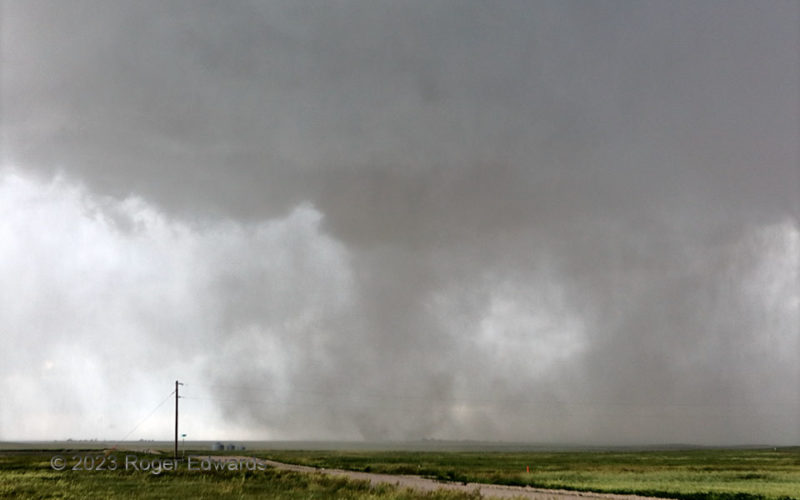
Closer Tornado, Harder View
Sometimes, tornadoes become more difficult to see with decreasing distance. The dusty "Kimball tornado" approached, and I began to hear its whistling swirl through the field about a mile away (lower center). All the while, it also became more diffusely defined near the edge. That's rather important when judging one's own safe distance! Right after this, I backed off southward a couple miles … [Read more...]
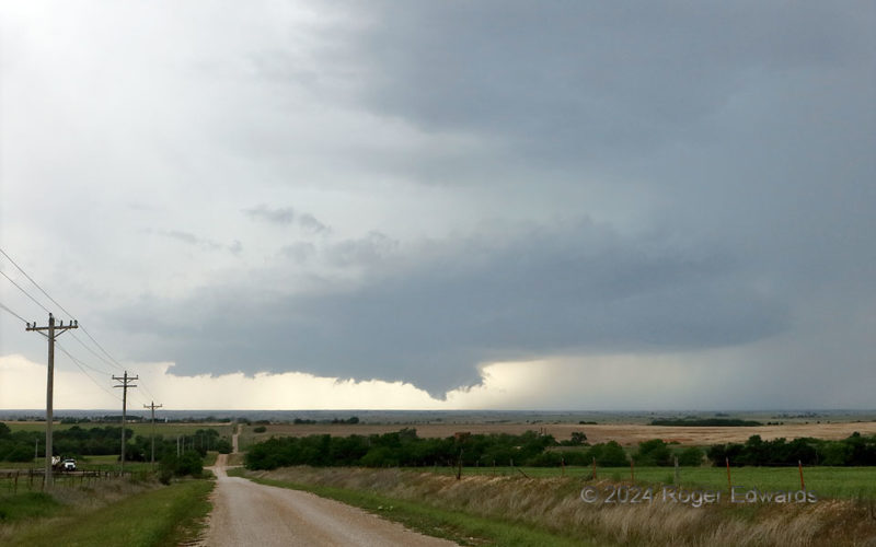
Organizing Supercell with Wall Cloud
Early in this supercell's life cycle, on a day when a lot of parameters favored tornado potential and promise was high for storm observers to witness something special, it rapidly organized a large updraft base and large, low, slowly rotating wall cloud seen here. Alas, this was as much as the storm would show for a few cycles until it got well northeast and turned into a nicely structured but … [Read more...]
- « Previous Page
- 1
- …
- 41
- 42
- 43
- 44
- 45
- …
- 418
- Next Page »