If you're in summer or otherwise warm, and tired of it, take this opportunity to chill, transported in the mind's eye to this peaceful, enchanting little stream in Vermont's White Mountains. Though the upper falls of the same sequence are much taller, this lowest cascade was readily accessible to wade right in and cool off sore feet from a day of hiking. 3 WNW Hancock VT (24 Sep 22) Looking … [Read more...]
Foothills Crepusculars
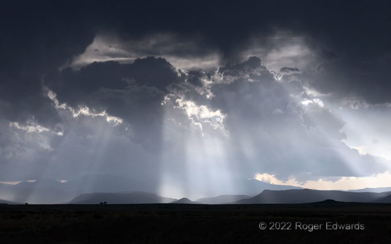
Brilliant crepuscular rays, carved out by foreground towering cumuli, contrasted themselves nicely against the dark shadow of a remnant anvil overhead, and background storms in the Sangre de Cristo Mountains of northeastern New Mexico. This sparsely inhabited area of the High Plains between the mountains and I-25 is seldom traveled by storm observers, given that a dryline sets up well east of … [Read more...]
Internal Illumination
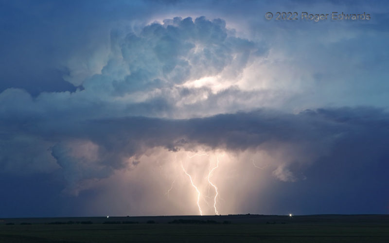
An electrically prolific little storm complex in the blue hour kept producing photogenic lightning, this time two closely spaced CGs essentially at once. That was accompanied by a lot of internally illuminating lightning to reveal the convective structure in mid/upper levels. What a fun event this was to behold, as it raced away to the southeast. 4 W Sharon Springs KS (4 Jun 22) Looking … [Read more...]
Stout Tornado in the Oil Fields
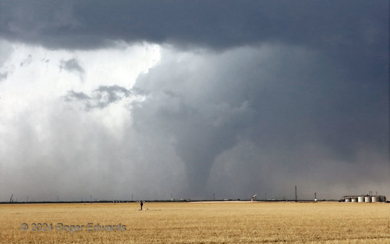
Here, the "Midland" tornado reached its best-organized stage, as a thick, tapered stovepipe, meandering slowly and erratically through the Permian Basin drilling region south of town. An EF3 rating was earned based on some damage in the oil fields, at about this time. Tornadoes that wreck actively used oil-field equipment or storage facilities can create spills and a hazardous materials (HAZMAT) … [Read more...]
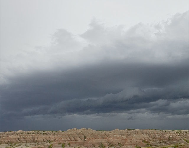
Sun through Storm: Badlands
For a short time before the arrival of 2024's edition of my "Badlands Storm", the sun was visible through the anvil. This was possible because the arcus cloud outran the core by several miles, out under parts of the downshear anvil that were thin enough to allow direct visibility of the sun. It's hard to beat the starkly beautiful Badlands (of either Dakota!) for storm observing on the High … [Read more...]
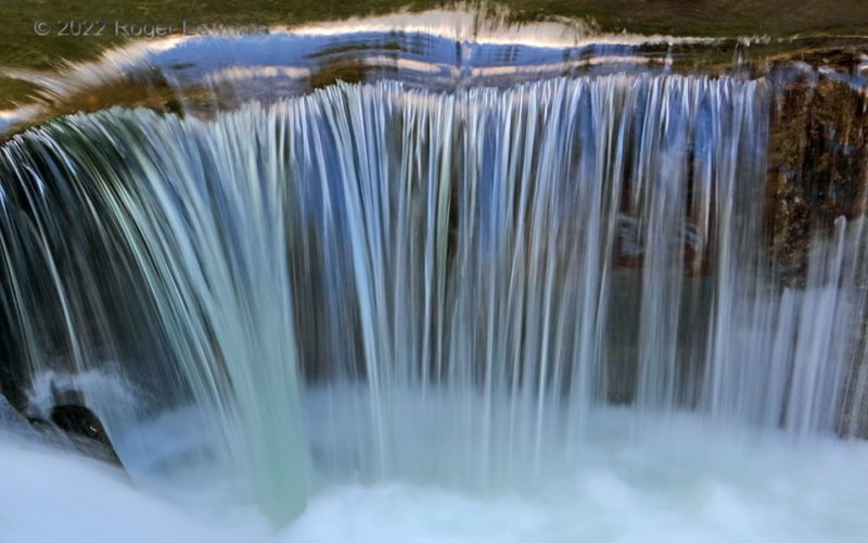
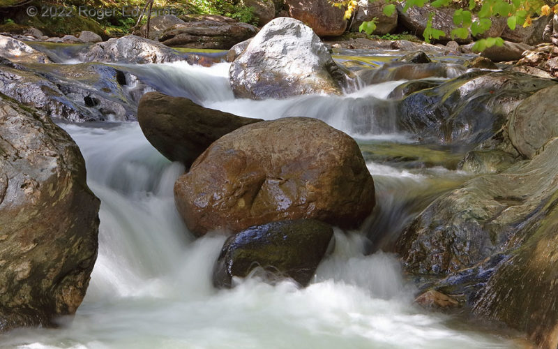
Rapids Gone Mad
One could say this little waterfall amidst a set of rapids (known as Warren Falls) was mad about being photographed, about flowing, about pretty much anything else. That's because this was along the Mad River in Vermont, in the Green Mountains physiographic province. One also could say, with much more truth, that the Mad River was calming, soothing and comforting on this fine, mild autumn … [Read more...]
- « Previous Page
- 1
- …
- 38
- 39
- 40
- 41
- 42
- …
- 413
- Next Page »