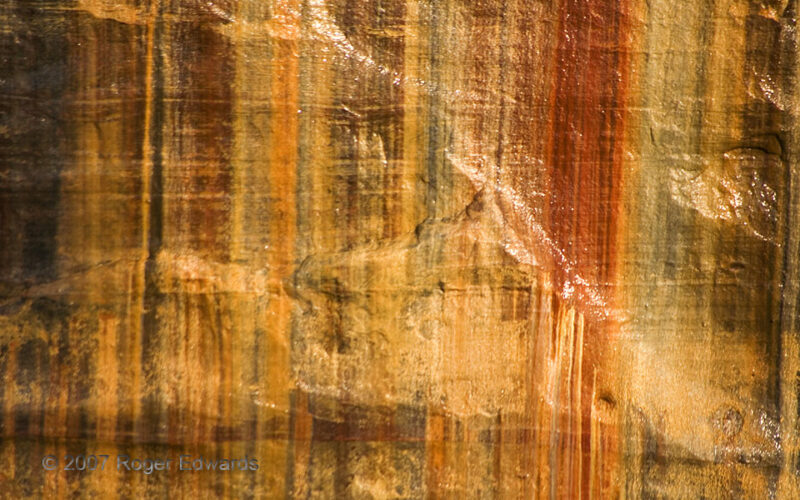
Next to a cliff overlook called "Lovers Leap," springs slowly drip recent rainwater down the face of smoothly layered Precambrian sandstone, staining it with varying proportions of oxides (mainly iron) derived from deeper in the same rock. That is how we see vertical and horizontal bands overlaid in an all-natural cross-hatching pattern on this and other parts of Pictured Rocks, one of Lake … [Read more...]
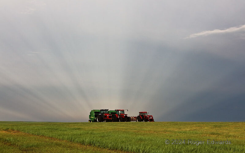
Glorious Farm Equipment
On this South Dakota country corner just a mile from Murdo, I witnessed a sublime sunset. Several minutes earlier, and on the opposite side of the sky, anticrepuscular rays formed by numerous western cloud elements appeared to merge together on the eastern horizon, beyond these farm implements, and deep into the rear of a severe-thunderstorm complex. Crepusculars and anticrepusculars (as they … [Read more...]
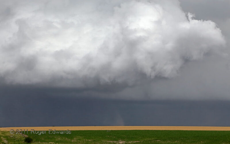
Another Forward-Flank Spinup
As of this writing, I've only seen about a half dozen forward-flank tornadoes in all my time storm observing, and all but one were with this weird, midday supercell! While one at right foreground dissipated under a still-rotating, scuddy part of an updraft base (note faint dark dust rightward of lower center), another persisted in the back, to the SW of the dying circulation. All of these … [Read more...]
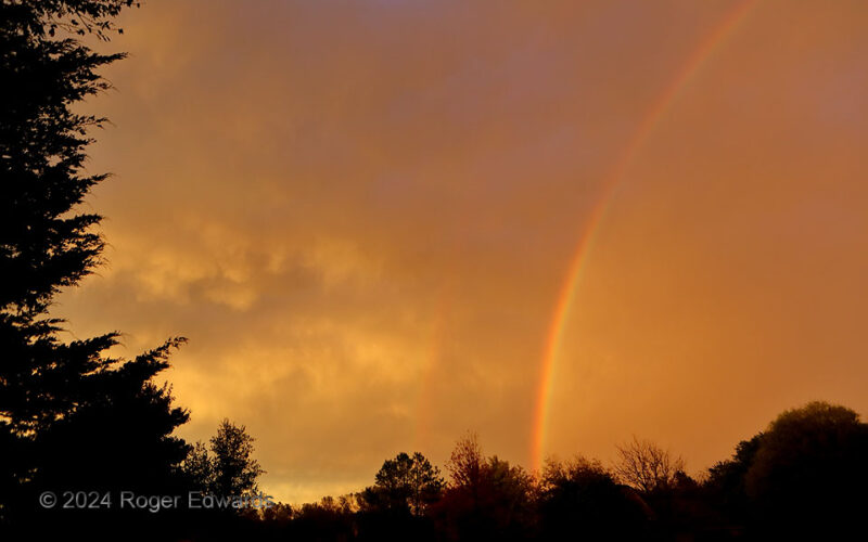
Autumnal Storm Retreat
Sometimes I would arise early enough from a post-night-shift slumber to catch the sunset, even in the cool season. This stormy spectacle was well worth an awakening by thunder, a little earlier than planned! The back side of the storm complex timed nicely for a double-rainbow and scuddy mammatus show in a forested part of east Norman where we live. Norman OK (3 Nov 24) looking … [Read more...]
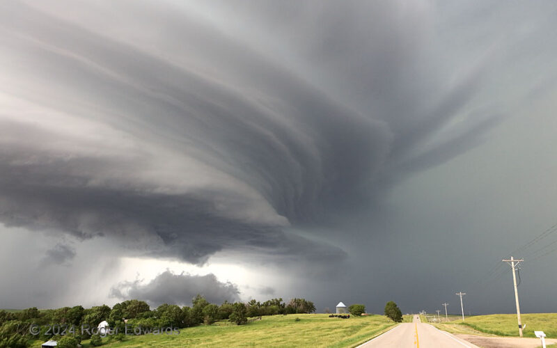
Supercell Highway
In south-central Nebraska lies a nostalgically cherished old two-lane, rolling up and down green hills and along river valleys. There, on just the right day every few years, one can observe a striated, fluid sculpture of vapors 60,000 feet deep swirl across the sky and over the road. I’ve witnessed the spectacle along this highway a few times, each event being deeply gratifying and worth every … [Read more...]
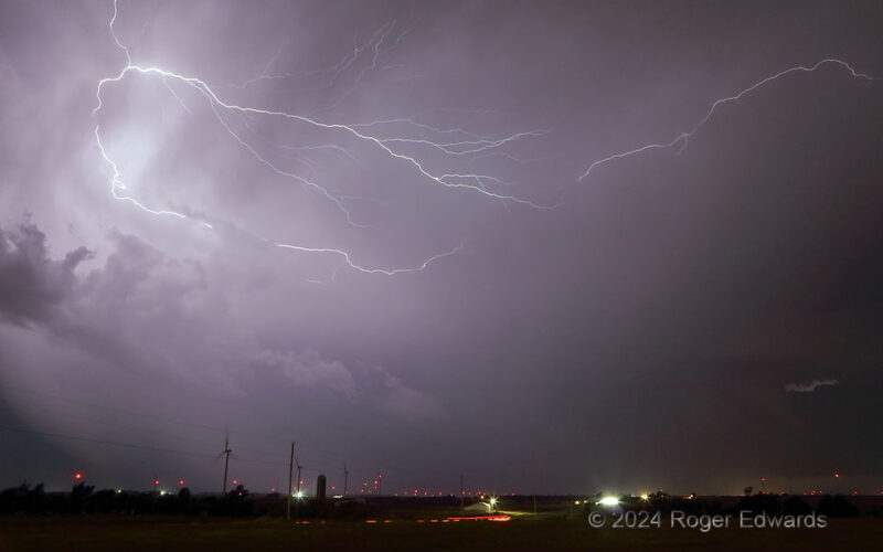
Western Crawler
Looking delicate but being deadly to anything in their way, tendrils of electrified plasma sliced the western sky, in front of a growing line of thunderstorms, southwest of the Oklahoma City metro area. Wind turbines faced south-southeast (left) in the inflow sector to the squall line, which soon would hurl outflow well ahead of the updrafts and become disorganized. 3 WNW Tuttle OK (10 Nov 24) … [Read more...]
- « Previous Page
- 1
- …
- 36
- 37
- 38
- 39
- 40
- …
- 418
- Next Page »