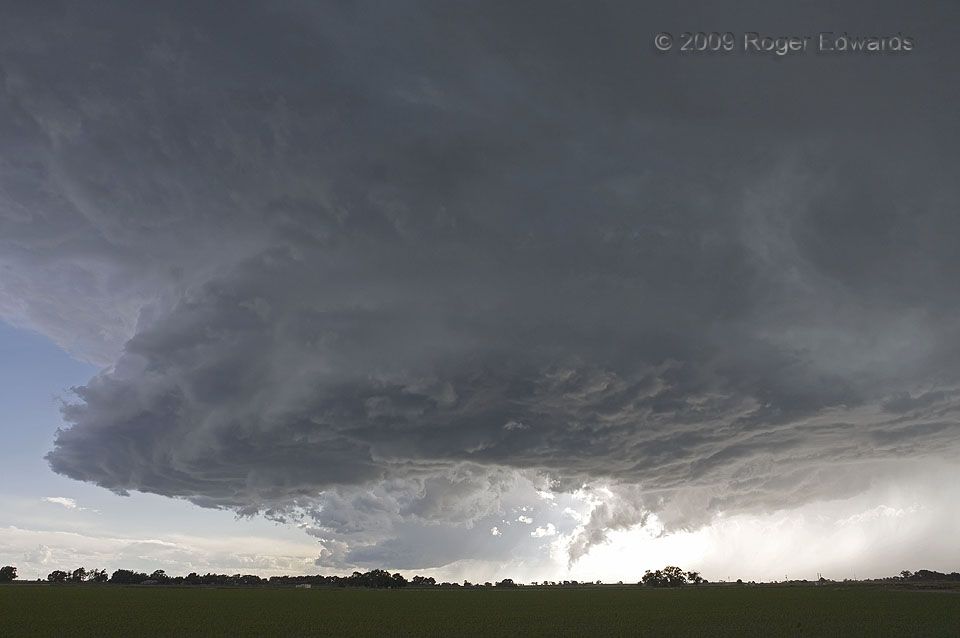
What had been three nearby supercells distilled themselves down to two: this one, which had a classical horseshoe base about 45 minutes earlier, and a differently shaped but equally beautiful northern storm centered less than 15 miles away. It was a marvelous experience to behold two such spectacles simultaneously at such close quarters, with outstanding visual clarity. Both storms were … [Read more...]

Supercell Pair: Northern
This storm, somewhat more laminar in appearance than its nearby southern neighbor, churned toward the ESE, just N of Colorado's Arkansas River Valley, for over two hours. Soon it would merge with the slightly younger southern storm to form a big, single supercell that would move off into the night and over southwestern Kansas. The interaction between the two storms, just prior to their merger, … [Read more...]
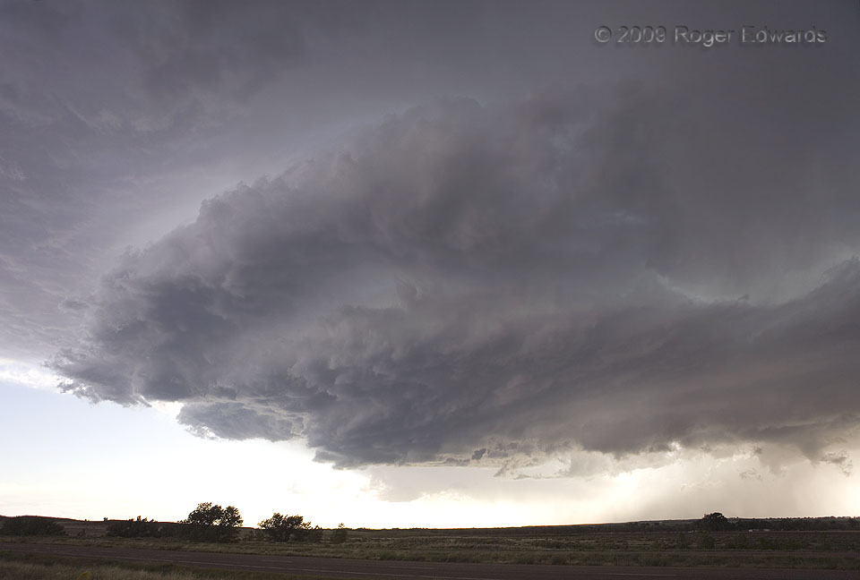
Horseshoe Base
The middle of a set of three simultaneous, close-proximity supercells presented a horseshoe-shaped updraft base as it moved generally eastward along the Arkansas River Valley of Colorado. At this point, the older, northern storm (unseen at right) was obscured by some rain and seemed destined for oblivion, but would rejuvenate later. The base of the third and smallest supercell actually can be … [Read more...]
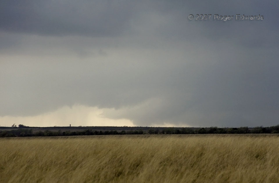
Distant Fat One
We saw six or seven tornadoes on this major outbreak day in the Texas Panhandle, but most were rain-wrapped, too brief to stop and shoot, or mired in dark conditions after sunset. Fortunately, this specimen, located in open country at least 10 miles SW of us and near the Donley/Briscoe County line, briefly presented itself as a viable (albeit faraway) photographic target before also becoming … [Read more...]
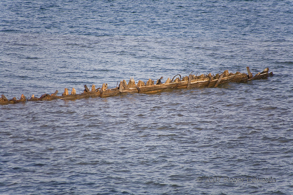
“Fedora” Shipwreck
On the windy night of 20 September 1901, the 282-foot-long wooden steamer Fedora uneventfully plied southward into the channel between the Wisconsin mainland and Basswood Island, bound for Ashland. Its impending demise was shocking and speedy. A kerosene lamp blew up in the engine room, igniting oil drums and turning the vessel into a giant floating inferno. With the water pumps also located in … [Read more...]
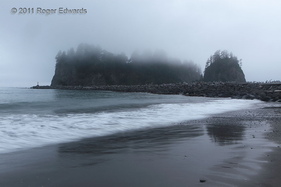
Washington Seashore in the Drizzle
Misty evening twilight fell upon the surf and sea stacks of Washington's Pacific coast, offering a serene scene for strolling solitude that was befitting the rainy, cool climate of the western Olympic Peninsula. LaPush WA (25 Jul 11) Looking WSW 47.9075, -124.64 … [Read more...]
- « Previous Page
- 1
- …
- 246
- 247
- 248
- 249
- 250
- …
- 413
- Next Page »