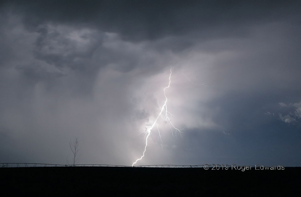
Following a long and rather disappointing daytime chase with fuzzy, poorly structured, generally non-photogenic storms, it was tempting to just throw in the towel, get an early take-out dinner, let the nighttime accumulation of storms pass eastward from the relative comfort of my motel room, and rest up for whatever may await the next day. Instead, a sweet visual dessert of lightning beckoned on … [Read more...]
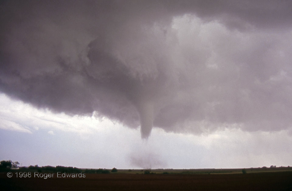
Tornado with Subvortex Filaments
A wide-angle film slide shows a classic Oklahoma tornado moving ENE toward the Cimarron River south of Dover. Note the skirt of scud wrapping into it at cloud base, and the well-defined slot of brightness to its upper right (to its NW). So-called "clear slots" like this—which often are just less cloudy—are common with tornadoes from classic supercells. They evaporate out of the clouds in … [Read more...]
Twilight Arcus from Behind (Flint Hills)
Flint Hills time is good time spent—here, quality over quantity. Alas, we were in the area only a short bit, thanks to fading twilight and hunger for dinner in nearby Topeka, where we had reserved rooms after a fruitful round of tornado observing to the west, earlier in the day. Sequential attempts to intercept additional supercells—storms that had developed farther east and south in the growing … [Read more...]
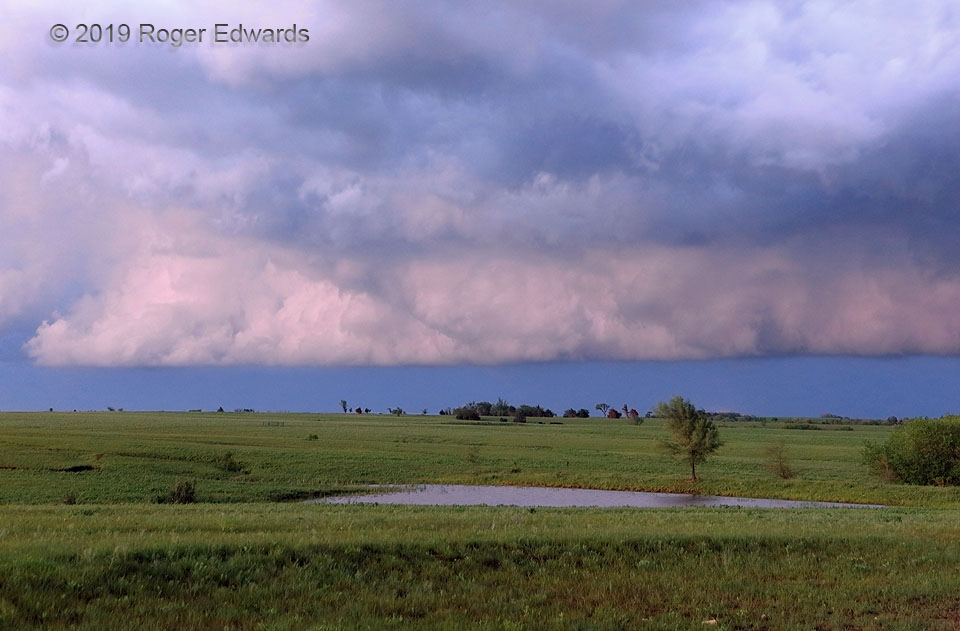
Storm on the Range
Cresting the last of the big high spots and roadcuts on US-87, before plunging down-valley toward Grass Range, revealed an awesome early-afternoon sight of great promise, only available in brief, truncated glimpses beforehand. This fine young supercell had erupted over the Judith Mountains northeast of Lewistown, headed for the open grasslands that gave the nearest town its name. Its … [Read more...]

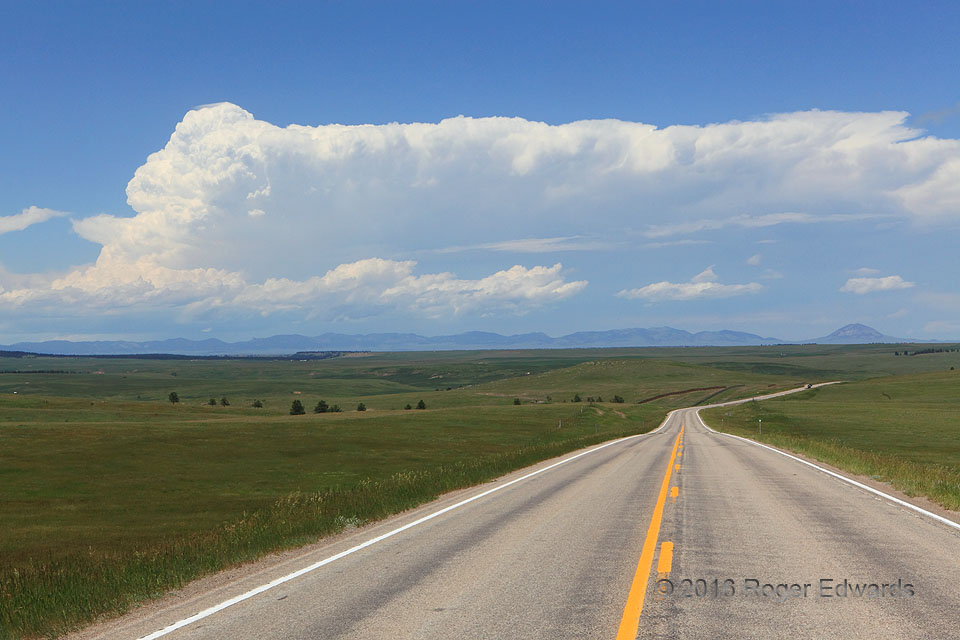
Midday Colorado Supercell
What an active storm day this was! Nationally, dozens of tornadoes marked a "Corn Belt outbreak" from Colorado to the Ohio Valley, including a deadly and very destructive one that night near Dayton, OH. Personally I saw four supercells and at least three tornadoes in northeastern Colorado, between Denver and the inner corner of Nebraska. The adventure began with this midday beauty: a … [Read more...]
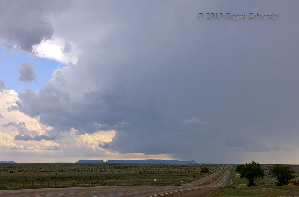
Rotating over Mesa Country
On the last day of my "normal" spring chase trip, one final supercell spun up along the intersection of outflow boundaries, over west-central New Mexico's mesalands. Promising as this scene may be, it represented the storm's peak; for soon it would ingest too much outflow air and wither slowly, while scooting eastward. Were it not for an unexpectedly active bonus pattern for northern Plains … [Read more...]
- « Previous Page
- 1
- …
- 195
- 196
- 197
- 198
- 199
- …
- 413
- Next Page »