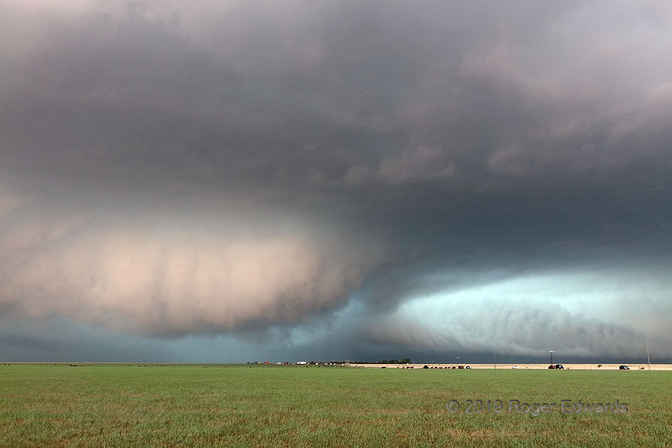
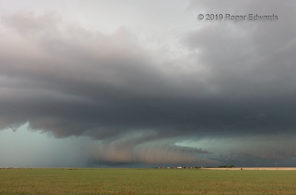
[Part 2 of 4] After observing acceleration and intense motion in this supercell's strangely shaped and colored tail cloud, the oddly colored wall cloud at lower left formed along the wrapping HP gust front of this storm to my southwest, raced northward, and began spinning and tightening rapidly as it encountered the high-helicity, backed-flow environment feeding the larger, older mesocyclonic … [Read more...]
“Armadillo Tail” Cloud
[Part 1 of 4] This messy, heavy-precip (HP) supercell just above the Texas Caprock already had produced a few rainy tornadoes near Tulia, and was fixing to spin up at least another couple brief ones within an intense, wrapping interaction of larger circulations. For now, the fascinating feature was an oddly lit tail cloud, contrasted with a coral-beige hue of eastern late-afternoon light, set … [Read more...]
Lighting and Lightening Lightning
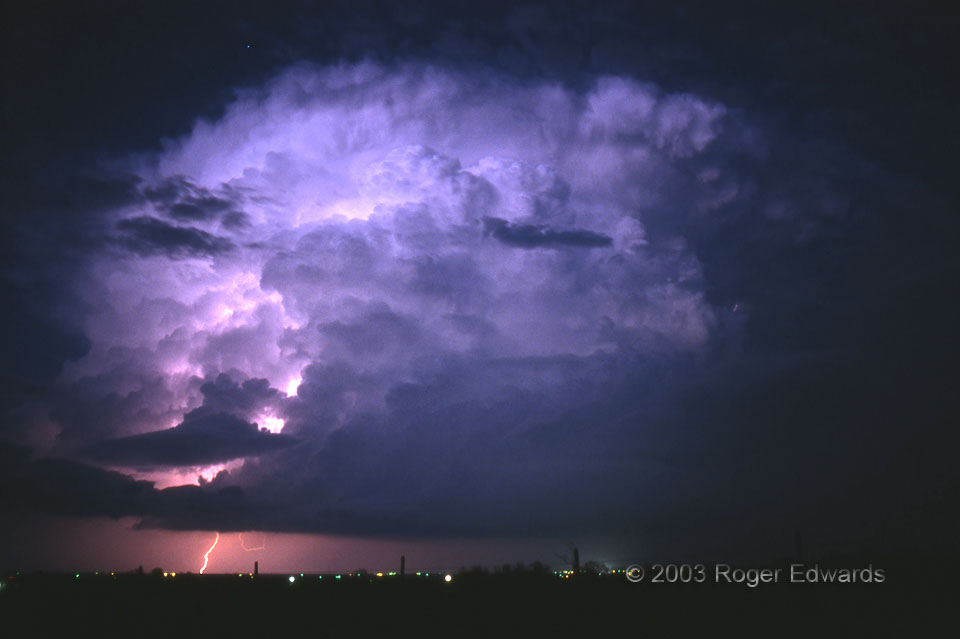
This supercell was doubly illuminated—from within and from without—by an enchanting combination of twilight glow and in-cloud lightning. Both lightened up the scene, hence my tongue-twisting, alliterative post title. For added measure, the storm fired off a cloud-to-ground stroke as a star rose from behind its billowing pile of convective towers. We stayed in one place as this storm formed … [Read more...]
Wondrous Storm Light
A maddening navigational error, gambling on a back-road shortcut that turned out to be flooded 15 miles in, made me backtrack 20 minutes each way onto a different, longer route, wondering what I had missed, barely able to return to the front of a growing storm cluster with embedded supercells. Yet that frustration became a blessing in disguise when I finally got back ahead of the storms, to be … [Read more...]
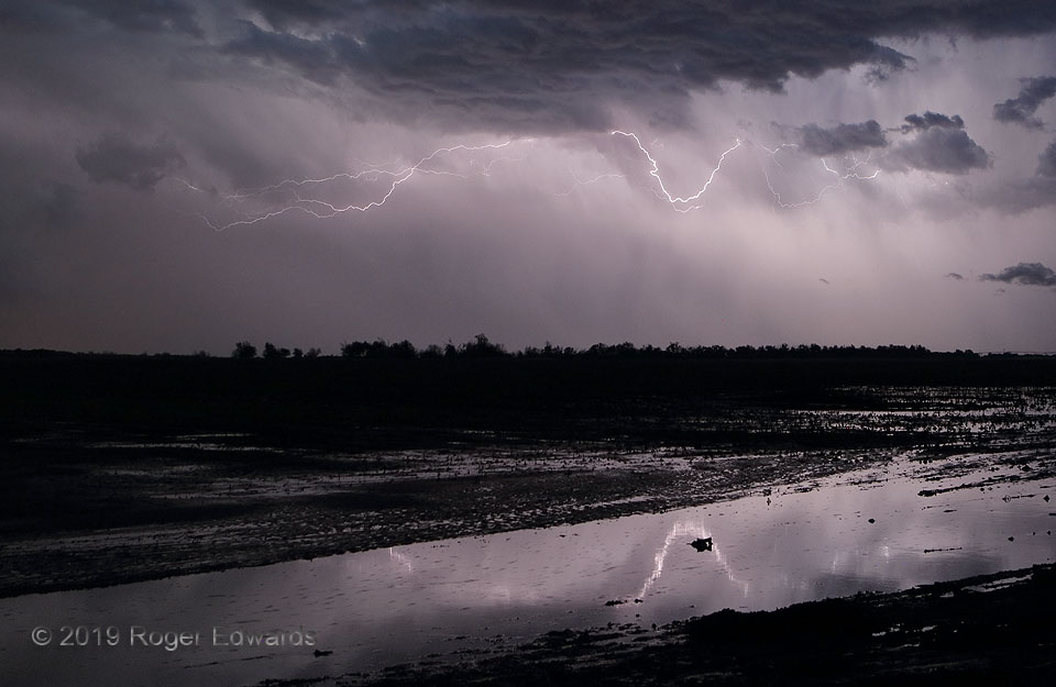
Crawler Lightning Reflected in Farmland Flood
After a heavy-precipitation (HP) supercell unloaded copious hail up to 1-3/4 inches in diameter, and some low clouds cleared, this storm provided quite the fireworks show from its backside. A dip in the main channel reflected in part of a flooded farm field, across which running water was clearly audible. No planting would be happening for a few days or more after this!4 N Olustee OK (8 May 19) … [Read more...]
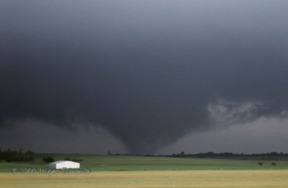
Multiple Vortices near Minco
Though we saw 11 tornadoes in this most intense and destructive of Oklahoma tornado outbreaks, photography of them was very difficult on high-speed (low ISO) slide film. This is one which somehow came out steadily in zoom, of the wildly gyrating and metamorphosing Minco tornado from Storm B. In this stage, its condensation appearance varied from fat cone to wedge, translucent scud racer, … [Read more...]
- « Previous Page
- 1
- …
- 187
- 188
- 189
- 190
- 191
- …
- 385
- Next Page »