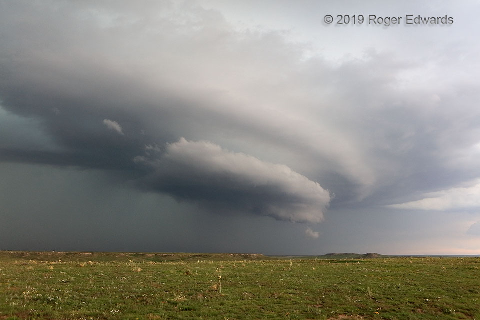
This wild formation had origins worthy of a swashbuckling meteorological adventure tale. A young, small supercell formed as a surface-based storm and quickly began rotating, in the moist, helicity-enhanced inflow region of a larger, older, established supercell. The newer storm produced some severe hail as it merged northward into the forward flank of the older one, while an unrelated outflow … [Read more...]
Supercell with Asperatus
This extraordinary cloudscape assembled from an extraordinary recipe: the merger of a newer, smaller supercell into the forward flank of an older, larger one, at the same time an outflow boundary from a separate area of storms crashed the party from the east. This updraft, region, which still rotated rather obviously, represented what was left of the original supercell's mesocyclone area after … [Read more...]
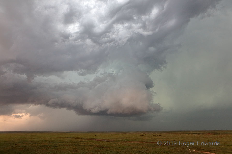
Daylight Darkens the High Plains
When beholding an imposing scene such as this, and pondering the relative paucity of meteorological understanding of the era, it's easy to understand how early Great Plains settlers may have considered the world's end as a fate not much more alarming than the biggest, loudest, most ominously stygian storms rampaging uncontrollably toward their homesteads. Even then, this churning maelstrom—a … [Read more...]
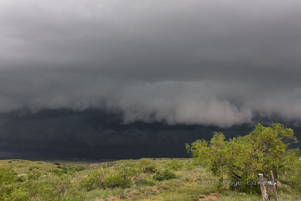
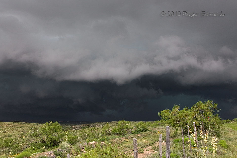
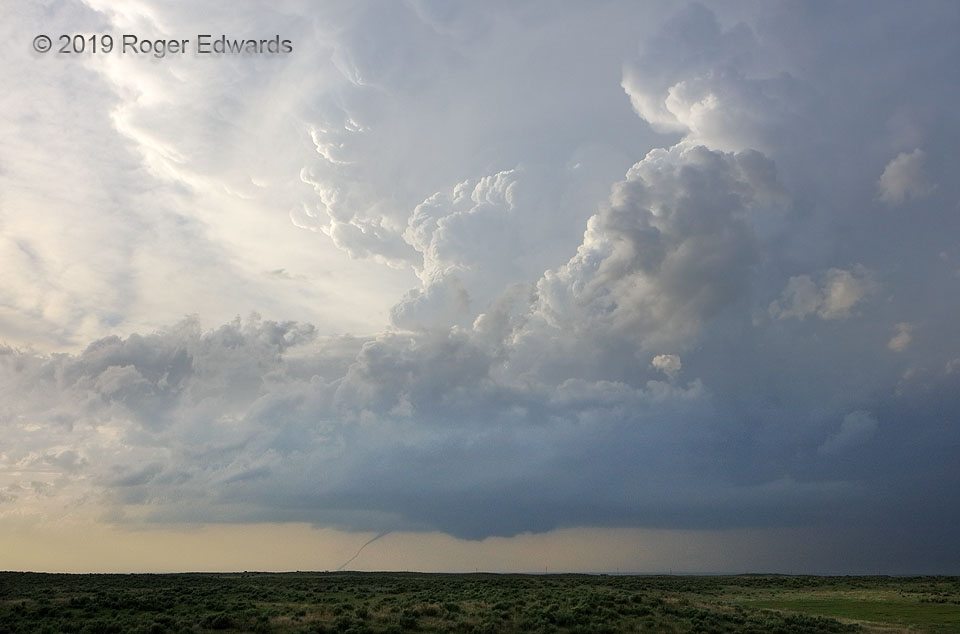
Panhandle Storm Coming
When an older supercell, moving hard rightward, merges with a newer supercell forming in its inflow region, all simultaneously meeting an unrelated, large outflow boundary moving westward from an old area of thunderstorms, something interesting shall happen. And so it was, here in the western Texas Panhandle: an evolution of the combined, semi-elevated convective mass into a deep, dark complex … [Read more...]
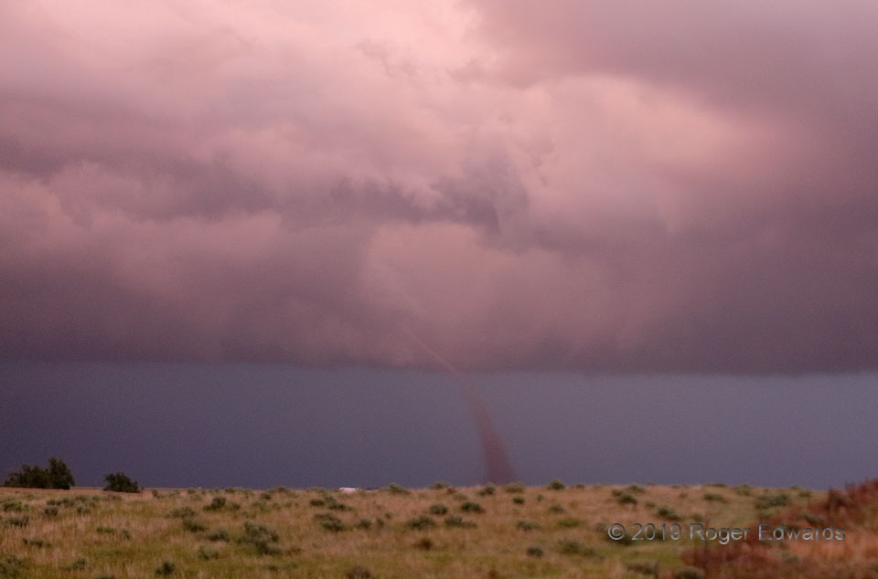
Kansas Sunset Tornado
After one photogenic daylight tornado, this dryline-fired supercell puttered along in messier form, with multiple, seemingly disorganized updraft areas, for over an hour. Then near sunset, a series of tornadoes began, starting with a brief dirt whirl under the flanking line near Fowler. That soon was followed by this vortex near Minneola, which developed as the new flanking-line's updrafts … [Read more...]
Complete Supercell Package
The pinnacle of High Plains storm observing is the sculpted, brilliantly lit supercell beyond green, rolling prairie, with warm, moist inflow at the back, meadowlarks singing...and a tornado beneath. We were in Oklahoma, and the tornado that began near the state line was in Kansas. As this vortex stretched along its journey to demise, a new wall cloud developed to its southeast (right) in … [Read more...]
- « Previous Page
- 1
- …
- 184
- 185
- 186
- 187
- 188
- …
- 385
- Next Page »