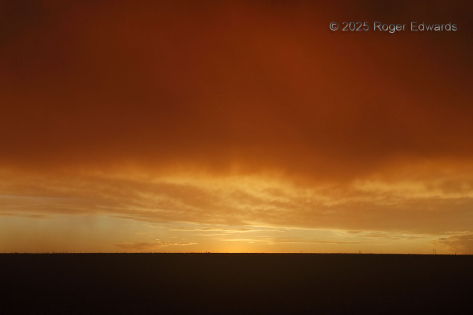
Doesn't it make sense that, on the opposite side of a "High Plains Eastern Sunset Sky," we get the "High Plains Western Sunset Sky" too? Yet somehow the two skies and landscapes, shot just four minutes apart from a few dozen feet across a country two-lane, looked greatly different. This view was more stark, ending on a treeless land that looks as if it could go on for infinity, and a sky nearly … [Read more...]
Dark Severe Surge
As messy and beset with precip and outflow as this complex supercell was, with this tremendous surge happening just to the south of one of a few embedded mesocyclones along US 277, I wouldn't have imagined that a couple of fortunate friends and scientific colleagues were seeing a legitimate tornado on this other side, and especially, able to see it in the darkness and rain. They somehow found an … [Read more...]
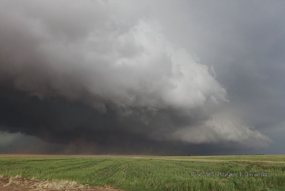
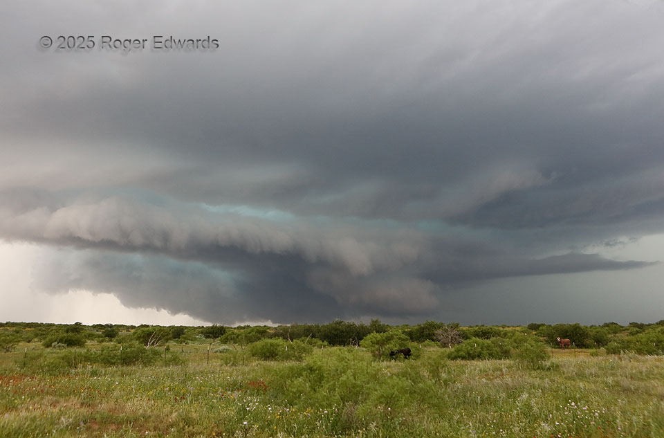
Addition by Division: Supercell Style
Homing in on a big, nasty (but nicely structured) HP supercell from the northeast, we didn't expect that it would divide into a multiple-mesocyclone complex as we got close enough for a look beneath. Yet it did. This was the northernmost of them, seemingly doomed for two reasons: 1) a dense cascade of precipitation already was plunging through the cloud base in the southern (nearest) part of … [Read more...]
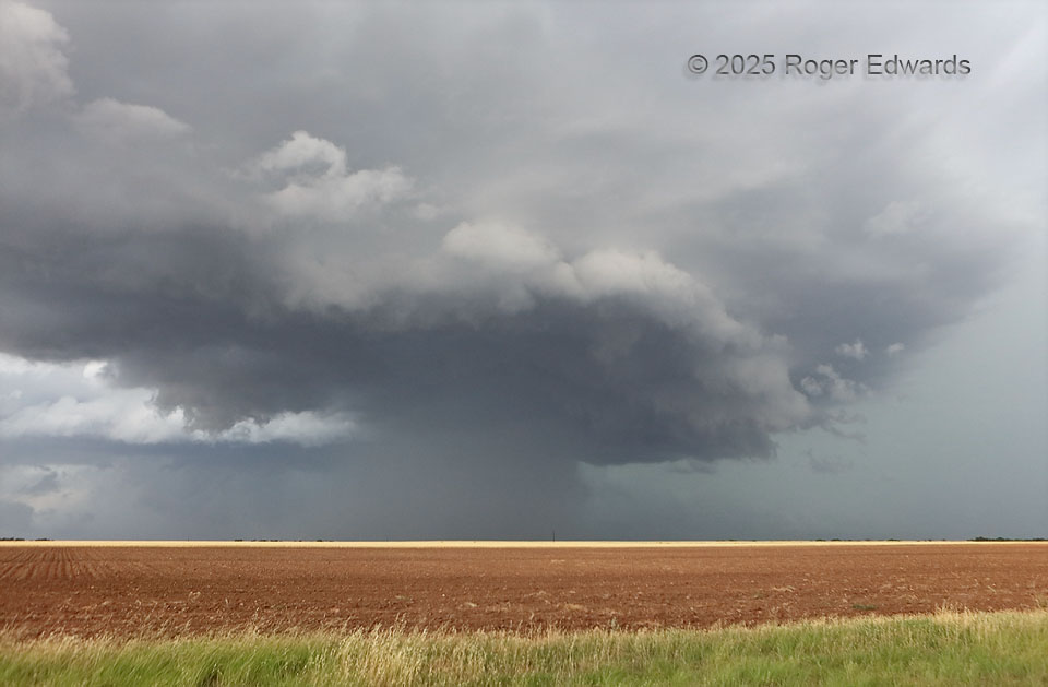
Another Northwest Texas HP Stormzilla
This was a day for messy supercells: first a complex and beastly storm in Motley and Dickens Counties that ultimately undercut itself with outflow and gusted out, then after about an hour and a half of transit to its north and east, this big, heavy-precip stack of wildness in the distance of Haskell County, on the southern end of what by then was a large cluster of storms. Long ago I nicknamed … [Read more...]
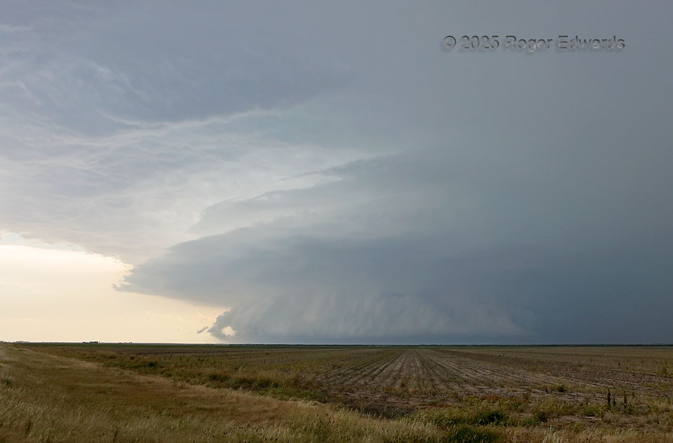
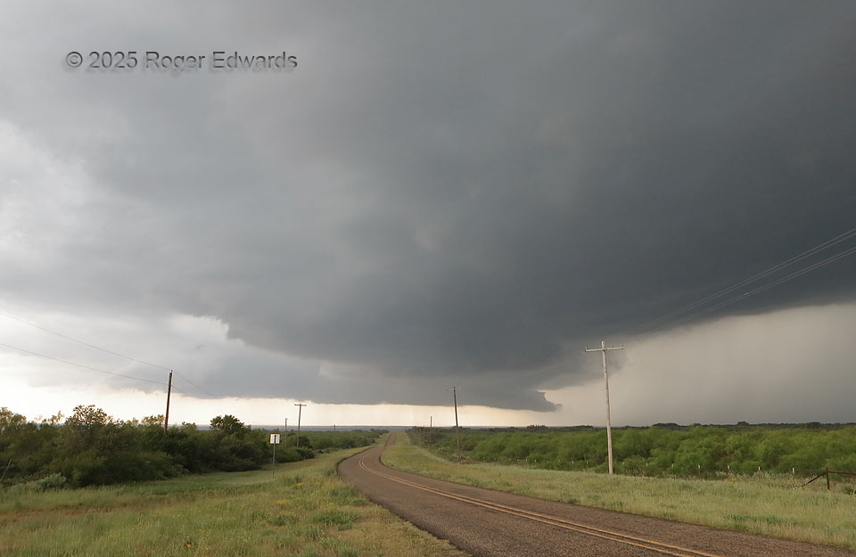
Complicated Supercell
A complex supercell that already had done one prominent mesocyclone jump (to a new occlusion point) was in the process of another here. This was quite evident once we navigated a gnarly but passable dirt road southeastward to avoid the forward-flank core, then zigzagged back southwest into the updrafts' broader path. A wildflower-festooned foreground field was a nice touch; it soon would take a … [Read more...]
Mesocyclone Jump
Here is an entry that is more educational than photogenic, but I'm including it because of the valuable lesson. It involves one supercell, two mesocyclones, and a distressing situation for all storm observers piddling around under the far one! This sturdy and mature supercell, right as it was entering a substantial void of paved roads, "jumped mesocyclones" to a new occlusion point along the … [Read more...]
- « Previous Page
- 1
- …
- 10
- 11
- 12
- 13
- 14
- …
- 418
- Next Page »