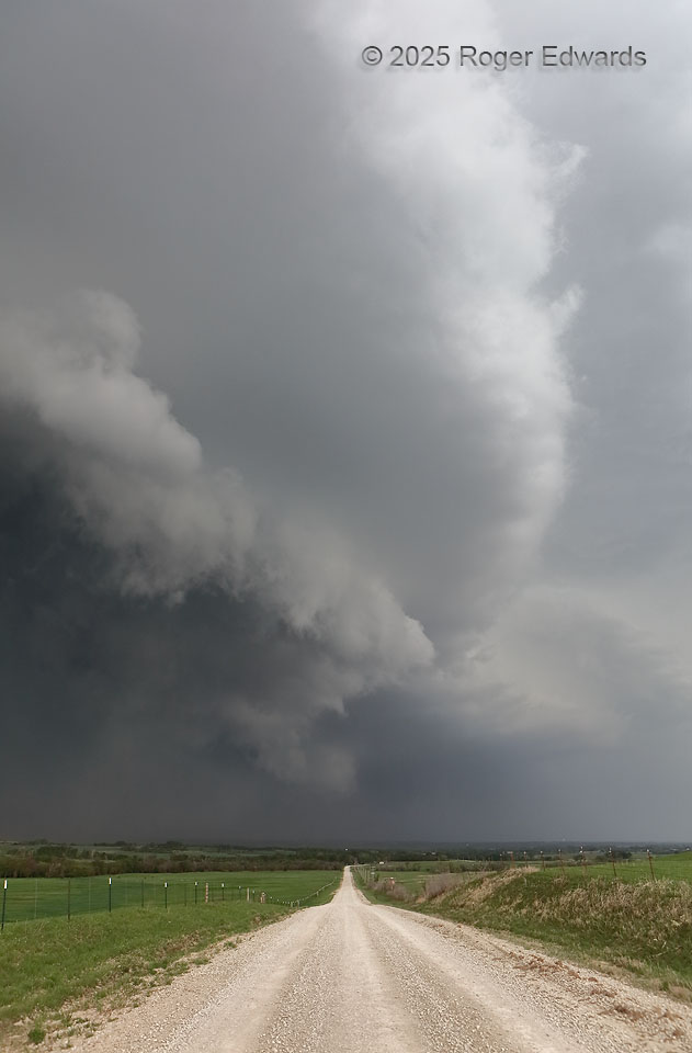
A fast-moving, hail-hauling, gust-blasting, heavy-precipitation supercell is no place to go. As such, the road this way was decidedly an unsafe route at this time, and we would have discouraged anyone northbound from continuing for another 10–15 minutes, at least. This very thing, I've had to do on several occasions while photographing storms! I hope to have saved those folks a great deal of … [Read more...]
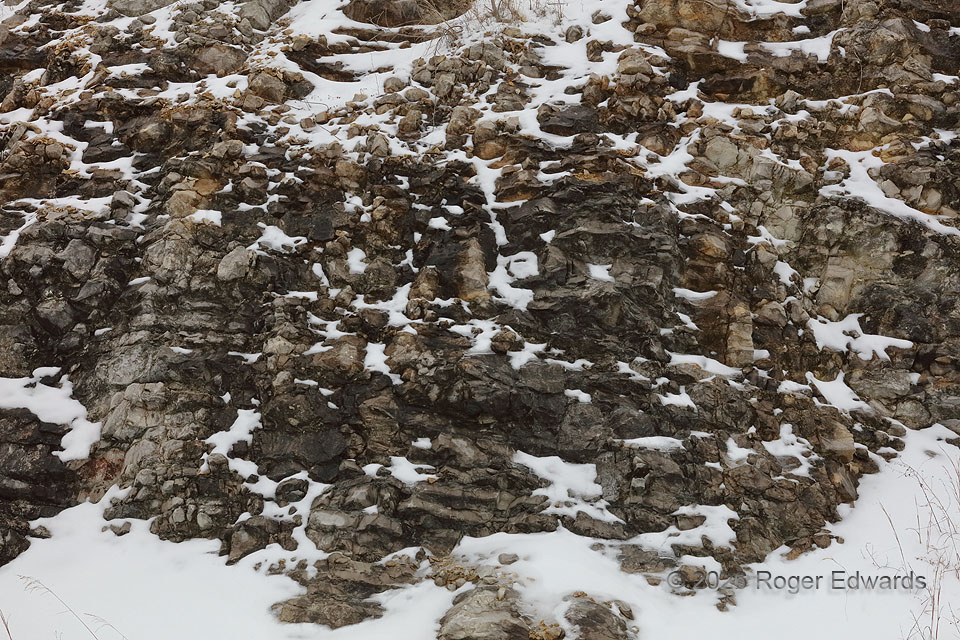
Snow Pockets on Roadcut
Cobbles and protrusions of buff to tan and gray limestone in the Ordovician Bromide formation, along a north-facing roadcut slope, offered ample pockets and crevices for lingering unmelted snow. The cool, cloudy conditions, though above freezing, allowed one more day of this fascinatingly mottled scene before more melting in an above-freezing north wind would erase the white parts. 5 S Davis OK … [Read more...]
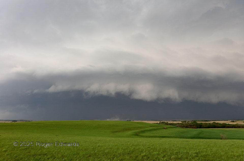
Flint Hills HP
Following a few hours of non-atmospheric sightseeing in northeastern Kansas, waiting for storms to form along a slow-moving, partly stalled boundary, storms erupted all along it in quick succession. That wasn't a desired outcome in an environment that favored nice supercells if that didn't happen. So we made the best of the mess, intercepting the first embedded supercell to roll up the line. It … [Read more...]
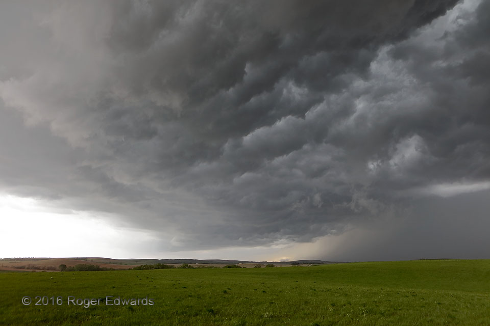
Whale’s Mouth and Core
Manifesting nicely the cliché, "History may not repeat, but it does rhyme," this turbulent underside echoes another I photographed one state to the south and nine years earlier. The visual similarity is uncanny! However, this time the process leading to essentially the same "whale's mouth" scene was much different: the rear-flank downdraft of a large, outflow-dominant, heavy-precipitation … [Read more...]
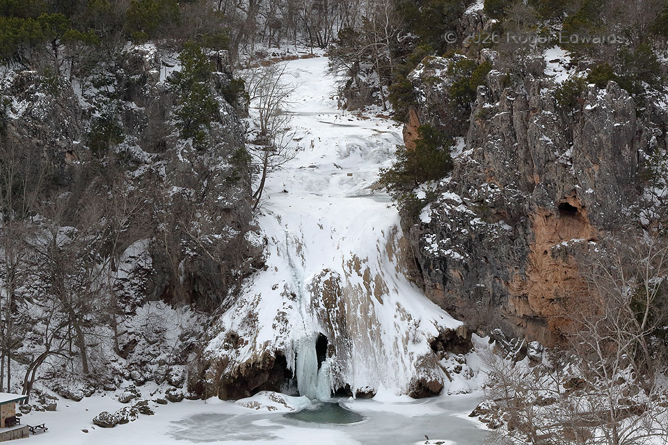
Turner Falls, Frozen
Most of the year, southern Oklahoma’s Turner Falls spills Honey Creek 77 feet down a steep slope of travertine. Water rich in calcium carbonate has deposited the travertine atop Ordovician limestone bedrock throughout most of the Quaternary period. The waterfall ices over like this every time there’s an extended spell of below-freezing temperatures with shots of bitter cold embedded (single … [Read more...]
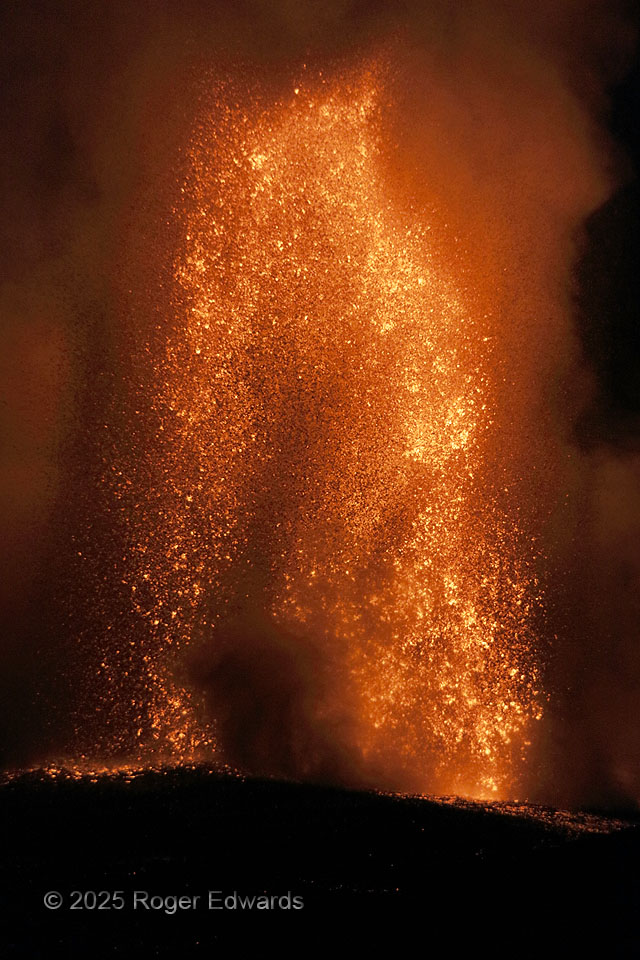
Lava Fountain Arch
In 2025 at Kilauea, the rocks went up, and the rocks went down. At 2,000 degrees, most still molten when they hit the ground, they lit up the sky and heated the air above and around. Tremendous pressure needs to underlie any reservoir of liquid to force it through a 50-foot-wide vent, Bernoulli-style, to heights topping 1,000 feet. That's especially true when the liquid is heavy as stone, … [Read more...]
- « Previous Page
- 1
- …
- 9
- 10
- 11
- 12
- 13
- …
- 418
- Next Page »