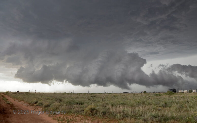
Fighting only partly modified cold outflow from an earlier supercell to the east, yet benefiting from it in terms of enhanced vorticity, this storm already had spun up one strong wall cloud and a few brief tornadoes. However, I suspect that the coolness of the other storm's outflow (which I could feel by this point) kept this one from producing more sustained and/or bigger tornadoes. Is this a … [Read more...]
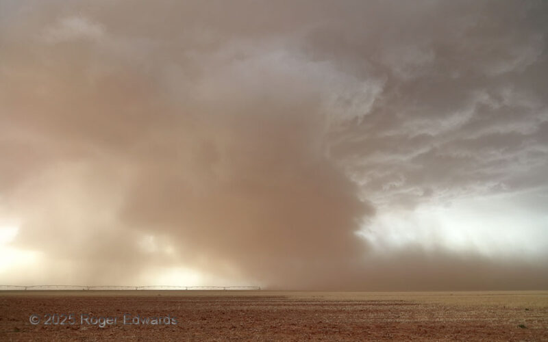
Boundary Striking A Match
This dryline-initiated supercell had chugged along eastward from the New Mexico border area, rather high-based and producing occasional severe hail, but otherwise nothing out of ordinary. An outflow boundary from a severe, heavy-precip supercell near Lubbock (that itself went up on an old outflow) surged west-southwestward and decelerated in this direction, but still was strong and moving. I … [Read more...]
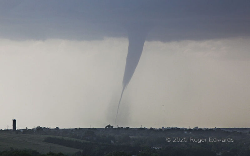
Three-Layered Tornadic Tube
This is a deep zoom from the same hilltop location where I shot wide angles of the parent supercell with this tornado beneath. Tornadoes almost always are wider than their visible clouds, and the strong winds can extend far outside the condensation edge. The cloud just represents where pressure has fallen enough to cool air to the dewpoint locally. Here, that happened in two layers: a narrow, … [Read more...]
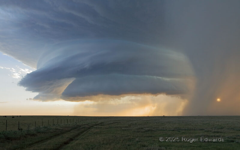
High Plains Supercell Masterpiece
A promising young storm rolled east-southeastward over the High Plains and into the golden hour, growing more spectacular by the minute. Had this supremely beautiful supercell stopped its dazzling evolution in this moment and place, then utterly vanished, this would have been "structure of the year" for me, in quite a good year for it. However, just when one could have supposed the artistry of … [Read more...]
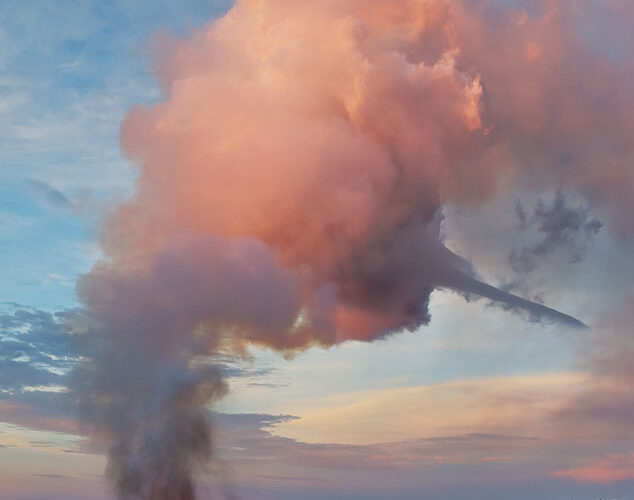
One Kilauea Sunrise
Of all the sunrises and sunsets I’ve seen, this was the most fully irreproducible: A nearly 1,000-foot volcanic fountain aglow, sending lava across the caldera floor, below a deep-convective column 20 times its height. The plume thrust upward then downwind with purpose, well into the rays of both the rising sun and the south Hawaii Island radar. A peculiar spike at right, made of the … [Read more...]
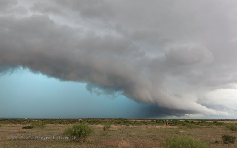
Thunderous Turquoise
Skies like this are stunning in their form and tone, but mean something decidedly unseemly in that deep, dark and swirling world "in there." We had witnessed a less rain-wrapped stage of this storm, knew it could mean trouble, and barely managed to catch back up. On the opposite side of the big, messy supercell, near Munday at this time, a mesocyclone unleashed a measured, 106-mph gust west of … [Read more...]
- « Previous Page
- 1
- …
- 10
- 11
- 12
- 13
- 14
- …
- 413
- Next Page »