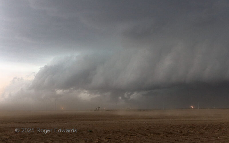
By the time this storm emerged again from the dust that cloaked it, outflow dominance had set in, and the supercell was surfing its own shelf cloud and gust front southeastward. [I had photographed another supercell's outflow effects from near this spot 17 years earlier.] At this moment, the associated wind shift was passing through a field of oil wells, including flaring chimneys for natural … [Read more...]
Tornadic Supercell in the Dust
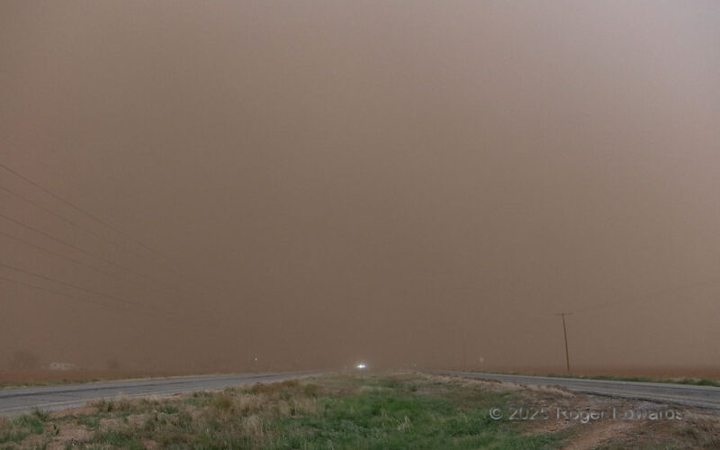
See the spectacular and majestic tornadic supercell that was right down the road and moving toward us? No? Good, because we couldn't either. The only cloud we could see was the dust cloud, in roaring inflow winds lofting it from nearby dry, plowed fields, akin to a storm-scale Dust Bowl. Based on our sequence of stops and others' observations, dust was continuous in a plume hundreds of feet … [Read more...]
Structure on the South Plains
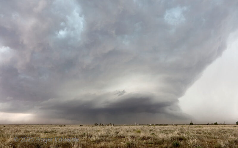
Normally, being east of a southeastward-moving, heavy-precipitation (HP) supercell is a lousy idea, both meteorologically and tactically. They tend to curl the forward-flank precip region (which can contain damaging hail and flooding rains) eastward then southeastward, rendering this view of the main updraft region at this distance nearly impossible, and our storm-relative position decidedly … [Read more...]
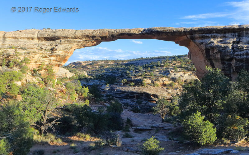
Owachomo Natural Bridge
Yes, here's another waterless "Water Work." When it's not waterless, that water works well. Spanning 180 feet, this large natural arch is composed of a tube of especially resistant Permian Cedar Mesa sandstone in Natural Bridges National Monument. Freeze-thaw cycles happen throughout the cool season when water in wet rock freezes to crystals, which expands and pries the grains apart from their … [Read more...]
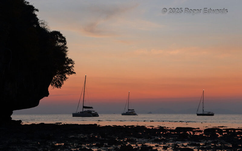
Low-Tide Railay Sunset
One evening after a fine evening on Railay Beach, came another. Peaceful waters of the Andaman Sea supported sailboats anchored in the twilight, while low tide broke reflections of the most fiery parts of the sky into little pieces. It was just another easy end to a calm, tropical day. Railay Beach, Thailand (1 Feb 25) Looking WSW 8.0096, 98.8375 … [Read more...]
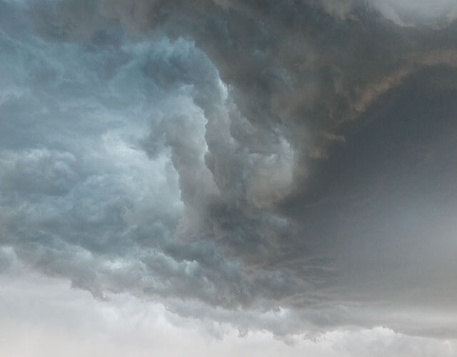
Elevated Whale’s Mouth
Swerving this way and that, a strange but explainable cloud formation hovered over the north-central Nebraska Sandhills like a giant, fluid abstract painting. The core at right -- earlier stronger, but now dying -- produced a shelf cloud atop a deepening layer of stable outflow from other storms that already had cooled the airmass near the surface substantially. Still cooler, yet still buoyant, … [Read more...]
- 1
- 2
- 3
- …
- 413
- Next Page »