Here is the east (left, from my vantage) end of a tremendous outflow surge across the wheat fields of the Nebraska Panhandle, thanks to a former heavy-precip supercell now evolving into a small bow echo. This storm produced reports of almost hurricane-force gusts near our location, and rocked the vehicle strongly as the core roared past. The right (west) side was also quite photogenic. 7 SE … [Read more...]
Search Results for: "Jun 18"

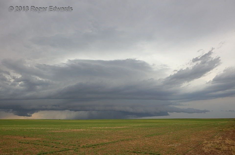
Harrisburg Arcus: Right Side
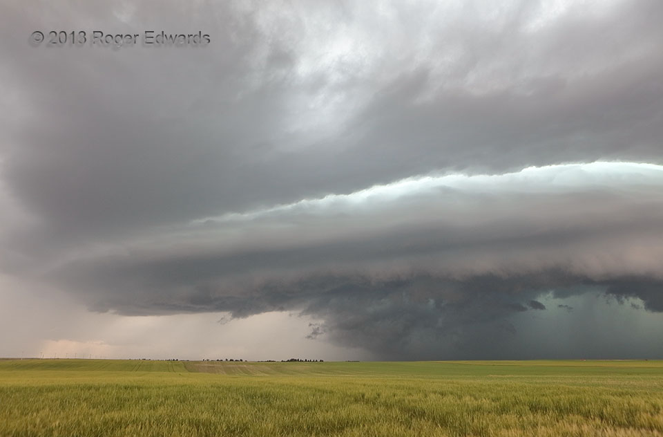
An outflow-dominant supercell began to lose its rotational characteristics and surf that outflow northeastward across the pocket of unstable air in which the storm formed. Since we stood to its northeast, that meant the leading edge of the outflow was directed right at is, offering a spectacular, multilayered shelf-and-chamber cloud stack from the western sky (shown here) to the southern. The … [Read more...]
Outflow-Dominant Supercell
Beneath the anvil of a broader area of earlier and ongoing convection, a pocket of residual, unstable air lay, unperturbed by all the activity around. When two outflow boundaries merged in that unstable patch, a supercell was born. Alas, the storm was in an environment of decent deep shear but weak low/middle-level flow. Despite developing a healthy midlevel mesocyclone with inflow tails, this … [Read more...]

Supercell across Lake McConaughy
This situation is unsuited to safe boating. Fortunately I didn't see anyone still out on the lake as a previously tornadic, always messy, now-HP supercell churned over the biggest reservoir on the central High Plains. As seen from this overlook on the south side of the "Big Mac" dam, the newest mesocyclone was located to the left of the intake tower, strongly rotating but now obviously tornadic, … [Read more...]
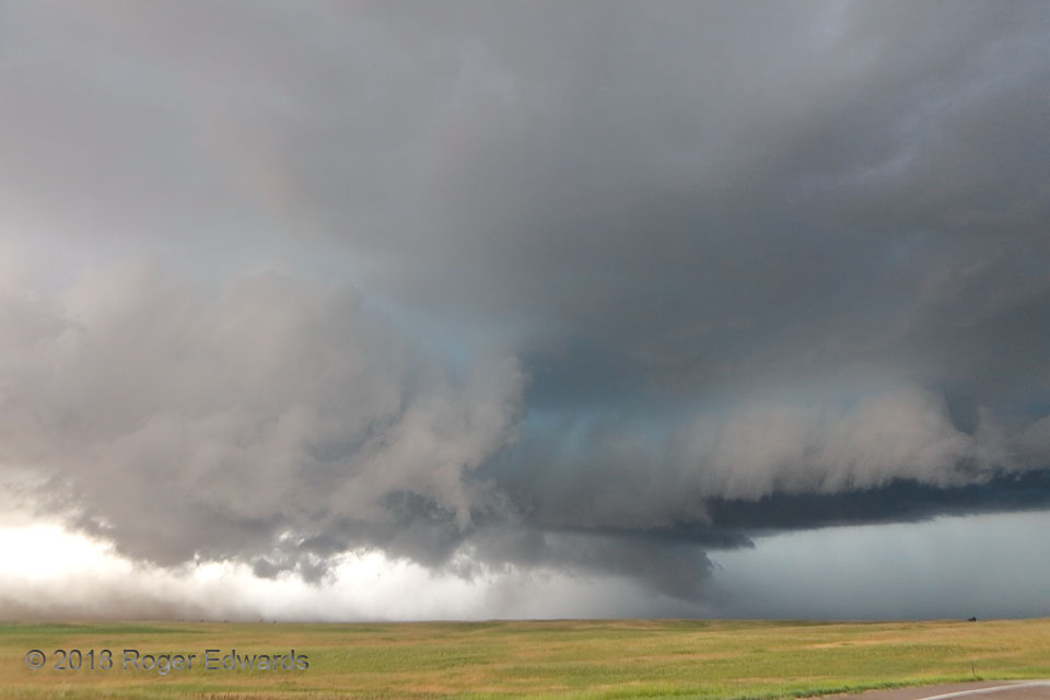
Messy Mesocyclone
Two hundred fifty miles back and forth for this? Why, yes! We had started the day northwest of the warm front in Kimball, needed an electronic repair nearest done in Cheyenne, WY, while forecast-targeting the northeastern corner of Colorado, northeast of a mesolow along the front where convergence should be maximized. I like challenges. High-speed-limit High Plains interstate: no problem! We … [Read more...]

Twilight Sparker
Despite its being worn down to a high-based, skeletal nub by dry entrainment and stable-air ingestion, the remains of what had been a vigorous little Colorado High Plains supercell continued to shoot cloud-to-air lightning every few minutes. Here, I was fortunate enough to catch one discharge and the faint ending part of another, with the shutter open on a brief time exposure. 5 ESE Boyero CO … [Read more...]
- « Previous Page
- 1
- 2
- 3
- 4
- …
- 6
- Next Page »