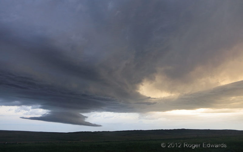
To answer the title's question bluntly: No! Nonetheless, those imaginary images came to mind, even in real time, as these otherworldly, supercellular cloud formations shifted quickly northeastward over the remote High Plains countryside south of the Black Hills. Perhaps scenes like this have contributed to the mythos of visiting aliens. Wall clouds usually are far more convective than laminar, … [Read more...]
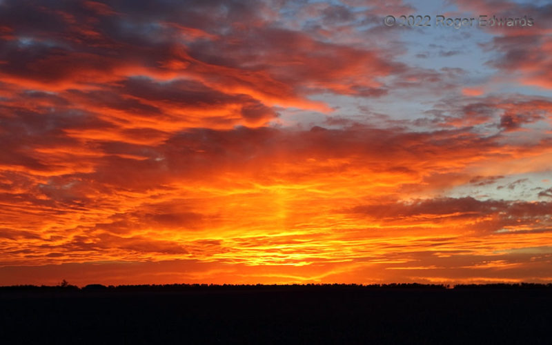
Blazing Sky and Pillar
Sometimes, the most amazing sunsets are the most unexpected. This was a repositioning day from prior days in northern New Mexico, eastern Colorado and western Kansas, to predicted supercell potential the next few, near where South Dakota, Wyoming and Montana converge. While on the way to Chadron for the night, I had pulled off here to loosen the legs a bit for the stretch run, and in hopes of a … [Read more...]
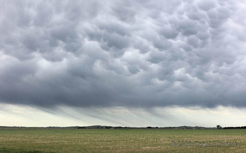
Sheared Cores and Mammatus
Well behind a surface cold front, a band of midday showers formed along the elevated frontal surface, tapping some residual moisture, and rooted in the lower middle troposphere. Individual showers raced off to the northeast, nearly along the axis of the convective band. Their rain shafts got so strongly tilted both from the parent showers' fast movement aloft, and stiff northerly to … [Read more...]
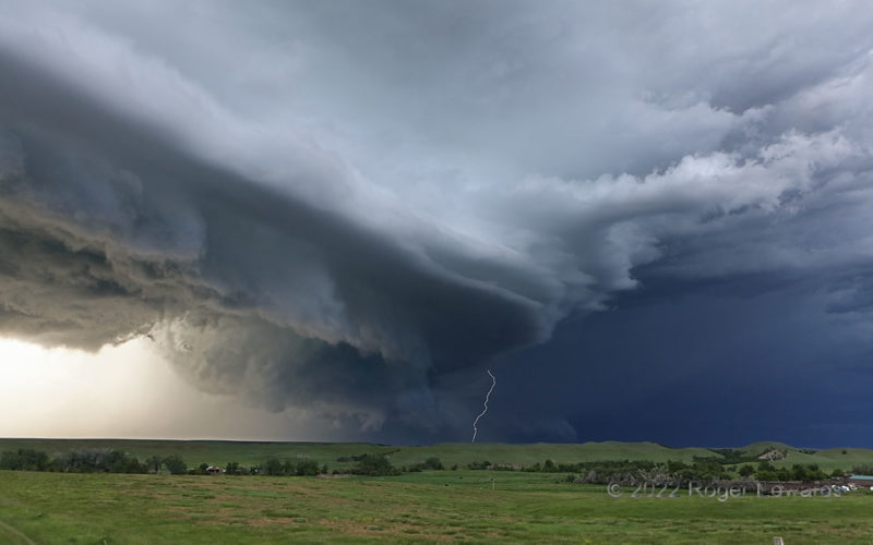
Supercell Sky, St. Onge
Aside from being one of the most spectacular scenes of the 2022 chase season for me, this look at a supercell also offered a veritable kaleidoscope of cloud forms and processes, all at once. The main mesocyclone, with broadly rotating wall cloud, churned along to the left of the lightning flash, and sported a nice "RFD cut", where the occlusion downdraft (the inward-directed part of the … [Read more...]
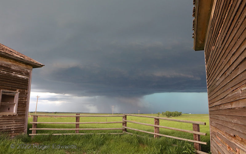
Young Mesocyclone at School
Two abandoned schoolhouses, and the fencing between them, fortuitously pointed many lines at a rapidly organizing mesocyclone, with a wall cloud condensed partly of rain-cooled forward-flank air. Half an hour before, this storm didn't exist; it erupted rapidly from deep convective towers lining a horizontal convective roll (HCR). The HCR, in turn, had existed for a long time, but its lift … [Read more...]
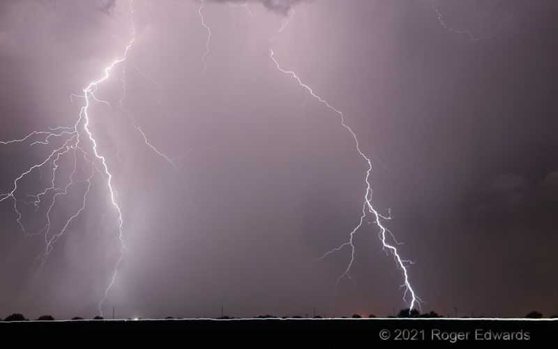
Streak and Sparks
Two of numerous cloud-to-ground flashes I shot that night, these blasted through a mix of rain and dust to overheat patches of the desert floor briefly. The lower segment of the left channel penetrated the divergent lower part of a rain core, that spread outward from the vertical plane of its prior descent. Meanwhile, a vehicle traveled southward along a state highway quickly, all the way across … [Read more...]
- « Previous Page
- 1
- …
- 92
- 93
- 94
- 95
- 96
- …
- 413
- Next Page »