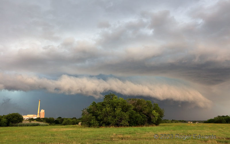
An unusual early/mid-June storm-observing excursion south of the Metroplex led to a short-lived supercell and storm merger west of Corsicana, whereupon an aerial flood of outflow commenced. What made the event striking was its coloration: the turquoise-tinted core, an east-facing arcus frontlit with a peachy hue. I've seen this effect several times before, but always on the High Plains, such as … [Read more...]
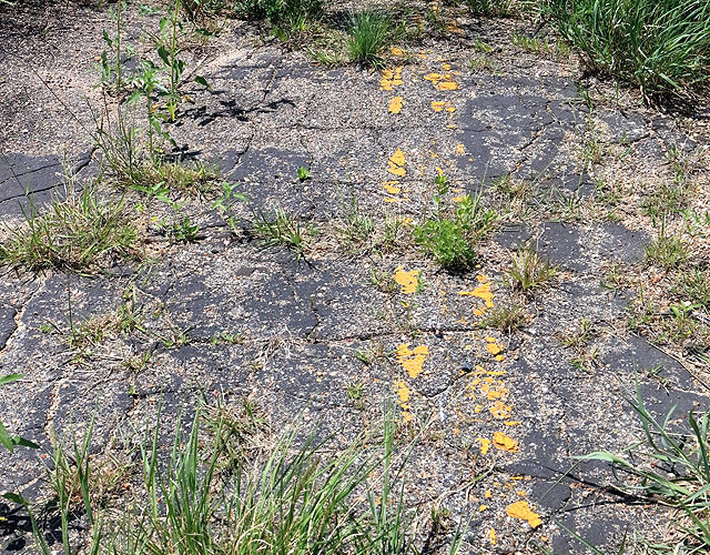
Roadway Reclaimed
An abandoned Nebraska Sandhills road, slowly reclaimed by the prairie it once divided, yields to the forces of weather and time. Over time, the weather damage adds up, 'til no road passeth here. Inch by inch, year by year, the asphalt will revert to smaller chunks, then granules, under unrelenting freeze-thaw cycles, direct erosion of running water and wind-blown sand, chemical wear, and growth … [Read more...]
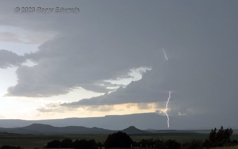
Supercellular Spark on the Mesa
A formerly imposing supercell begins to weaken somewhat, but still spits lightning from high in its inner forward-flank core edge, as it moves east-southeastward into the high mesas along the Colorado/New Mexico border. This flurry of amperage was the storm's grand finale before it plowed into the mesas and dissipated, dispersing a cloud field to contribute partly to a grand sunset later. 1 NW … [Read more...]
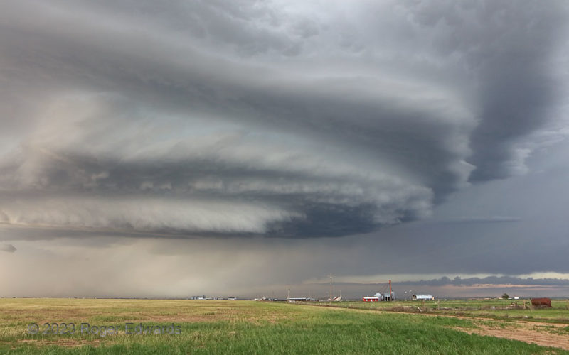
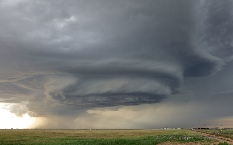
Wild Hereford Supercell: Part 4
[Part 3 of 4] As the Hereford-Happy supercell slid closer, it filled more of the wide frame of view, yet demanded patience in not hurrying to move back ahead too quickly. I've seen hundreds of Great Plains supercells, each mostly understood in a physical sense of how it comes to look as it does, yet each uniquely alluring in its ability to fill the sky with flowing forms not experienced outside … [Read more...]
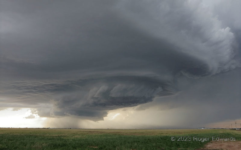
Wild Hereford Supercell: Part 3
[Part 3 of 4] At about this point in the supercell's passage to our north, and just beyond Hereford, I thought of my late scientific colleague, mentor and friend Al Moller, who was famous for "going berserk" in a positive way over such wild storm structure. I imagined, as he had done sometimes when we'd meet afield, his slapping one hand on my vehicle's hood, flinging his other toward the storm … [Read more...]
Wild Hereford Supercell: Part 2
[Part 2 of 4] Reviewing the photos of the "Hereford" stage of this storm, it was hard to decide which one or two out of around four representative pieces best depicted the experience, so I offer you all four. Aside from its fascinating physical processes and explanation (Part 1), the supercell was simply spectacular throughout multiple stages of its development and movement southeastward through … [Read more...]
- « Previous Page
- 1
- …
- 64
- 65
- 66
- 67
- 68
- …
- 413
- Next Page »