This show capped a long but fruitful, three-episode day of storm observing. After I puttered around a late-morning/early-afternoon storm complex and its surging outflow in central Kansas, north and northwest of Wichita, some messy, partially surface-based, mid/late-afternoon supercells (and their outflow-dominant progeny) erupted on the dryline and moved into a somewhat modified western part of … [Read more...]
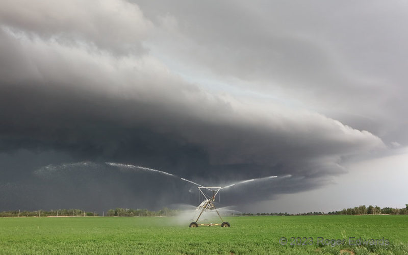
Irrigating the Storm
One of my most offbeat scenes as a storm observer appeared in west-central Kansas. A former supercell, blowing upscale into a raging line of severe storms with a menacing and strongly forced arcus cloud, didn't need any help sustaining itself. Nevertheless, this center-pivot machine offered some. Not enough to matter anyway, mind you...the storm processed millions of times more water by volume, … [Read more...]
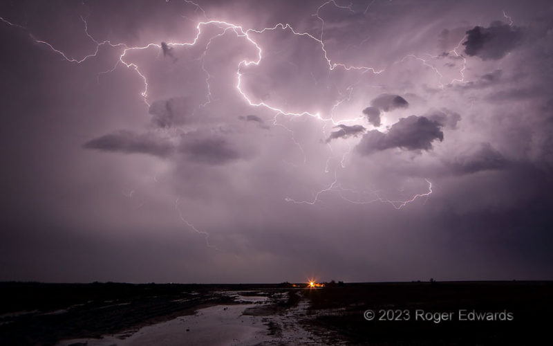
Sparkin’ Behind the Farmhouse
Three closely spaced, deeply and intricately branched lightning discharges, in quick succession, divided the darkness and split the silence beyond a west Texas farmhouse. During a drought year, and in a part of the state usually thirsty of crop and livestock, the hazard posed by the lightning was worth the accompanying hundreds of square miles of beneficial rainfall relief. 1 SE Aspermont TX (7 … [Read more...]
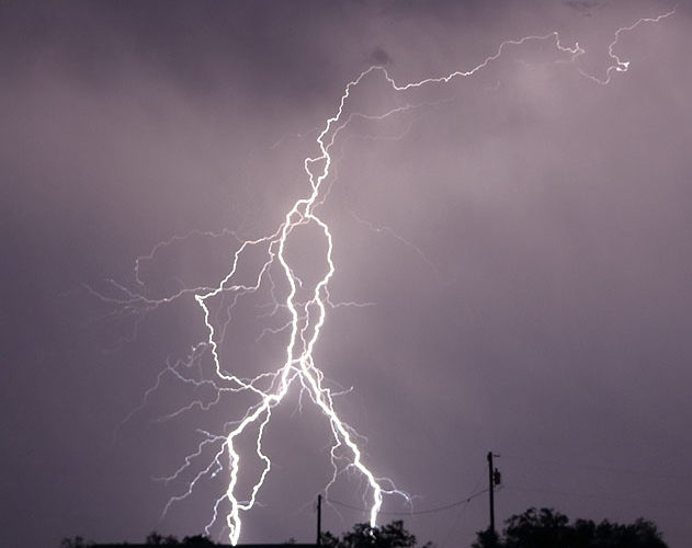
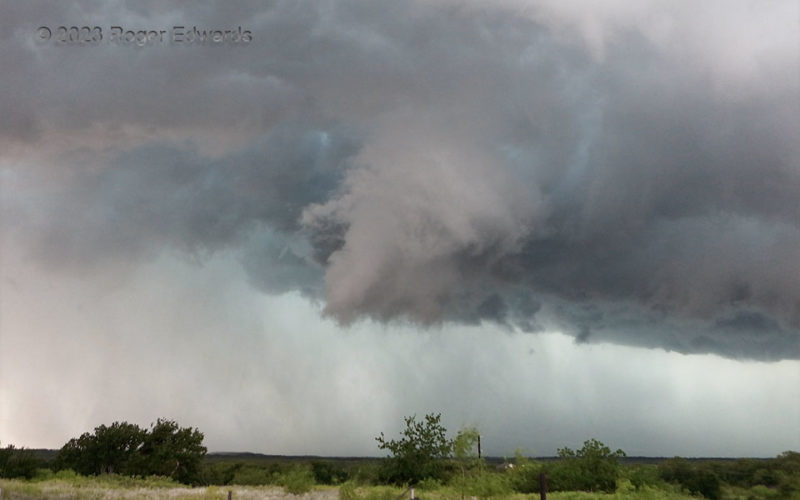
Supercell Outflow Dominance
"Outflow-dominant" isn't a popular term anymore with respect to supercells, but I don't care. I'm using it. This was one. That is why. A supercell can be outflow-dominant and still maintain an existence, albeit a tenuous one, as most such storms ultimately lose a direct vertical pipeline of surface-based inflow air and either shrivel, merge with nearby storms and expand upscale into a wind … [Read more...]
Almost
On the first supercell of the day that I intercepted, a broad, scuddy, poorly defined wall cloud narrowed and tightened up noticeably just a mile or two to my west, about the time a radar-based tornado warning was issued. It assumed a tilted, somewhat conical shape with peak low-level rotation strength right at this time, and I was watching the ground beneath closely for evidence of debris that … [Read more...]
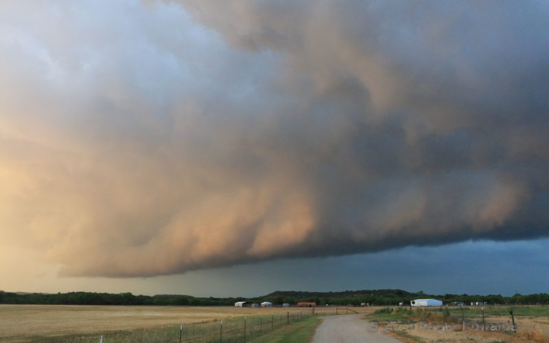
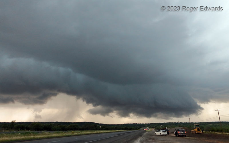
Transitions
A storm evolving from a nearly tornadic supercell to an outflow-driven multicell passed over an uneven landscape transitioning from the southeastern Great Plains to the northwestern Hill Country, during the change from day to night. Right before sunset, the filtered warm rays caught the inner rim of a shelf cloud that still had convective elements, thanks to a remnant midlevel mesocyclone still … [Read more...]
- « Previous Page
- 1
- …
- 57
- 58
- 59
- 60
- 61
- …
- 413
- Next Page »