A severe and imposing supercell offered hail as big as tennis balls within the core, and stacked-plate structure seen from the inflow, while it churned from the north side of Amarillo east-northeastward past our location. The High Plains annually offers such stunning storm formations for beholding by the eyes of appreciative observers. Make no mistake, however, this is not a welcomed sight to … [Read more...]
Flag o’the Flow 4
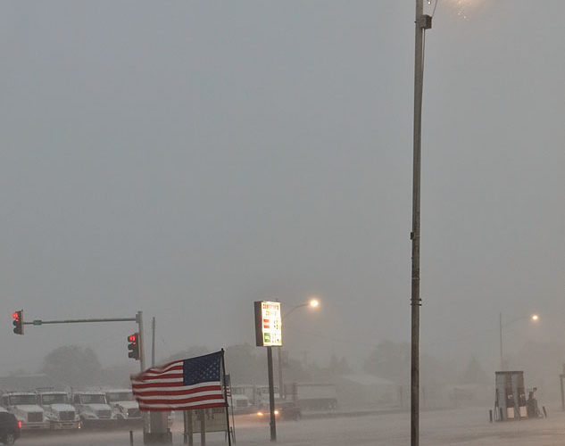
[Part 4 of 4] Following the passage of the gust front, the squall line raged forth with sustained winds above 50 mph and, at the nearby airport, hurricane-force gusts that broke tree limbs, even in a place well accustomed to intense winds from thunderstorms and other causes. This caused the lowest of the two flags, directly in front of a car wash where I was sheltering, to stand up horizontally … [Read more...]
Flag o’the Flow 3
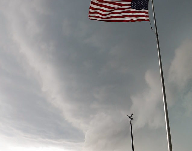
[Part 3 of 4] Just before I jumped into safe harbor (now unseen to the right) to avoid an atmospheric hosing, the squall line's shelf cloud raced overhead and eastward, from right to left, while the flag stood up in the outflow winds. Very shortly thereafter, heavy rain and severe gusts hit, validating my decision to just let this maelstrom pass overhead from the relatively safe shelter of a … [Read more...]
Flag o’the Flow 2
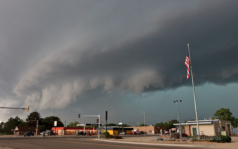
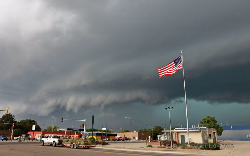
[Part 2 of 4] A quintessential Great Plains sky of doom descends upon the burg of Hill City, which is no stranger to such things. The northerly winds in the inflow region calmed as the immediate edge of the more intense outflow air (gust front) hit, just ahead of the striking arcus cloud. Within less than one minute, the entire shelf would move overhead, issuing its own version of a "shelter … [Read more...]
Flag o’the Flow 1
[Part 1 of 4] What had been a "Pioneer's Nightmare" of a sky near Colby, raging east to menace Hoxie, targeted Hill City next with its most severe winds yet. That was despite some northerly, cool outflow from a bowing segment to the north (hence, the flag blowing southward) that would seem to stabilize things and temper gust potential a bit. Regardless, lift was strong enough with this storm … [Read more...]
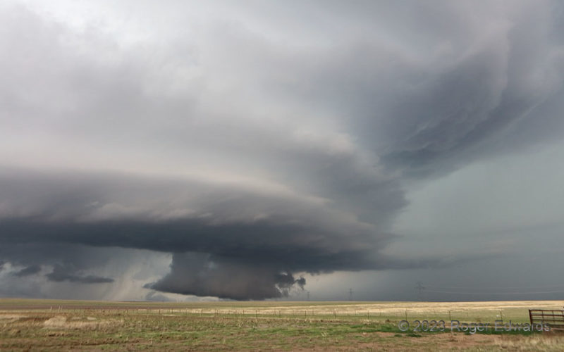
Dusty Inflow near Radium
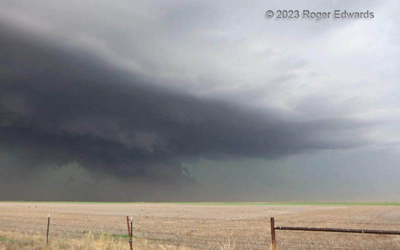
This dryline-fired supercell was in a transition stage, moving into only slightly destabilized and modified outflow air from a large complex of thunderstorms that swept across Kansas earlier in the afternoon. Instead of weakening, or becoming completely elevated, this storm hung on in a fine balance, with just enough airmass modification, via warm advection and weak diurnal heating, to keep it … [Read more...]
- « Previous Page
- 1
- …
- 56
- 57
- 58
- 59
- 60
- …
- 413
- Next Page »