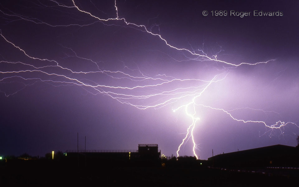
Decades later, this is still one of my all-time personal favorites, mainly because of the variety of lightning on display: a split-channel CG strike, along with a mixture of connected and disconnected "anvil crawlers." These natural pyrotechnics blazed through a region of light rain trailing a mesoscale convective system (MCS), which was moving SSE away from the scene. There is no place better … [Read more...]
Multicell Storm from Torrington – 2
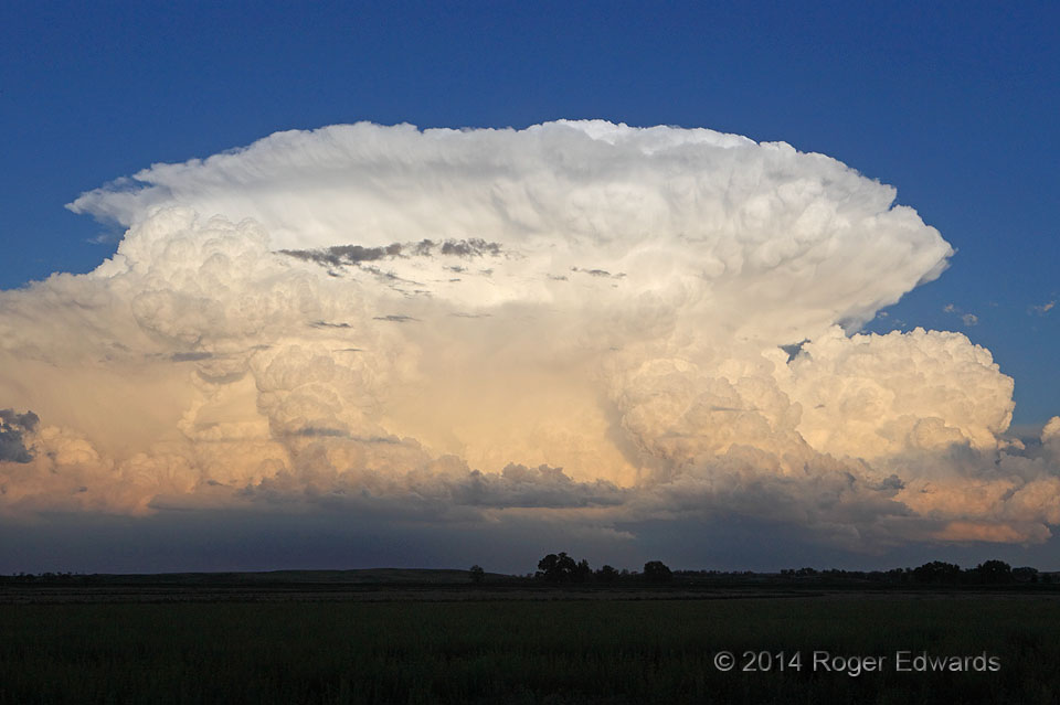
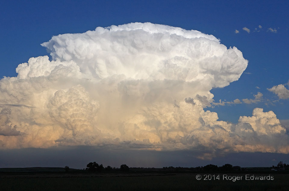
Intense, tilted, twin updraft plumes pumped countless kilotons of moisture into a storm complex along the Wyoming-Nebraska state line, just a few minutes after the last shot. It was well worth a delay in dinner. Even though we were getting rather hungry for tangible food, this magnificent rampart of convective resplendence was satiating our annual (and ceaselessly voracious) springtime appetite … [Read more...]
Multicell Storm from Torrington – 1
Cruising into Torrington after a decent afternoon of storm observing and landscape photography up near Lusk, we intended to meet with a group of friends for dinner in town. Fortunately they, too, are storm observers, and understood perfectly why we were delayed until near the end of their meal: this magnificent eruption of convection near the Nebraska border, brilliantly illuminated by the last … [Read more...]
Seibert Sparks
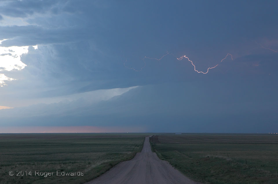
A lonely, rolling dirt road on the High Plains seems to lead to one destiny: a severe storm with a chambered, striated cloud texture, darkening the western sky at afternoon's end and flinging hot little filaments of electricity to and fro, as if to remind the captivated observer not to lose attention. To its immediate north, and just off-view at right, distant sunset colors peeked under laminar … [Read more...]
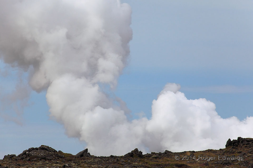
Geothermal Steam Cloud
A strange cumulus-like cloud column appears to rise straight from a landscape of craggy, sharp lava rocks. The rocks are real, but they are the rim of a crater within which steam is generated, every day, all day, year-round—part of the Gunnuhver geothermal area on the southwestern peninsula of Iceland. I loved the background slate-blue tones of a maritime subarctic sky subtly infused with … [Read more...]
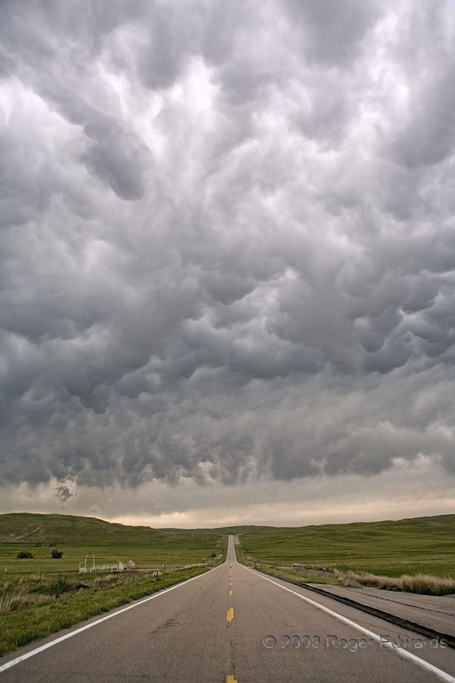
Mammatus over a Sandhills Highway
A large field of cumulonimbus mammatus streams east from a supercell unseen to the left, high over the Great Plains vastness of the Nebraska Sandhills. With the vegetatively stabilized dunes impeding any consistently good views beneath the storm's base, we had to be content appreciating with this sight, fantastic in its own right, until the supercell drew closer. 13 S Hyannis NE (11 Jun 7) … [Read more...]
- « Previous Page
- 1
- …
- 395
- 396
- 397
- 398
- 399
- …
- 418
- Next Page »