
Andrew's building-enhanced, swirling gusts deposited a Chevrolet Corsica on top of both a concrete wall and an Olds Calais, looking NW in the parking lot of the office building then housing the National Hurricane Center. The Oldsmobile belonged to NHC meteorologist Hugh Cobb, who had flown to NMC (now NCEP) in Washington as part of a backup crew. He unexpectedly learned what happened to his car … [Read more...]
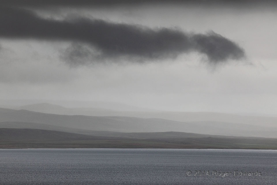
Tail Cloud over Icelandic Fjord
Even as far north as the near-Arctic North Atlantic, we saw moist convection in the form of compressed cells that weren't deep enough to produce noticeable lightning, but still had recognizable updraft bases...and yes, even a tail cloud. This deep-zoom peers from the SE end across the far side of the Midfjordur, a roughly 1-mile-wide, 10-mile-long inlet on the northern coast. This is a very … [Read more...]
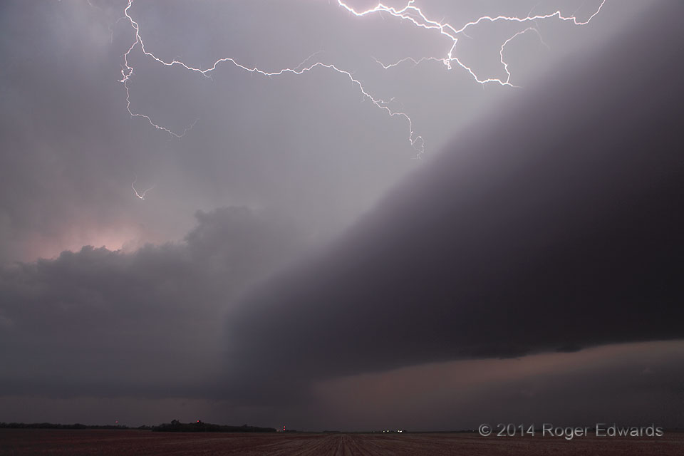
Evening Interaction
So much was going on here that it was a saturation of fascination! In the pastel twilight, a laminar shelf cloud—corresponding to the above-surface part of a rear-flank gust front from a supercell off the right side—interacted with the forward-flank region of a trailing supercell, whose base and tilted updrafts can be seen at left. Right above this interaction: intense flickering of … [Read more...]
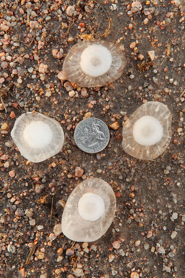
Quartet with Quarter
Under late-afternoon sunlight, the shoulder of a Colorado dirt road forms a fine backdrop to exhibit the complex structures of four severe hailstones that had fallen about an hour earlier, with partial melting since. I had mined these from some nearby grass, which tends to keep the hail elevated above relatively warm ground and into a shallow layer of hail-refrigerated air. This preserves the … [Read more...]
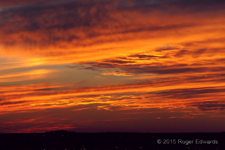
Deep Sunset Zoom
Even past the peak of overhead colors, sunset scenes can take on a rich, naturally saturated depth when using a long zoom lens to extend the field of view deep into the reddened western sky. This makes an already amazing Oklahoma sunset erupt with fiery tones and highlights distant cloud textures we might not notice otherwise in the broader perspective. Norman, OK (24 Jan 15) Looking … [Read more...]
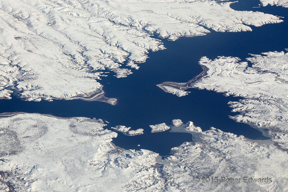
Ute Reservoir Surrounded by Snow
Flying over the High Plains of eastern New Mexico in midwinter yielded one uncommon sight: a snowfield surrounding a large reservoir in semi-arid countryside. I was amazed that Ute Reservoir still had as much water as it did. As for the snow, not only did it make for a starkly beautiful highlighter for the little canyons and arroyos that drain into the lake, but with this area in a prolonged … [Read more...]
- « Previous Page
- 1
- …
- 374
- 375
- 376
- 377
- 378
- …
- 413
- Next Page »