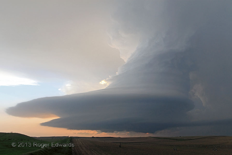
Quite simply, this was one of the most stunning supercells I've ever witnessed. That's saying something, out of many hundreds overall and at least a couple dozen that offered mesmerizing, jaw-dropping structure. Given that this was a wide-angle view, a substantial fraction of the sky appeared to be spiraling upward into the lofty netherworlds. A jury selected this image for exhibit at the 2015 … [Read more...]
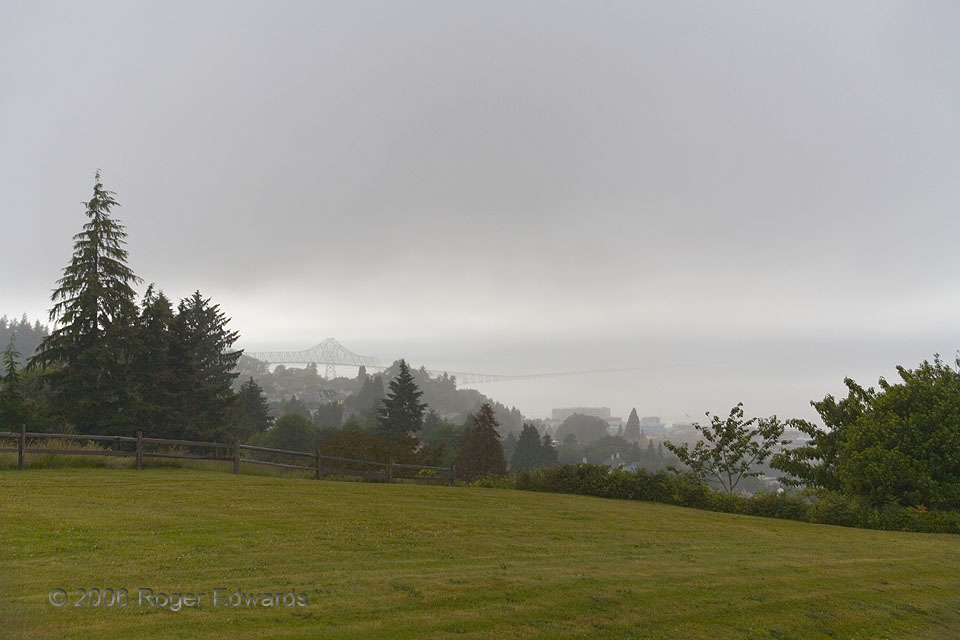
Misty Astoria
Seldom does one get to look down from ground level toward cloud base, but that was the case on this damp Pacific Northwest evening. Drizzle fell on the residential hillside overlooking downtown Astoria, the Columbia River estuary and the U.S. 101 bridge, as the cloud base tilted downward from my location across the river. This was a most relaxing, soothing scene, one worthy not only of … [Read more...]
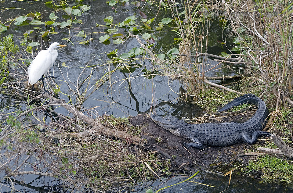
Wild Florida
The broad, moist plain known as the Everglades supports a mixture of tropical and midlatitude wildlife unmatched elsewhere in the world. That includes this egret and alligator, eyes fixated on each other as a meal and a menace, respectively. This uneasy balance between predator and prey makes a good metaphor for that between vitality and utility across all the glades. It depends on the slow … [Read more...]
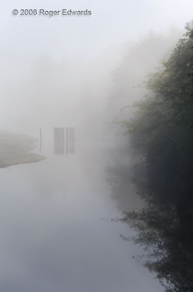
Foggy Backwater
Back behind the beaches of the Strait of Juan de Fuca lay a calm backwater, cool and still in the fog of early morning. Old mooring timbers, trees and reflections of them all diffused into a ghostly scene reminiscent more of a painting than either a photograph or eyewitness experience. Only the distant sound of gentle surf entered this otherwise silent world, an unseen whisper from somewhere to … [Read more...]
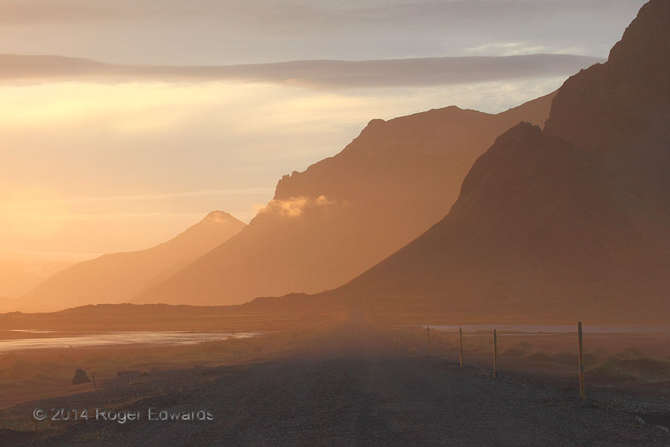
Late Light at Vesturhorn
One road to a land of dreamscapes began where the Vesturhorn range meets tidal wetlands, leading through a thin coastal fog and around a bend to the deepening golden light of the sunset hour. This was a moment as much as a place, and only can be revisited in loose approximation. In that moment, nothing else mattered besides its ephemeral beauty and overt, extrinsic transcendence. The glorious … [Read more...]
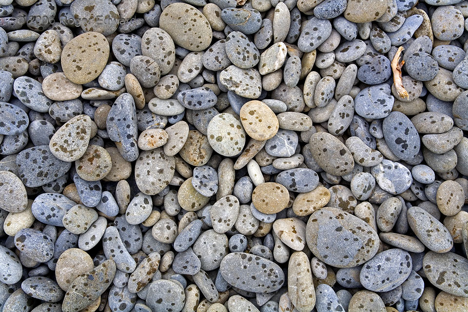
Rock Rain
Having been rounded smooth by wave action then hurled high on an Olympic National Park beach during Washington's winter storms, these pebbles lie passively, occasionally collecting spots from raindrops, as they await either the collector's pocket or more sorting within the next cool season's intrusions of pounding surf. 2 NW Queets WA (13 Jul 6) Looking SE 47.5655, -124.362 … [Read more...]
- « Previous Page
- 1
- …
- 360
- 361
- 362
- 363
- 364
- …
- 413
- Next Page »