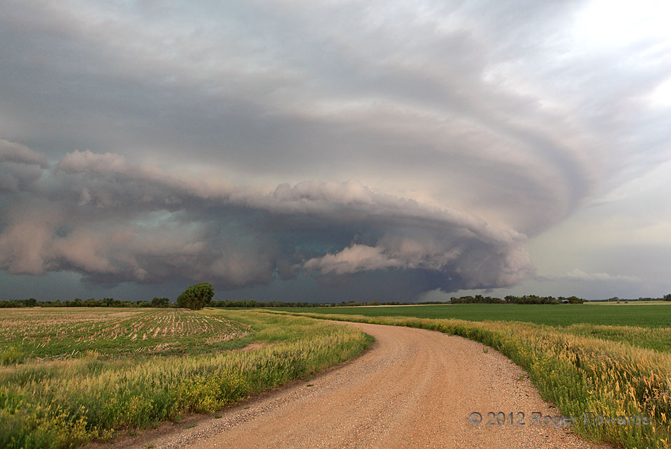
After the dissipation of the US-12 supercell, we were left stormless but for a distant area of darkness to our ENE in which radar imagery showed a big, likely heavy-precip supercell. With that being the only reachable option at the time, and a very good east road in front of us, we caught up to this beauty sooner than expected. Though the encounter was brief, we enjoyed immensely the spectacle … [Read more...]
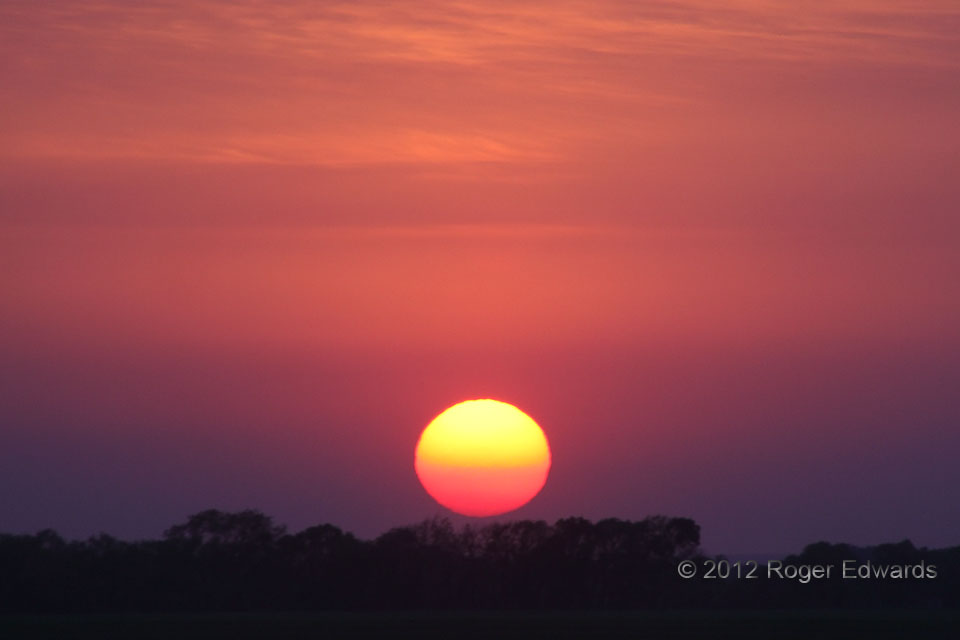
Great Northern Sunset
Another pleasant storm-observing day came to a brilliantly colored close, this time over the fertile flatlands of northeastern North Dakota. This high in latitude, the sun sets well northward in the western sky and late in the day, such that we were fortunate to find the last room in the last available lodging in Grafton (and only fast food for dinner) soon thereafter. 2 SSE Hoople ND (9 Jun … [Read more...]
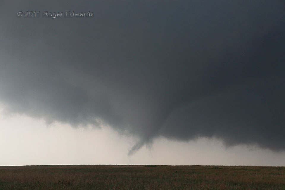
Vortex Puppetmaster
The tornadic marionette kept twirling, its vortex master flailing assorted spinning plumes of condensation 'round and 'round, 'til finally the show had to end. Beneath the main cone, which changed little in form, subvortex filaments danced, contorted, formed, vanished and spun wildly, all within any given few seconds. 1 SE Hickory OK (21 May 11) Looking NE 34.5418, -96.8488 RADAR … [Read more...]
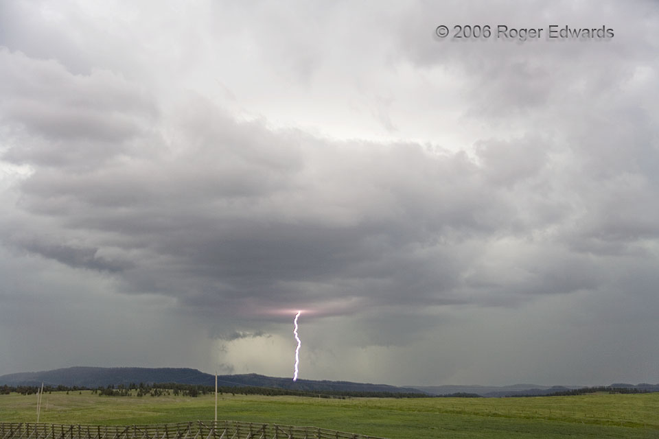
Red Electric Halo
Our Wyoming Black Hills supercell produced numerous strobing CGs, a good number captured by our cameras. This one fired through an outflow-lifted updraft, forming a cloud base halo that got progressively redder with distance from the penetration point of the stroke. Meanwhile, since the last Daytime Lightning shot, the mesocyclone had produced a brief, low contrast tornado. Its wall cloud still … [Read more...]
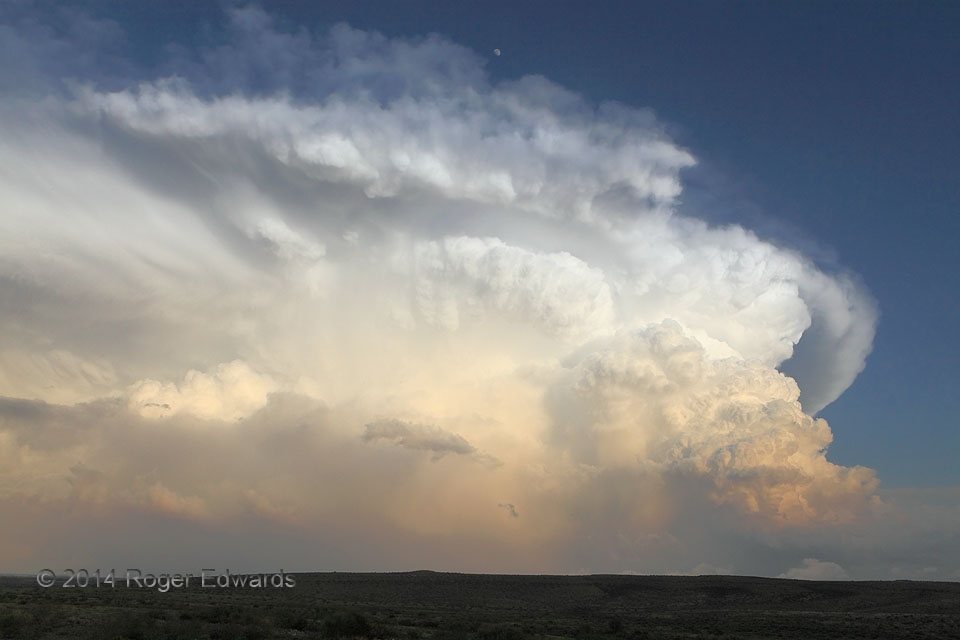
Carlsbad Storm and Moon
Our rewarding convective day began at lunch and ended after dinnertime, with over eight hours of storm observation (a full day's pleasure) in southeastern New Mexico. It all culminated magnificently in the appearance of this sunset-hour supercell under the waxing gibbous moon. The anchoring storm at right had formed south of the original supercell that we had been watching for many hours, then … [Read more...]
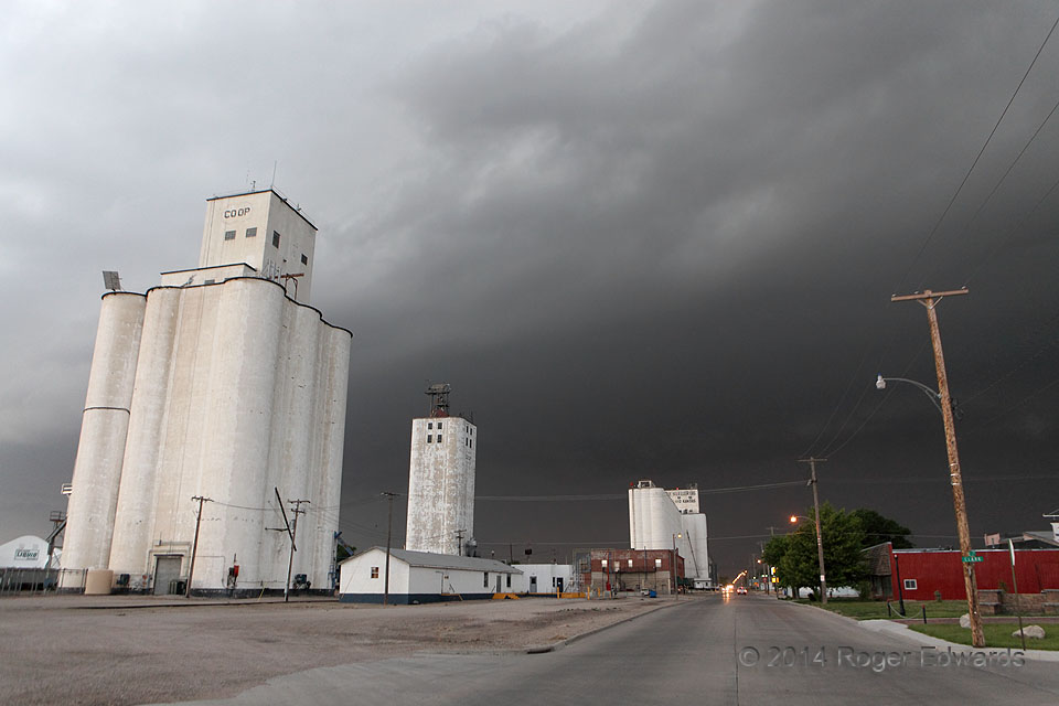
Darkening Goodland
After intercepting the supercell stage of this well-organized, damaging storm complex in eastern Colorado, we zoomed along to Goodland and protected our vehicle from the baseball-size hail and severe outflow (while en route down the Interstate, we deliberately had located a south-facing car wash online). Then it rolled quickly into town, menacing the citizenry with this dark pall of gloom, before … [Read more...]
- « Previous Page
- 1
- …
- 359
- 360
- 361
- 362
- 363
- …
- 418
- Next Page »