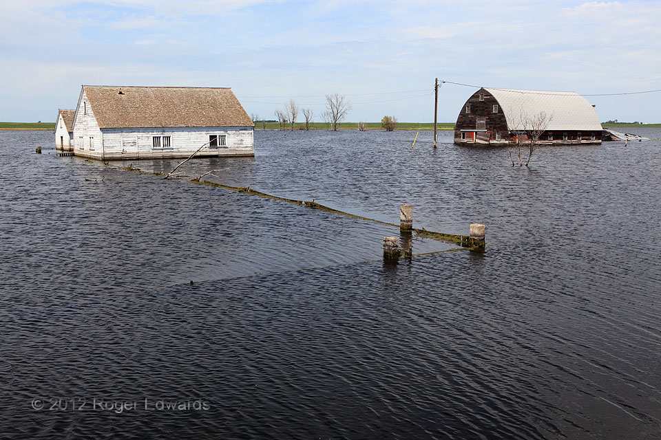
The abandonment of this farmstead long predated its inundation by a rising glacial-relic lake. The flood simply makes the place even more of a "fixer-upper"! Although water tables have been rising naturally for several years in much of eastern North Dakota and northeastern South Dakota, heavy spring rains and snowmelt in 2011 boosted that process enormously. To the southwest, Roscoe's sewage … [Read more...]

Shaw Lake Reflections
Golden aspens of a Colorado high-country autumn, and the cumulus-decorated blue sky above, fluidly alternated their reflections off the waters of Shaw Lake in the San Juan Mountains. This surreal, abstract scene was astoundingly straightforward to shoot too: enlarge ISO to enable fast shutter speed and high f-stop, point the camera at the rippled water, zoom in to the desired section, focus on … [Read more...]
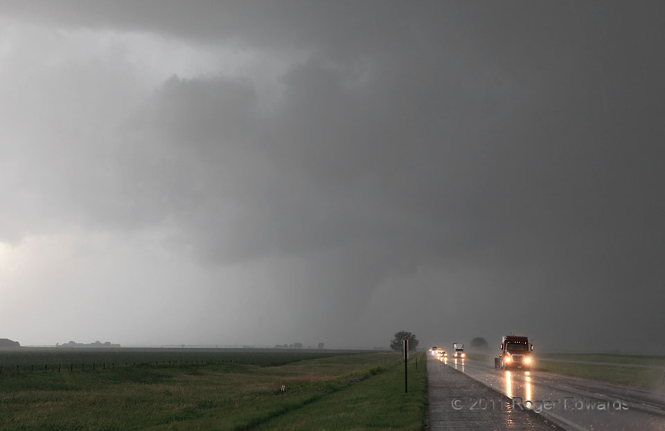
Interstate in Danger
We already had seen several tornadoes with a separate, bizarre, midday to early-afternoon supercell near the center of a deep-layer cyclone, well west-southwest of here. After that storm died, I knew that some young convective towers, visible on the dryline far to our east, could grow into supercells. We also had an unusual but reasonable chance to intercept the "second-phase" event via I-80—a … [Read more...]
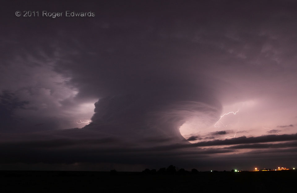
First Alma Nocturnal
A wide-angle view of the southern Nebraska night reveals a strangely sculpted supercell in dramatic shape, its ambient anvil region festooned with an encircling moat of radial high-cloud textures. This was the first of two magnificently constructed nighttime supercells to roll eastward just to our N on this uniquely special occasion for nocturnal storm observing. Its otherworldly, breaking-wave … [Read more...]

Alien Surge
Eating 10:30 p.m. fast food within view of Ogallala's extraterrestrial-themed water tower, I thought, "What a great shot that would make with a big fat CG blasting through the air behind it." Most such imaginary photo compositions remain just that, especially when reckoning with something as sudden and out of control as positioning a nearby lightning strike. Yet, less than an hour later, it … [Read more...]
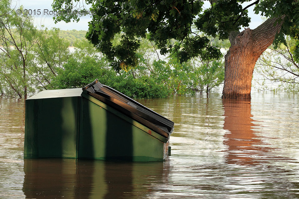
High Lake
Record May rains in central Oklahoma hoisted the level of Lake Thunderbird well above normal shorelines, inundating piers, overlooks, boat ramps, lakeside woodlands, and in this case, a campground. The dumpster itself offered an interesting composition as an "unsanitary abstraction". 2 NW Little Axe OK (10 May 15) Looking ESE 35.2487, -97.2383 … [Read more...]
- « Previous Page
- 1
- …
- 354
- 355
- 356
- 357
- 358
- …
- 418
- Next Page »