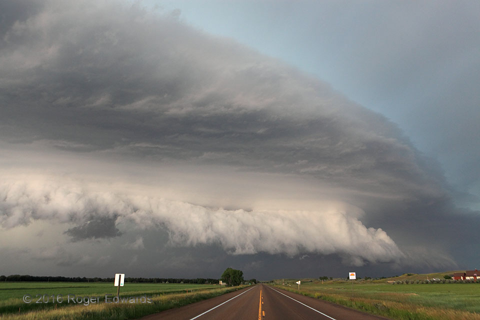
As my late friend Jim Leonard was fond of saying, this storm meant "serious business now". Functioning as "tail-end Charlie" for a line of severe storms, the supercell wielding this wild sky was roaring eastward at over 60 mph, permitting us only few very brief photo stops over a 70-mile stretch west of town. We arrived at friends' house in Glasgow with three minutes to spare, before measured … [Read more...]
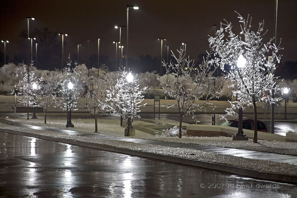
Four Lights in Freezing Rain
Four bright lights shone through correspondingly placed trees at the National Weather Center, as the saplings became ever more thickly coated. While meteorologists inside worked all through the night to forecast how and when it would end, the 2007 ice storm unfolded directly out the windows. Freezing rain was falling at the time of this photo, and would continue off and on through the … [Read more...]
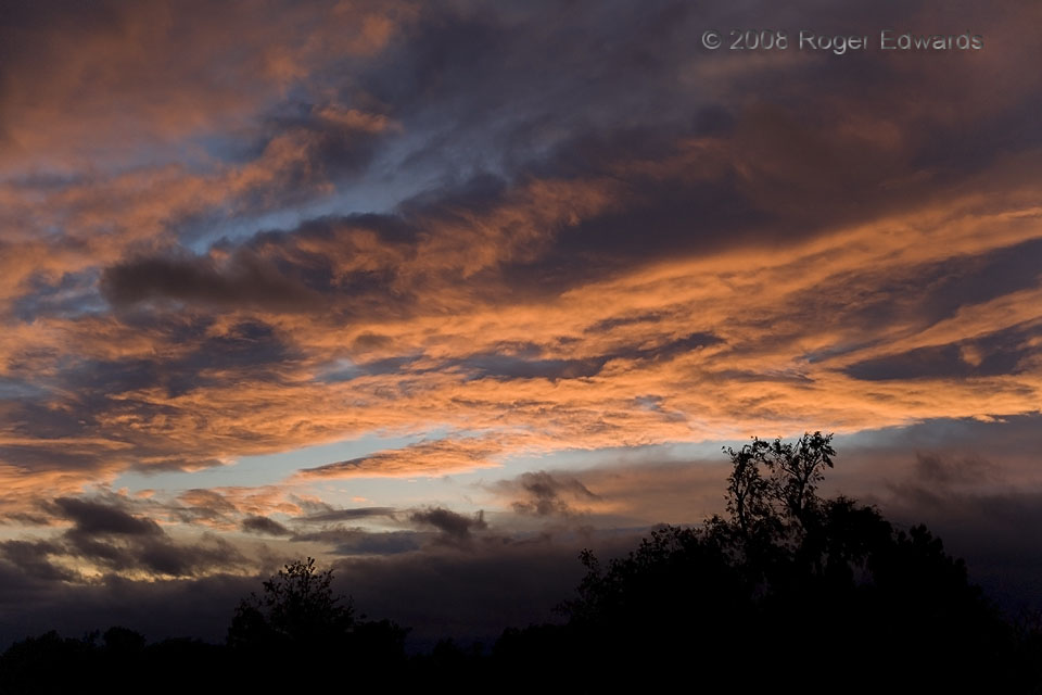
Scuddy Cirrus Sunset
Vaporous rags of low-level scud added even more texture to a masterfully multidimensional upper-level scene just after sunset, while scud in outflow coursed through the low levels in soft silhouette. Slate blue of cloud shadows, orange-yellow sunshine reflections and lighter sky blue jockeyed for supremacy on the palette of skylight, much to this photographers delight. Norman OK (7 May 8) … [Read more...]
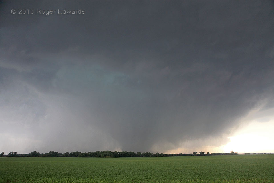
Bennington Tornado: Broader View
Here is a wide-angle view of the long-lived, nearly stationary Bennington tornado during one of those transitional phases between cleanly visible and rain-wrapped, as a heavy cascade of rain and hail descend through the occlusion downdraft at cloud base (turquoise area). Given its erratic, very slow movement and EF5-level winds sampled by mobile radar, this tornado could have done catastrophic … [Read more...]
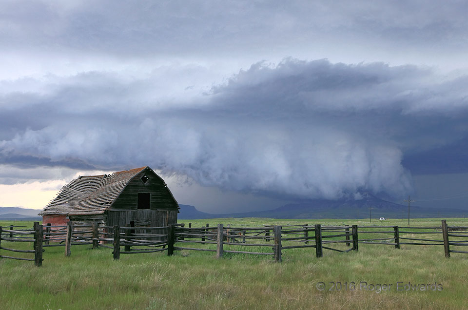
Convergence at Coffee Creek
As a relic of a homestead's past creaked in the storm's inflow winds, the supercell's wall cloud engulfed a butte in central Montana. Always I will wonder: what was it like on top as the wall cloud swept across? Where the Rockies disperse piecemeal into the green grass of the northern Great Plains, many things converged in this unique moment: air masses into the storm, land and sky, light and … [Read more...]
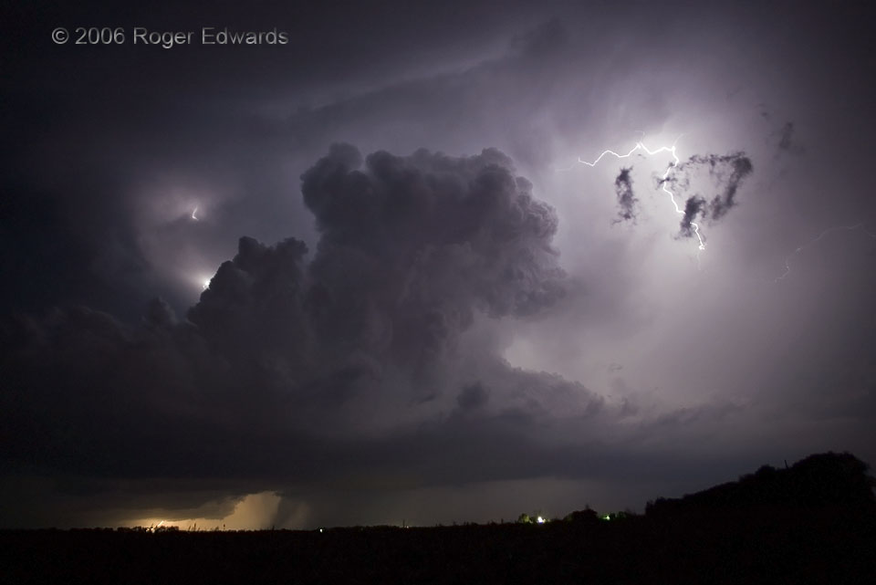
Kansas Nighttime Non-Tornado
This small supercell moved NE along a slow moving cold front and stayed surface-based for about an hour, until merging with other storms. In the meantime, the storm flashed brilliantly, mainly with in-cloud lightning, occasionally hurling a ground strike or aerial filament. Does the distinct, dark lowering below its base, just left of lower center, look like a tornado? Brief glimpses of such a … [Read more...]
- « Previous Page
- 1
- …
- 314
- 315
- 316
- 317
- 318
- …
- 424
- Next Page »