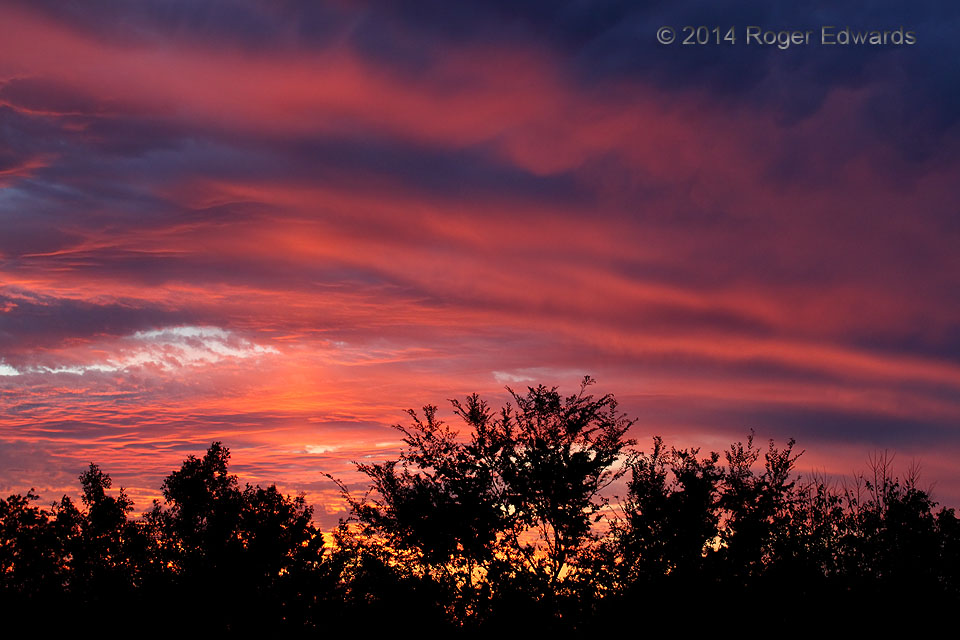
Two days after another splendid, banded arboreal sunset, the sky lit up even sooner and brighter, though as usual, uniquely. Every sunset scene is different simply by virtue of the fluid nature of cloud forms, regardless of the foreground for the shot or the zoom or pan chosen by the photographer. Here, in addition to the brilliantly lit banding and indigo shadows, a faint sun pillar casts a … [Read more...]
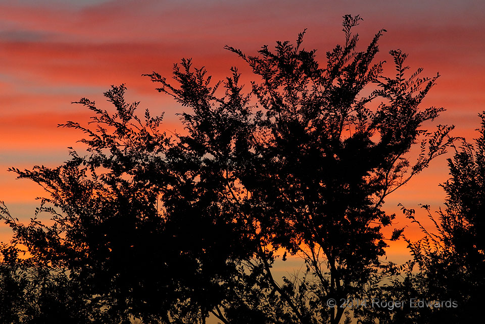
Arboreal Sunset
This scene was shot on the west lawn of the National Weather Center. Not one normally prone to letting foregrounds take up this much of a sunset composition, I did some experimentation with the vertical branches and horizontal sunset-cirrus bands, deep-zooming into the reddest part of the western sky, and was rather pleased with the results. Zooming that tightly through such intricate detail, … [Read more...]
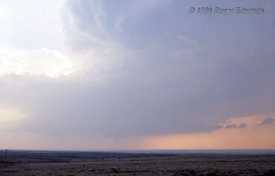
Oklahoma Panhandle Did It Today!
For hours, this dryline-born storm puttered erratically north-northeastward across the Texas and Oklahoma Panhandles as a high-based multicell and weak supercell, seemingly allergic to the concept of robust organization. We got disgusted by its poor structure and seeming impotence in spite of favorable deep shear, and left just before sunset to aim for the next day's presumed target area in … [Read more...]
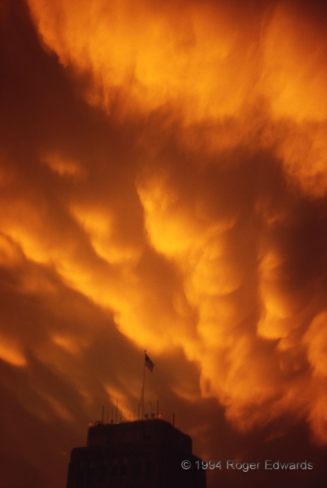
Orange Sky
Blazing across the twilight sky above Kansas City's city hall, a supercell-spawned show of flaming-orange mammatus signals the end of a stormy day. The stormy evening, however, was just beginning, as the supercell became elevated with a marvelous lightning show across areas north of the Missouri River. Kansas City MO (25 Jun 94) Looking NNW 39.0996, -94.5789 … [Read more...]
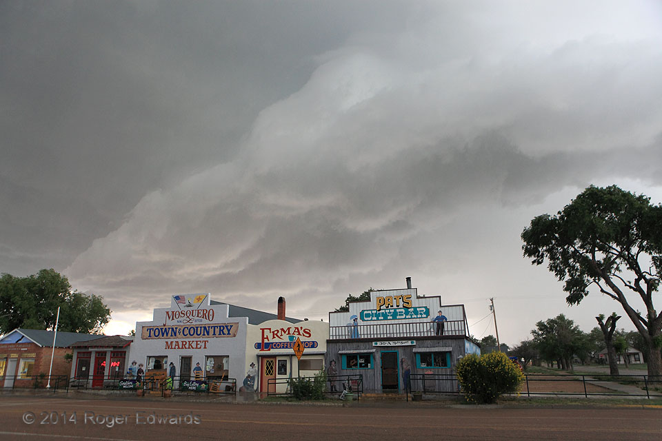
Mosquero Gust Front
Quaint and quirky, the friendly old High Plains burg of Mosquero, NM, temporarily hosted a supercell on this tumultuous late-spring afternoon, a storm that had sported a classical wall cloud and mesocyclone region shortly before the outflow-dominant phase seen here entering town. A profuse, vegetation-shredding hail dump soon would follow, leaving eerie scenes in its wake rather uncharacteristic … [Read more...]
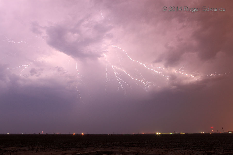
Altus Crawlers
Darkness ruled the night. Then, for just a second or two, from one node of intense charge separation high in the sky, and hidden behind an intervening chunk of midlevel clouds, filaments of electricity erupted in several directions at once, crawling at lightning speed along the underside of the storm's anvil. Back into the dark we stood, until the next fleeting burst of atmospheric pyrotechnics … [Read more...]
- « Previous Page
- 1
- …
- 291
- 292
- 293
- 294
- 295
- …
- 418
- Next Page »