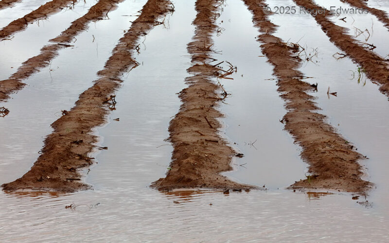
Unusually heavy seasonal rains, boosted hugely by passage of multiple heavy-precipitation supercells in the preceding weeks, left plowed fields flooded and unusable across much of northwest Texas during mid-spring 2025. Having driven by this field in a darkly cloudy late afternoon on the way out to the Permian Basin for a chase, I noticed these furrows as a potential photo subject, hoping for … [Read more...]
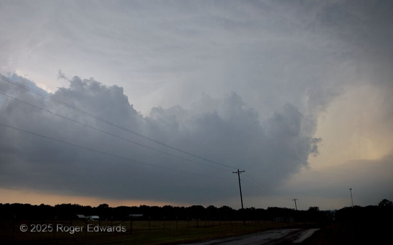
Pretornadic Supercell
When someone asks me what I look for in a maturing supercell before it produces a tornado, I'll describe something much like this: a very wide, but well-tilted updraft, large and low base, juicy moist environment (preferably along a diurnally baked baroclinic boundary for added low-level vorticity, as this was), not excessive precip behind (W or SW of) the updraft, a well-formed tail extending … [Read more...]
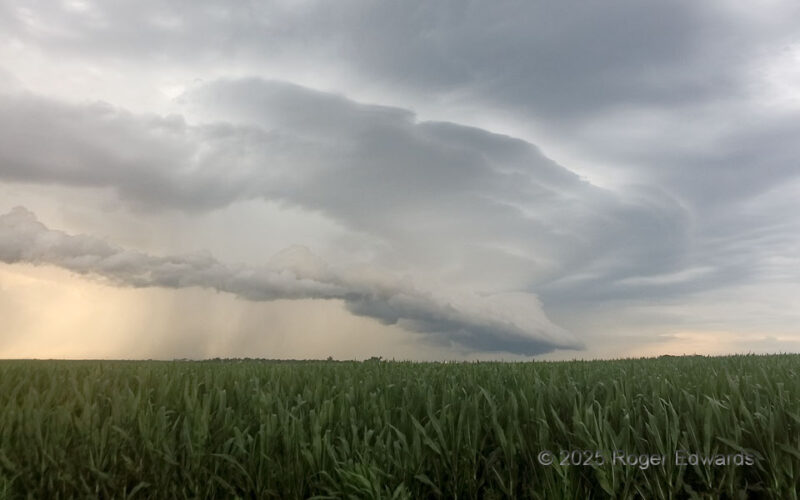
Tiered Arcus over Cornfield
The last chase of the 2025 spring season for me ended in early summer as some have, and also as some have, with outflow. At least this time, it was a splendidly layered, photogenic, tiered arcus formation from a band of multicells and weak supercells that developed to the west near Grand Island. By this time, in central Nebraska, the corn is at least "haah as a man's aah," as my East … [Read more...]
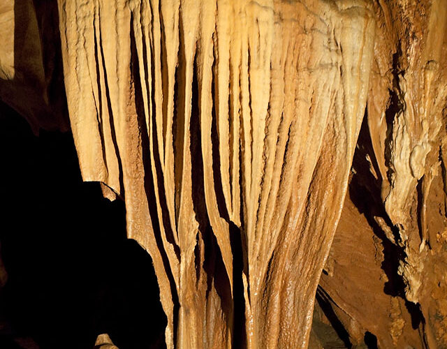
Tropical Cave Dripstone
Some cave dripstone assemblies, such as those in Carlsbad Caverns, are mainly round in cross section, with some platy shapes; however, these were almost uniformly flattened. I'm not sure to what extent the climate above regulates their shape, since Carlsbad lies under subtropical semi-desert, whereas northwestern Thailand's Chiang Dao is natively a tropical rainforest. Regardless of those … [Read more...]

Underlain Coloring Layers
A midwinter flight from Chicago to Tokyo, closely following the Great Circle route through subarctic to Arctic lands of North America, offered the chance for some interesting high-latitude viewing before sunset. Here, sunset already was occurring beneath the later of altocumulus translucidus undulatus clouds, reddening both their own undersides and some fuzzy, semi-opaque stratus areas beneath. … [Read more...]
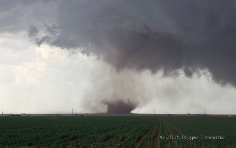
South Plains Tornado
A tornado with a stubby condensation cone stirred up plenty of dust during its 10–15-minutes of fame over the Texas South Plains, northwest of Lubbock. The tornado roamed about the south side of a large low-level mesocyclone, and did not move very much, except generally southward with the drift of the parent supercell. As this is a dusty area above the Caprock, the circulation dutifully raised … [Read more...]
- « Previous Page
- 1
- …
- 27
- 28
- 29
- 30
- 31
- …
- 418
- Next Page »