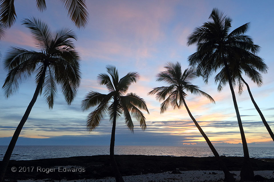
The tropical sunset: it is an idyllic scene of tranquility and warmth, calm and soothing, the object of longing by a large segment of humanity in the temperate latitudes! I'll attest that such times and places are every bit as good for mind and soul as advertised. Three different perspectives on the same sunset, in essence, rolled three sunset experiences into one: an earlier display of … [Read more...]
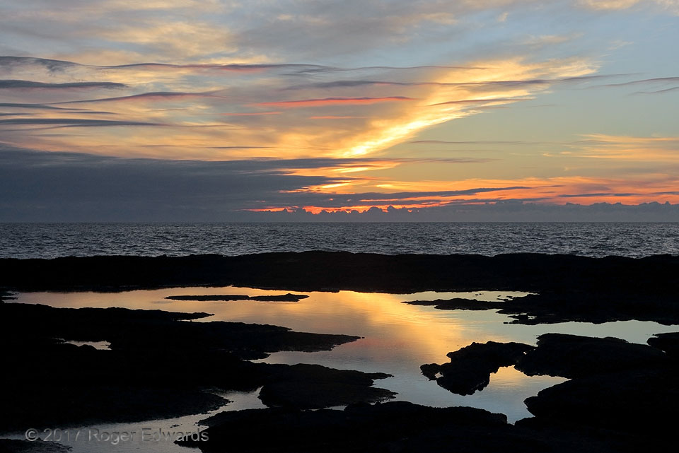
Sunset Reflectives: Pool on Lava
Golden-lit high cirrus clouds, skeletal attempts at asperatus clouds in middle levels, and tide pools on lava ledges combined for a marvelous sunset scene unique even for Hawaii. A deep zoom of the same sunset sky, just a few minutes earlier, offered a drastically different view! 2 WNW Keokea HI (26 Dec 17) Looking WSW 19.4179, -155.9124 … [Read more...]
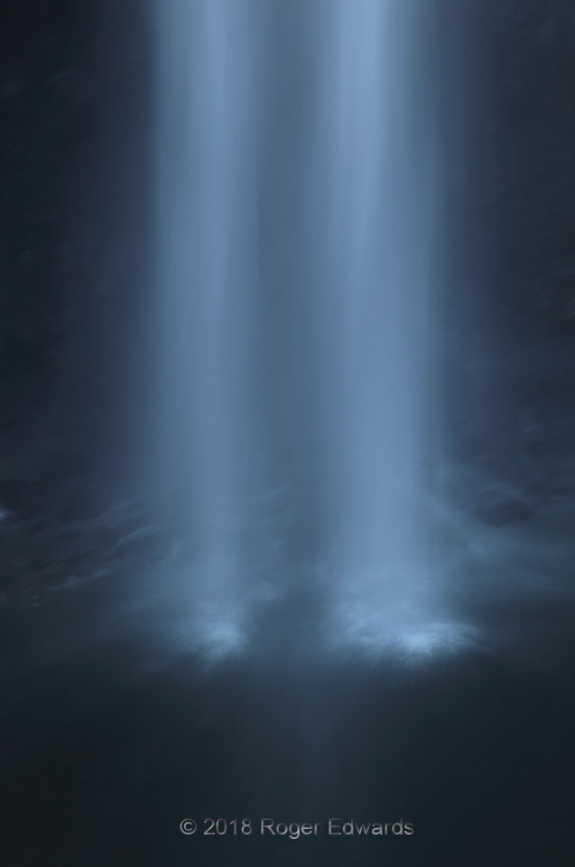
Water Beams
This is one of my very favorite waterfall shots, and it was practically unplanned. The lofty grandeur of Akaka Falls, which is taller than a 40-story building (442 feet), rightfully commands attention. Yet with the afternoon sunlight blasting glare into my face just above the top of the east-facing falls, I was playing with other compositional possibilities in the shadows, mainly to pass the … [Read more...]
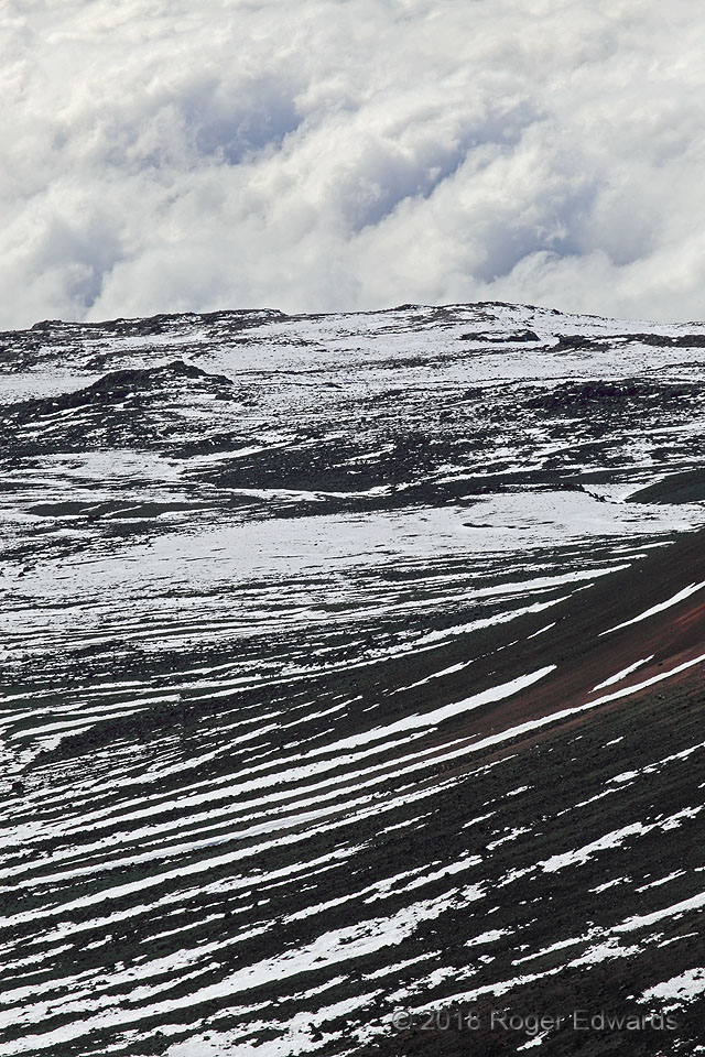
Hawaiian High
This view looks like it could come from looking up any temperate continental mountain in the world bearing dark volcanic rocks. Instead, this is Hawaii's Mauna Kea, looking down toward a ragged stratocumulus deck below, from just a few feet below its 13,802-foot summit. Even with its position in the tropics, below 20 degrees north latitude, Mauna Kea catches snow on its coldest winter days, as … [Read more...]
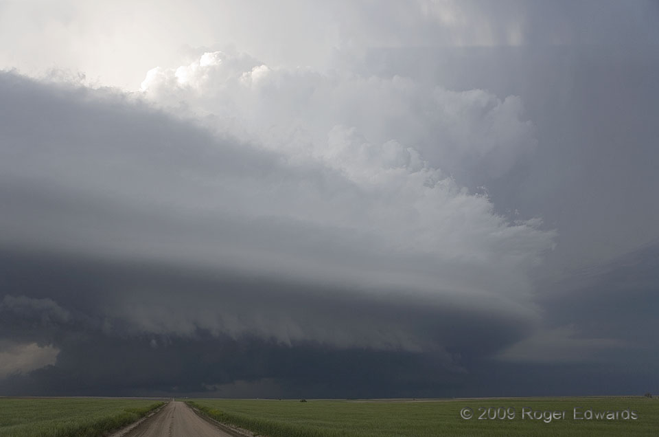
Gurley Swirl
After producing one tornado in Wyoming and very nearly another in the Nebraska Panhandle, this storm settled down somewhat to "just" a menacing convective mass of wind, rain and hail, wrapped within a fascinating sweep of curves and lines in its cloud package. Many processes were at work here! The thick, striated bands sweeping outward from the storm formed in layers of laminar, rising flow atop … [Read more...]
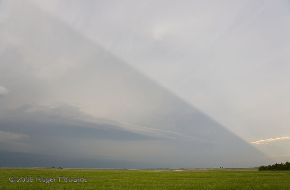
Anticrepuscular Storm Shadow
A big supercell to the north (left) cast one of the best-defined storm shadows I've seen, rendering a crisp edge to some of the last moments of late-afternoon sunshine. The shadow line is the same one seen at the top of this nearly simultaneous shot of the business end of the storm. This is also a marvelous manifestation of anticrepuscular (a.k.a. postcrepuscular) rays, which appear above the … [Read more...]
- « Previous Page
- 1
- …
- 262
- 263
- 264
- 265
- 266
- …
- 413
- Next Page »