Ratcheting southwestward along a backbuilding line, we finally found the "Tail-End Charlie" convection, a supercell that was being undercut by the collective outflow from the combination of itself and downshear storms. Regardless, it made for a nice, soothing scene for a vanload of tourists and their guides in the "golden hour" of warming pre-sunset light, on the western rim of the magnificent … [Read more...]
Brief but Beautiful
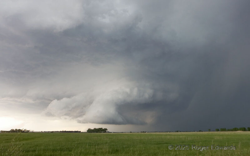
After producing several nonsupercellular "landspout" tornadoes, and amid a late-afternoon enlargement of low-level and deep-shear vectors in the storm's mesoscale environment, a large-based multicell complex contracted to a supercell for just a little while. Even here, at its peak structure, uniquely beautiful as all Great Plains supercells are, the storm started to undercut itself with outflow … [Read more...]
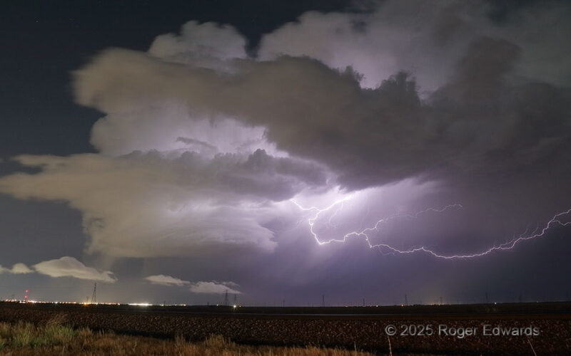
Nighttime Illuminations
Last chance to shoot a dying supercell before I get into the city! Having rolled back northwest from a long-lived storm east of Tahoka, I was tired and longing for lodging, when many flickers appeared back in the direction I was headed anyway. I took the chance to stop and hope for a few more flashes from a storm that seemed to get less active as I approached. The stop also would delay my … [Read more...]
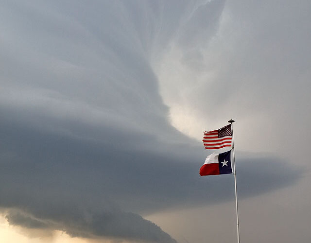
Texas Sky
The North Texas sky in May never fails to include the supercell: an organized, rotating, twisted, tilted column of moist air many miles high, processing millions of tons of air per minute at upward speeds nearing 100 mph, and a prolific producer of severe hail, damaging wind, and sometimes even tornadoes. The flags’ direction and uprightness gives a hint as to why the storm is there, and why … [Read more...]
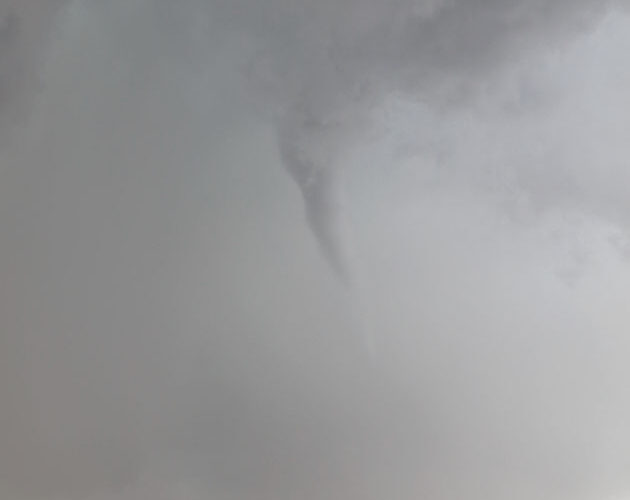
Whale’s Mouth Tornado
We had finished watching a "landspout" fest from a line of thunderstorms that was becoming outflow dominant, and drove east a few miles through light to moderate rain to catch back up to the gust front, when my passenger yelled about a tornado to our south. Sure enough, as I pulled to a stop, a faint column of rotating spray and dust was visible out his window, under the tip of a condensation … [Read more...]
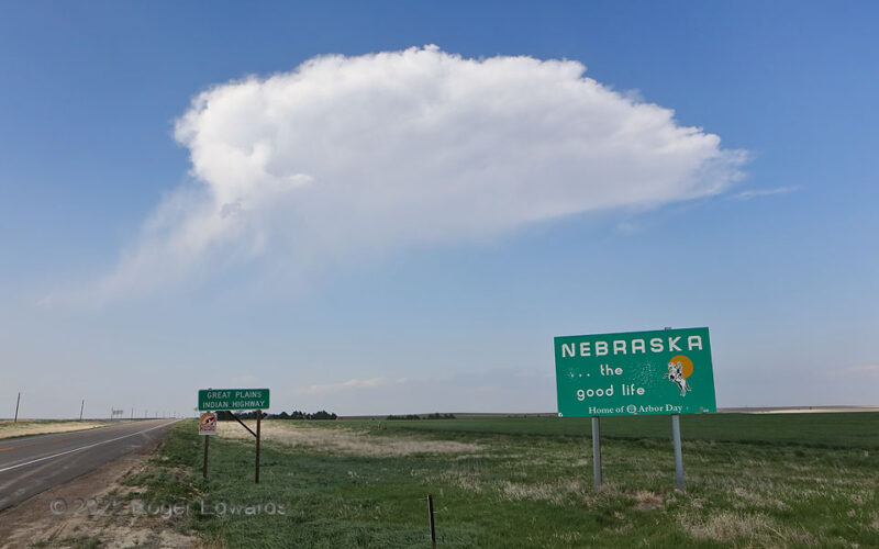
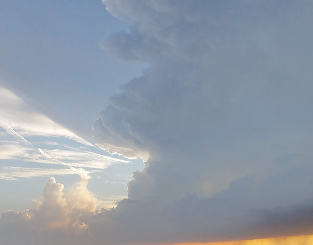
Cornhusker State Orphan Anvil
"The good life" somehow evaded this dying gasp of deep convection just north of the Kansas/Nebraska border, as seen from right on the state line. Storm observers often refer to these cloud formations, whereby a small anvil and fuzzy, rainy remnant of a low- to middle-level updraft are all that remains, as "little orphan anvils." The linked image is a literal textbook archetype that I shot on … [Read more...]
- « Previous Page
- 1
- …
- 24
- 25
- 26
- 27
- 28
- …
- 418
- Next Page »