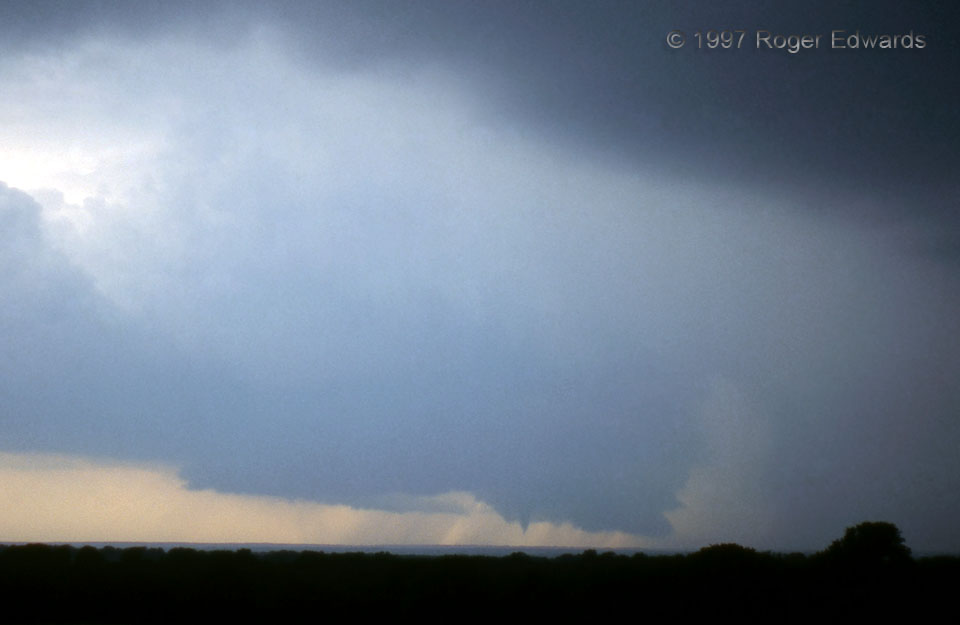
After having a very hard time finding a good view of this fine young supercell in the hilly Western Crosstimbers country, Steve Corfidi and I pulled up an open-gated driveway toward a hilltop house with people watching the storm, to ask if we could use their high vantage. Not only could we, but the residents welcomed us with cold drinks and standing room in their west-facing garage, while we all … [Read more...]
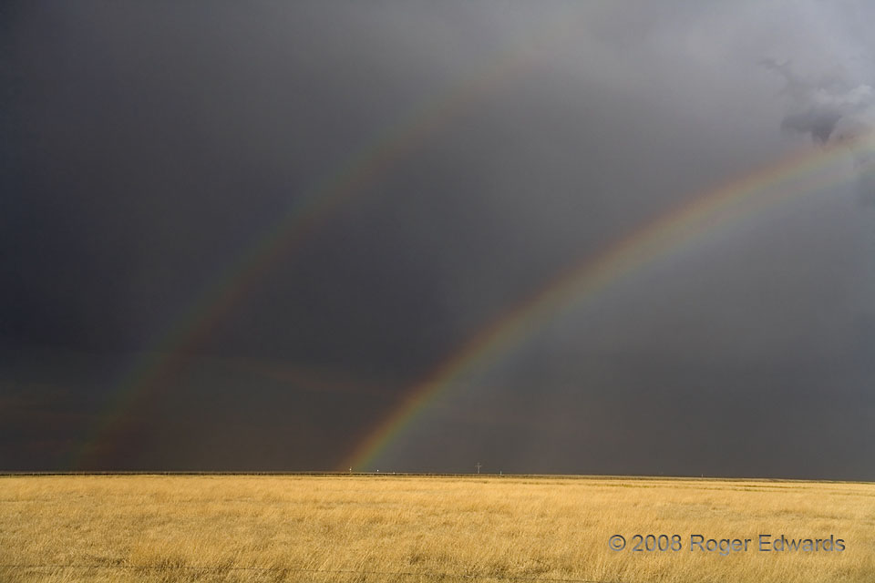
Double Rainbow over the High Plains
After observing a weak, anticyclonic supercell from near the Kansas-Colorado line, we made a slow tour around its E, S and W sides, seeing some nonsupercell tornado action from separate convection along the way. Here, along the back side of the storm, the late afternoon sunshine lit up its shield of trailing rain in the form of one of the grandest double rainbows I've seen. Notice the … [Read more...]
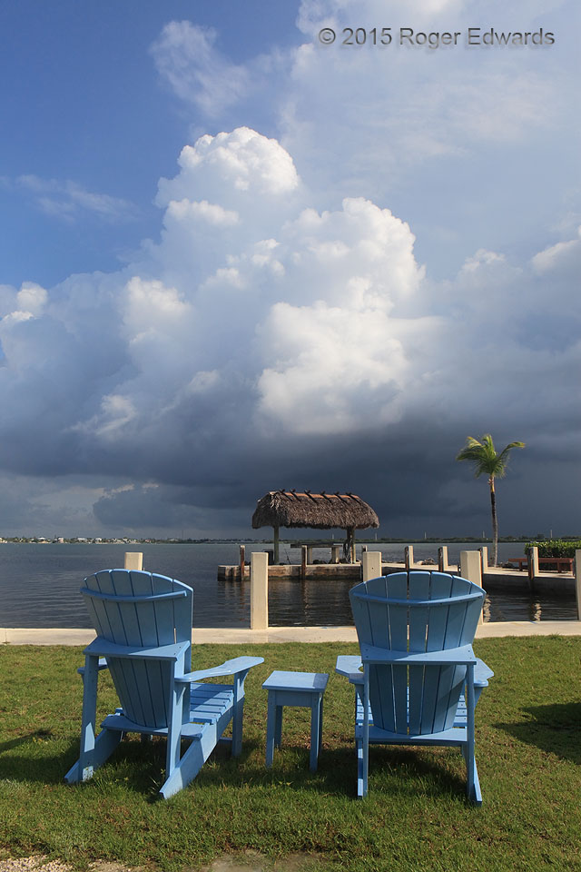
Tropical Convective Afternoon
Relaxation beckons on a breezy Florida Keys afternoon, the eastern sky decorated with bright, soft towering cumulus formations above the tranquil waters of Pine Channel. Leisure time wouldn't last long, however; the towers merged with other convection behind and to their south, and in those deep east-southeasterly winds, sending a wall of rain and strong wind through the area and blowing those … [Read more...]

Chisos Mountains Stratocumulus
Unusually moist conditions for a normally hot, dry time of year kept the Big Bend desert floor bounteously abloom, and supported stratocumulus clouds in the top of the boundary layer, where they were penetrated by the Chisos Mountains. Strong surface heating and destabilization mixed these clouds away within less than an hour. That heating also weakened already meager capping in advance of … [Read more...]
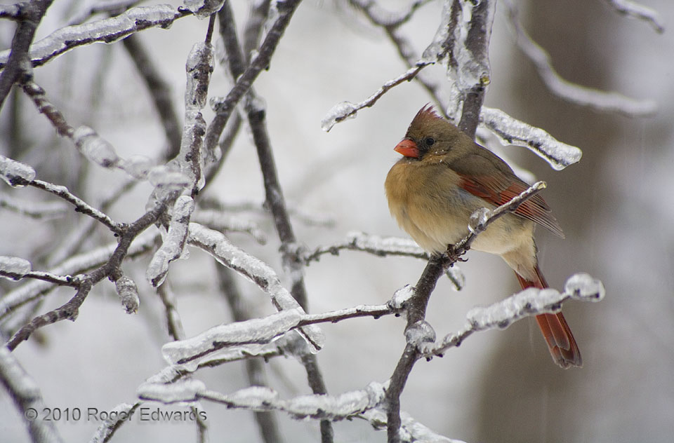
Cardinal Winds
A colorful female cardinal fluffed her feathers to stay warm, against the double misery of cold wind and spits of frozen precip, streaks of which can be seen below her tail. Her presumed mate frequently occupied a nearby position in the same tree, as they alternated between perching there and dining at our feeders. Fortunately, in low-light conditions, the gusts abated just long enough to allow … [Read more...]
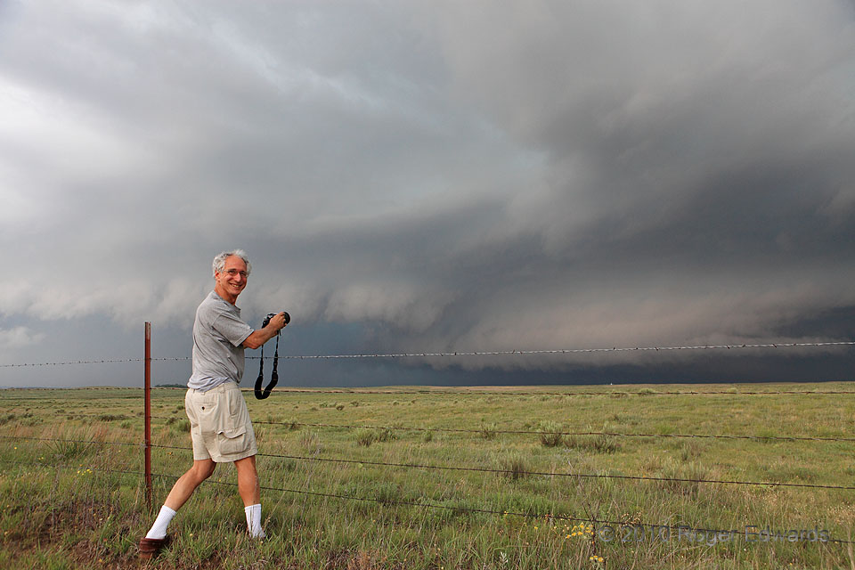
Howie’s Quarry
Severe-weather scientist Howie Bluestein enjoys the stormy skies, readying to shoot his quarry after successfully tracking it across the northeastern Texas Panhandle and the eastern Oklahoma Panhandle. His weapon of choice, as mine, was the camera. Having already produced a couple of tornadoes, including a colorful, rain-wrapped specimen farther SW, the heavy precipitation (HP) supercell came … [Read more...]
- « Previous Page
- 1
- …
- 229
- 230
- 231
- 232
- 233
- …
- 418
- Next Page »