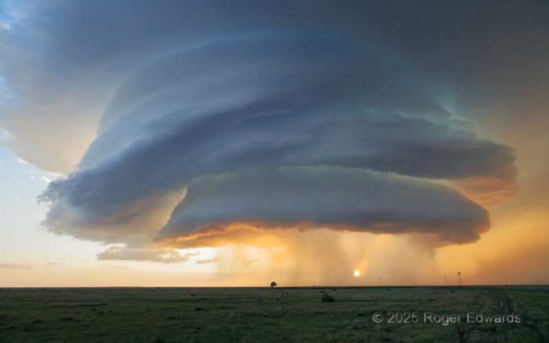
Out of dreams and into the sky swirled the supercell of the decade so far, and one of the most fundamentally joyous, deeply astonishing scenes I've ever witnessed in any context. This storm already had splendid structure, which just kept getting better until forming a vaporous stack of upside-down, offset bowls, splashed within and without by layers of filtered sunset and precipitation colors … [Read more...]
PV Cone
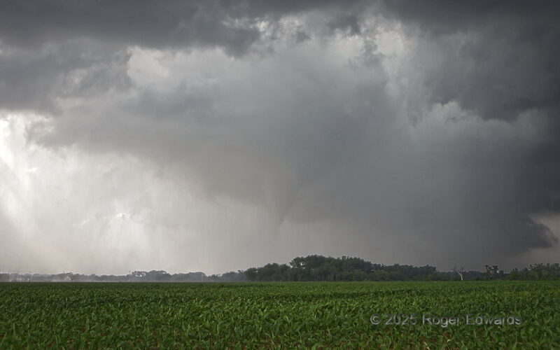
A nearly ideal and isolated supercell in my conception for potentially becoming tornadic, finally did, though just once, with this modest and rain-wrapped cone, in an environment that seemed favorable for so much more. The folks around Pauls Valley (PV as known locally, instead of "potential vorticity" as we meteorologists use) were glad that it produced no more. Note the classical … [Read more...]
Another Hereford Mothership
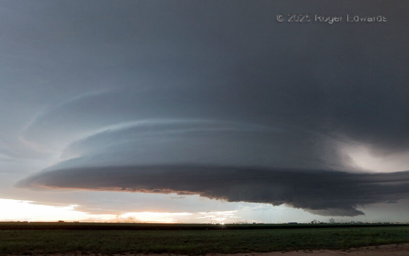
Slightly less than two years after observing a wildly structured, daytime supercell over Hereford (moving ESE), came another, moving SSE in twilight, and crossing the previous storm's path right over town. Though Hereford probably is tired of these, thanks to the lightning, severe wind and hail, we observers were not, because of their power and beauty. The small stir of dust near ground, just to … [Read more...]
Furrow Flooding
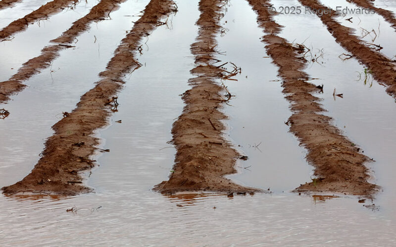
Unusually heavy seasonal rains, boosted hugely by passage of multiple heavy-precipitation supercells in the preceding weeks, left plowed fields flooded and unusable across much of northwest Texas during mid-spring 2025. Having driven by this field in a darkly cloudy late afternoon on the way out to the Permian Basin for a chase, I noticed these furrows as a potential photo subject, hoping for … [Read more...]
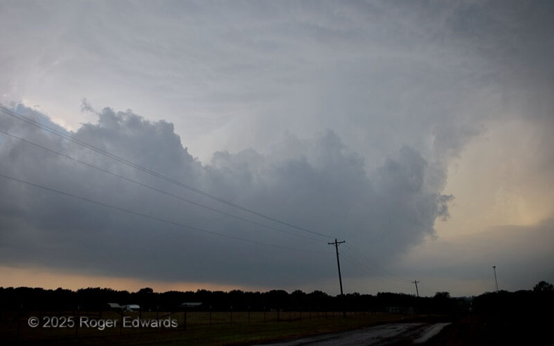
Pretornadic Supercell
When someone asks me what I look for in a maturing supercell before it produces a tornado, I'll describe something much like this: a very wide, but well-tilted updraft, large and low base, juicy moist environment (preferably along a diurnally baked baroclinic boundary for added low-level vorticity, as this was), not excessive precip behind (W or SW of) the updraft, a well-formed tail extending … [Read more...]
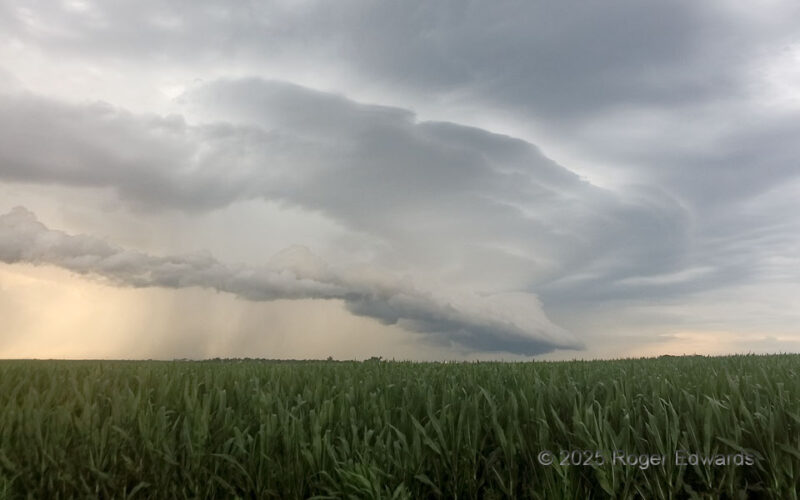
Tiered Arcus over Cornfield
The last chase of the 2025 spring season for me ended in early summer as some have, and also as some have, with outflow. At least this time, it was a splendidly layered, photogenic, tiered arcus formation from a band of multicells and weak supercells that developed to the west near Grand Island. By this time, in central Nebraska, the corn is at least "haah as a man's aah," as my East … [Read more...]
- « Previous Page
- 1
- …
- 21
- 22
- 23
- 24
- 25
- …
- 413
- Next Page »