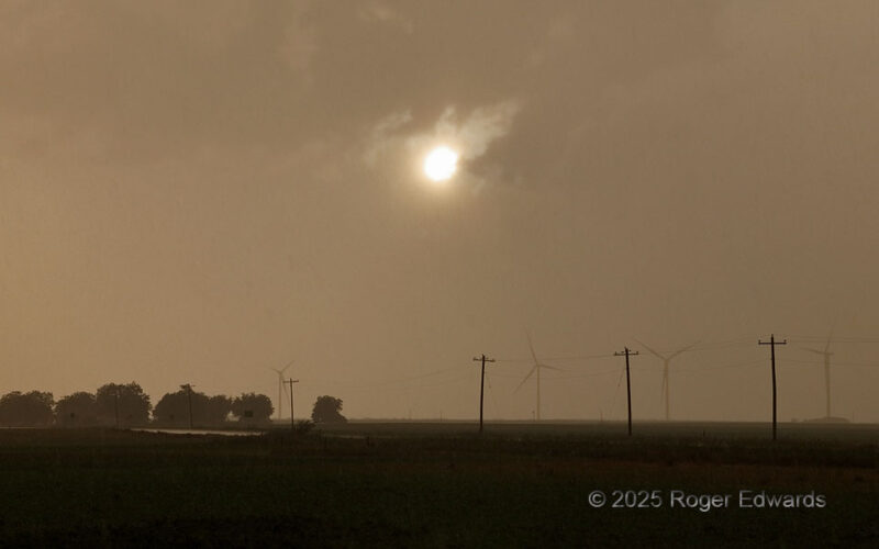
This is why it's called the "golden hour." That last window of time before sunset, and before a distant yet still-unseen thunderstorm shadowed the entire scene, yielded a cool, gold rain on the back side of what had been a long-lasting storm and its newly joined larger complex. As seen from less than half a mile down the same road, the front side was quite remarkable too! 1 ESE Vera TX (8 Jun … [Read more...]
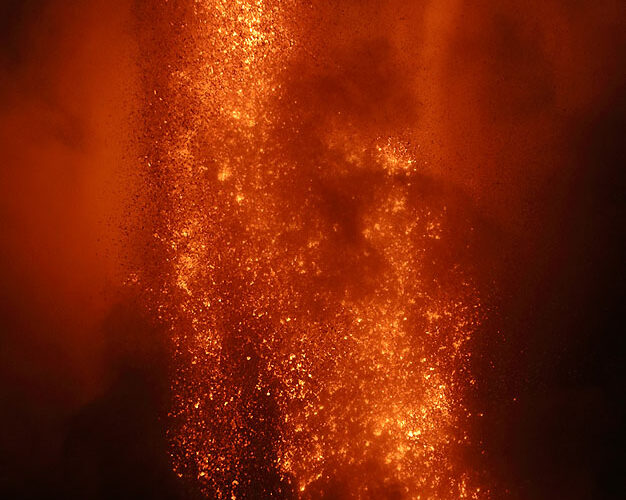
Volcanic Fountain and Vortex
Kilauea’s 2024–2025 eruption sequence featured numerous, cyclic, roaring fountains in the southwest part of the summit caldera’s Halemaumau crater, some of which produced the highest fountains near the summit since the 1959 eruption in the Iki crater about 2-1/2 miles away. Witnessing Episode 33 of this eruption realized a lifelong dream for me, with spectacular sights and sounds straddling … [Read more...]
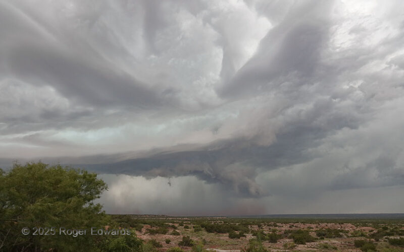
Ominously Nontornadic
A very large, strongly rotating wall cloud could not tighten up enough to produce a tornado. This mesocyclone cycle ultimately would be undercut by its own rear-flank downdraft. The supercell's underside was so dark partly because it was deep and strongly precip-loaded, but also, because other cells were forming immediately to the southwest and casing progressively thicker anvil material over … [Read more...]
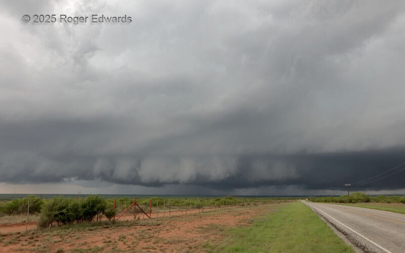
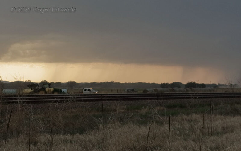
Relocating Red Dirt
Despite obviously being somewhat high-based and outflow-dominant, this long-lived storm wasn't ready to give up yet. A strong low/middle-level mesocyclone still drove the bulk of its updraft behind the dirt-pushing gust front and shelf cloud evident here. The storm was moving quite fast to the southeast, and keeping ahead of it on widely spaced paved roads of this part of northwest Texas was … [Read more...]
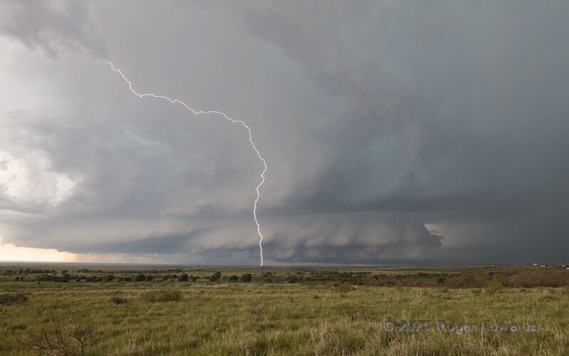
Big Supercell and Anvil CG
This broad, deep supercell formed over my head at Buc-Ee's in east Amarillo, then went hiding in terrain for awhile. It was content to make me go way out ahead and wait for it to leave the relative road void of the Palo Duro Canyon, while it charged southeastward right down said canyon unrestrained by road concerns, and while electrically bombarding the area around this spot. One among dozens of … [Read more...]
Third North Platte “Spout”
In a series of nonmesocyclonic "landspout" tornadoes from the same multicell storm's large base, this third (distant center) for-sure one was the faintest, and nowhere nearly as dusty as the second or broad as the first. Nonetheless, it sported a needle-like condensation funnel and narrow, wispy dust tube. Except for the foreground's being Platte Valley lowland on the Great Plains, this event … [Read more...]
- « Previous Page
- 1
- …
- 19
- 20
- 21
- 22
- 23
- …
- 418
- Next Page »