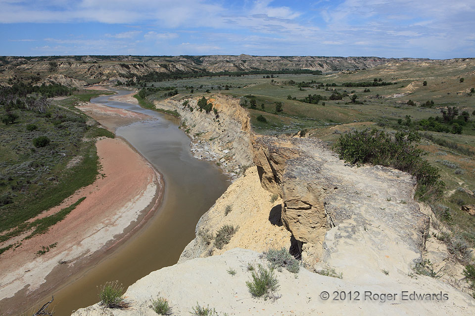
From Ice Ages to today, the Little Missouri River, and its local tributaries and gullies, have carved and carried countless megatons of loose rock, sand, clay and loess off the badlands of Theodore Roosevelt National Park. Some sediment from this marvel of the northern Great Plains helped to build Louisiana, or ended up on the seabed of Gulf of Mexico, before the big dams of the Dakotas tamed the … [Read more...]
Small, Ragged, Rotating
A high-based supercell, with skeletal yet sharp texturing, seemed more fitting over the central High Plains than the red-dirt flatlands just northwest of the Oklahoma City metro. The wall cloud at left, though narrow and scuddy, rotated steadily. This caused concern that it might produce a tornado were the circulation to tighten up any further. Instead, a surge of outflow kicked past and under … [Read more...]
Spreading Anvil Cloud
Despite the small multicellular updraft area, it was intense enough to pump copious volumes of moisture into the anvil—a cloud formation unto itself, but one that is a defining part of (and dependent upon) cumulonimbi. The small cumuli at right, beneath the NW edge of the anvil, are splendid examples of convection forming along a differential-heating boundary. We often see such cloud lines … [Read more...]

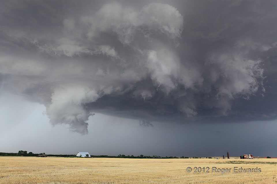
Arcus Cloud over the Flint Hills
The storm-intercept day began way up in Council Bluffs, IA, and ended east of Wichita, KS, with this beautiful skyscape. Along the way, we saw a few supercells, most heavy-precipitation in character, one with a classical rotating wall cloud, and even a flanking-line funnel. After all that afternoon action, this was an ideal way to finish the day. Atop a limestone plateau fringing the Flint … [Read more...]
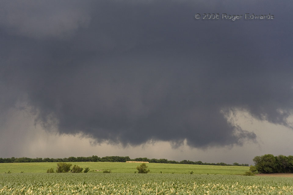
Circulation near Emporia
This storm spun out of the Flint Hills as part of a chain of mostly messy supercells, carrying with it a load of heavy precipitation and the related baggage of smaller storms dragging along its immediate rear flank. Somehow, unlike with most of several other low-level circulations we saw on this fine day of eastern Kansas storm observing, this strongly rotating and classically formed wall cloud … [Read more...]
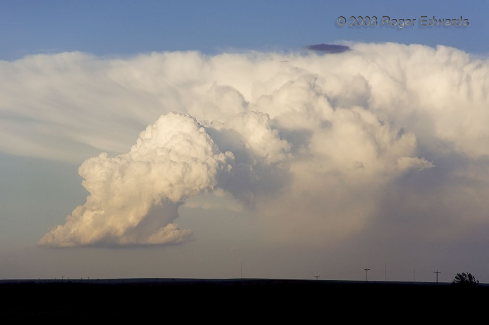
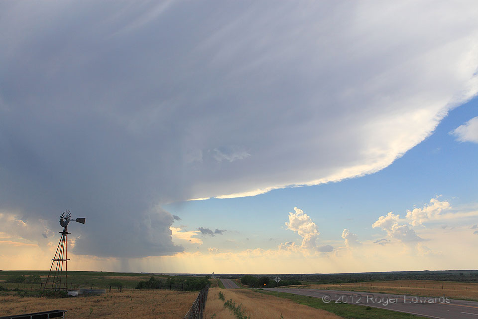
Skinny, Tilted Cb Updraft Tower
Some form of this resilient convective plume had been around for many hours, though it crawled only a few tens of miles in its entire lifespan. It began in mid-afternoon as the "Cheyenne Wells Antisupercell" and outlived a line of "landspout"-producing storms to its south. Its rear-flank core treated us to a nice double rainbow north of Kit Carson. Then we found a motel and restaurant in town, … [Read more...]
- « Previous Page
- 1
- …
- 222
- 223
- 224
- 225
- 226
- …
- 418
- Next Page »