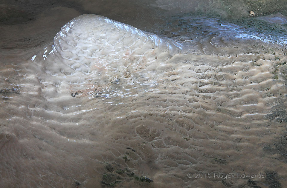
Upon disembarking at Fort Jefferson, in the Dry Tortugas, the last thing I expected to photograph was a stalagmite. Yet here it was: on the floor of the interior arched hallway, wet with the dripping of calcium-rich water from above. The drops fell from seam in the ceiling masonry, with several shallow stalactites (mostly an inch or less tall) dropping water onto this mound, which formed in the … [Read more...]
Backbuilder
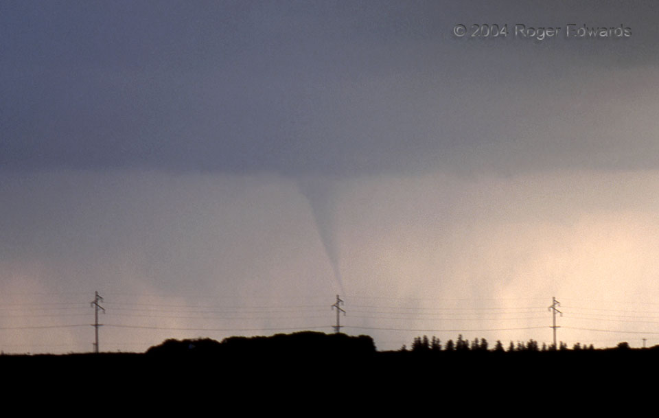
This tornado caught us somewhat by surprise. Instead of being spawned by a supercell of some sort, it developed near what was then the tail end of a squall line, as the line was "backbuilding" southwestward through constant formation of new cells. This process is called discrete propagation, and if the environment is just right (rich in boundary-layer cyclonic vorticity), can spawn such … [Read more...]
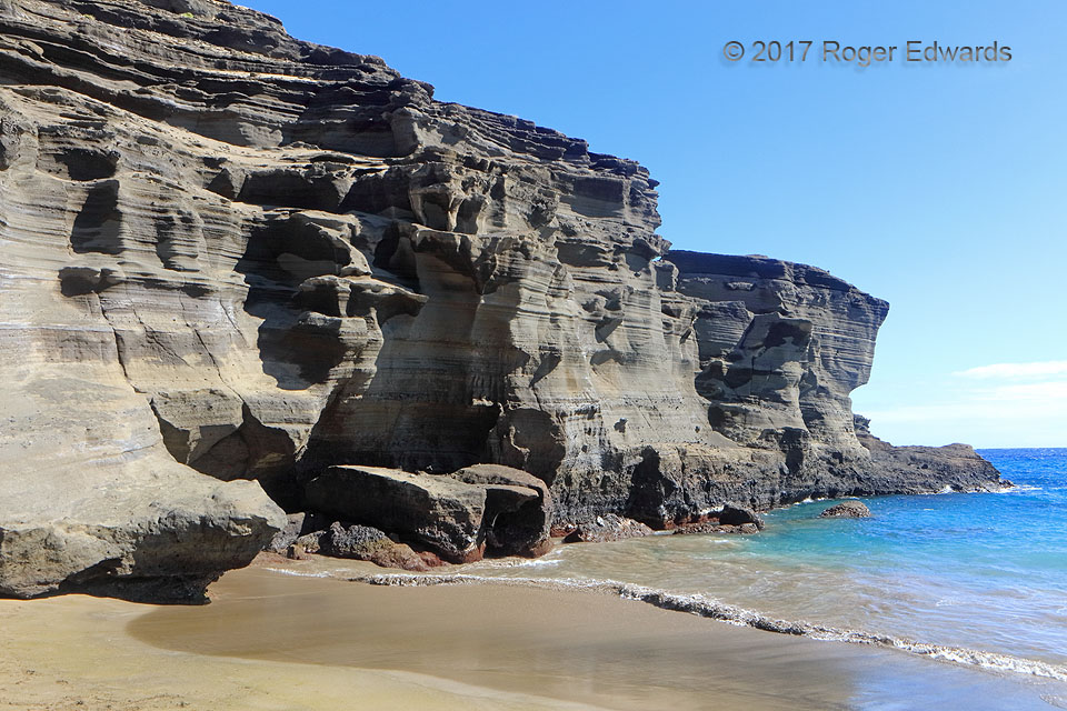
Papakolea “Green Sand” Beach Cliffs
Just a few miles northeast of the southernmost point in all U.S. states, the "green sand" beach of Papakolea is one of only four in the world. Its cliffs of loosely cemented, tuffaceous sandstone were layered by multiple events of Mauna Loa rift eruptions, and wind and water deposits of pyroclastic sediment over the last 10,000 years. Crystals of olivine, the mineral causing the greenish tint … [Read more...]
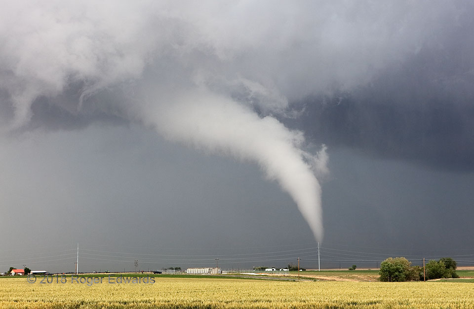
Ragged Tornado and Accessory Vortex
Before slowly elongating into its "white snake" stage, the Prospect Valley tornado exhibited some behavior that was uncommon in my experience for a tornado not rotating particularly fast above the surface. For once, the fuzzy, ragged cloud material along the near left "edge" of the visible funnel were forming in place and rising nearly vertically, connecting with the main condensation tube. This … [Read more...]
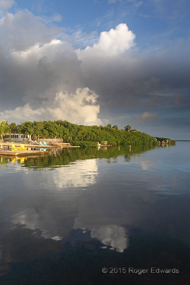
Morning in the Keys
A placid, sporadically showery morning in the lower Keys was decorated by towering cumulus clouds and a faint rainbow segment, the sky textured by a deck of smoke whose origin I never learned, at the top of the boundary layer —all of it mirrored marvelously in the rippled tidewaters of Pine Channel. The gentle wave action reflected the highest convective cloud tops in such as way that they … [Read more...]
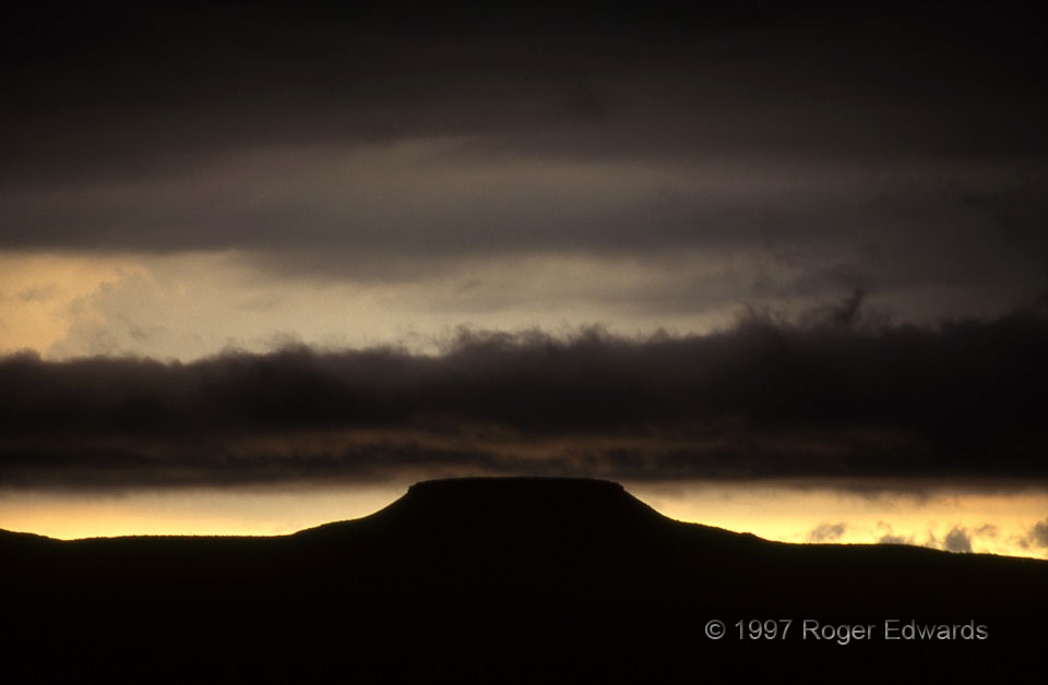
Silhouetted Stratus over a Butte
Barely clearing a southwest Texas butte "one dark and windy day", this narrow ribbon of stratus behind a thunderstorm complex was silhouetted and partially underlit by a low sun. A dark altostratus deck loomed above, "up a cloudy draw." As I beheld this scene, that old Johnny Cash tune spontaneously came back to life in my mind, right in the moment and on the spot. Eerily similar to how … [Read more...]
- « Previous Page
- 1
- …
- 221
- 222
- 223
- 224
- 225
- …
- 413
- Next Page »