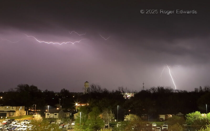
This was a good way to start my 40th year of shooting lightning, having gone full circle to less than 200 yards from the spot where I captured my first lightning photo on film. A lot has changed since 1986 on the OU campus: built, torn down, built some more. The parking garage from which I shot this didn't exist until the years began with 20. But the same atmosphere does, and the same … [Read more...]
Postcard from a Dead-End Road
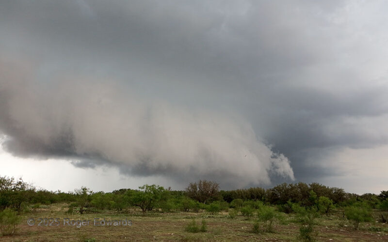
Hoping to get a closer look at a supercell that was traversing a large road void, we took a net northwesterly back road that "went through" to an eastern escape option on the maps, only to find it paved, then gravel, then dirt, then gated, chained and padlocked with a hand-painted DEAD END sign attached. Normally it's a treacherous situation to be in front of a fast-moving, outflow-dominant … [Read more...]
Wrapped and Rollin’
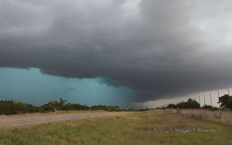
Already an outflow-driven, heavy-precip storm by the time it approached Menard, this storm enlarged, turned hard right (southeast), and became deeply rain-wrapped, appearing on radar in a form that sometimes earns the nickname "landcane" for its spiraled arms. One of those was the dense, intense precip arc seen at left, the rear-flank core, full of deep turquoise tint, large hail and strong to … [Read more...]
Herington Highlight
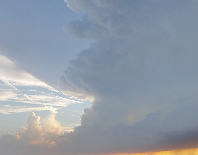
Ratcheting southwestward along a backbuilding line, we finally found the "Tail-End Charlie" convection, a supercell that was being undercut by the collective outflow from the combination of itself and downshear storms. Regardless, it made for a nice, soothing scene for a vanload of tourists and their guides in the "golden hour" of warming pre-sunset light, on the western rim of the magnificent … [Read more...]
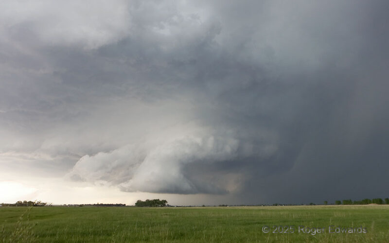
Brief but Beautiful
After producing several nonsupercellular "landspout" tornadoes, and amid a late-afternoon enlargement of low-level and deep-shear vectors in the storm's mesoscale environment, a large-based multicell complex contracted to a supercell for just a little while. Even here, at its peak structure, uniquely beautiful as all Great Plains supercells are, the storm started to undercut itself with outflow … [Read more...]
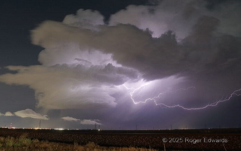
Nighttime Illuminations
Last chance to shoot a dying supercell before I get into the city! Having rolled back northwest from a long-lived storm east of Tahoka, I was tired and longing for lodging, when many flickers appeared back in the direction I was headed anyway. I took the chance to stop and hope for a few more flashes from a storm that seemed to get less active as I approached. The stop also would delay my … [Read more...]
- « Previous Page
- 1
- …
- 18
- 19
- 20
- 21
- 22
- …
- 413
- Next Page »