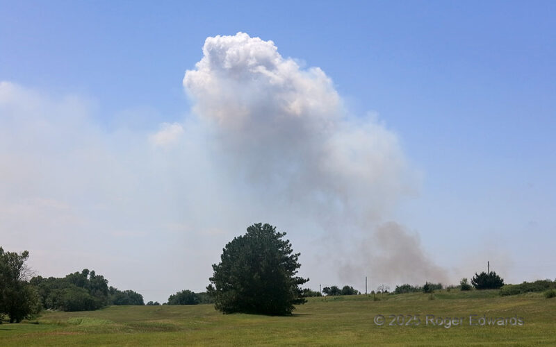
Agricultural burning, that got a little bit out of control, raised a plume of smoke in the area that I could see for about 20 minutes before stopping at about the nearest reasonably accessible view. Episodic pyrocumuli (flammagenitus) bubble over the top of the plume whenever pulses were hot and/or moist enough to raise the pyroconvective column to a condensation level, on an otherwise fairly … [Read more...]
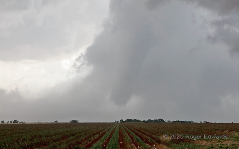
Ropesville Rope Out
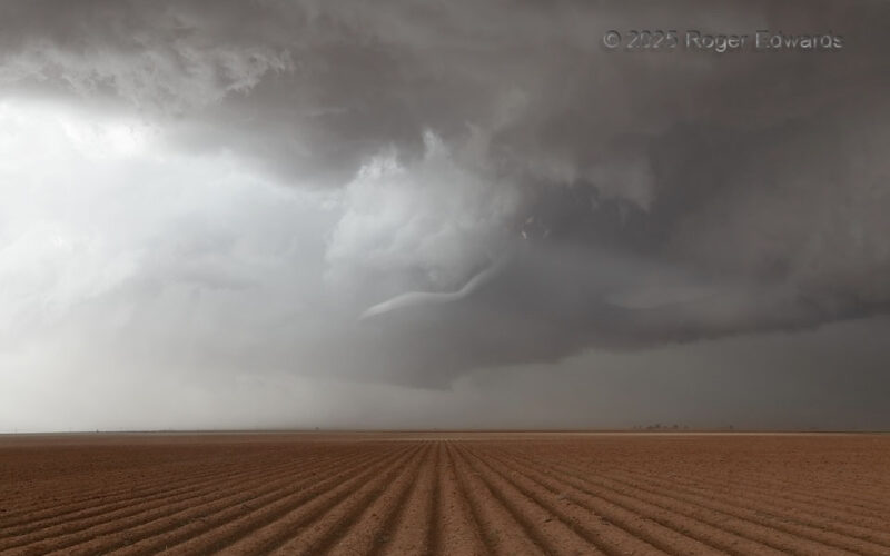
Even though this was somewhat closer to the town of Meadow, it wasn't far SW of Ropesville either. I like the latter name better, as it describes what was happening. Still raising a thin swirl of dust (clearly not over a furrowed field as in the foreground!), this dying tornado had been deeply wrapped in rain for, "I don't know how long." As has been true many times before, including earlier … [Read more...]
Tahoka Twilight
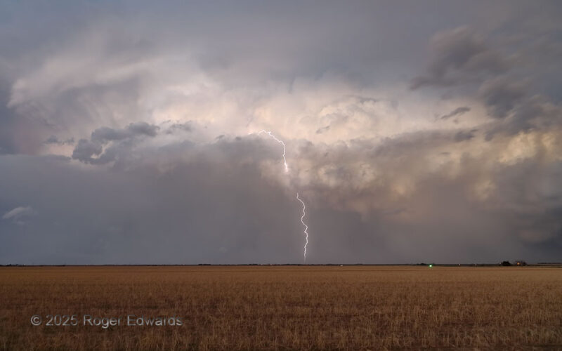
Convinced not to follow a long-lived supercell by both late time and a more-stable environment to the east of the Caprock, I watched it recede to the distance, while experiencing some of the soothing joys of a High Plains twilight: aromas of moist and rain-freshened earth, the caress of gentle breezes in cool outflow, final singing of western meadowlarks, and of course, the throbbing of light in … [Read more...]
Railay Sunrise
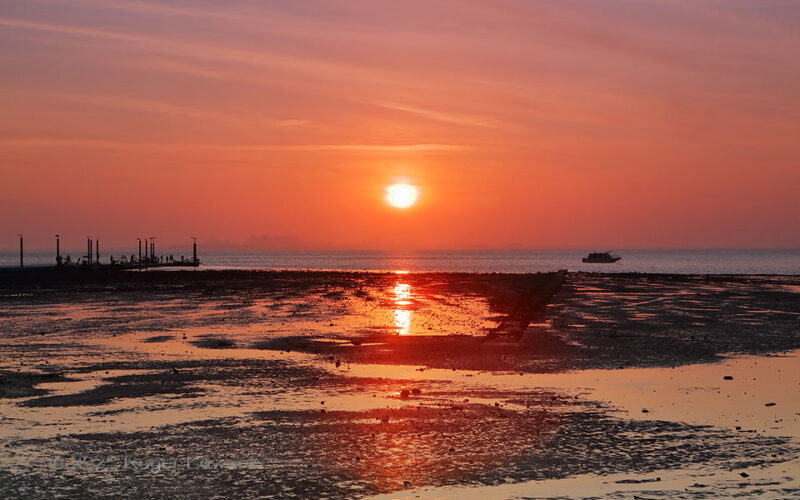
Sunrise reds diffused across the sky through haze, while at low tide, water collected in rivulets and puddles on the flats. It was a fittingly serene, peaceful and colorful setting for another casual and fair day in the deep tropics of boreal wintertime, and a rare chance to look eastward across an arm of the Indian Ocean from an extension of the Malay Peninsula (whose main reach is seen in the … [Read more...]
Emergence from Uncertainty
After the main "Beck" tornado clearly dissipated, the mesocyclone got rain-wrapped, perhaps with one more brief spinup in the process. The mesocyclone then started rotating strongly again as it lurched back southwestward from the main part of the supercell, in classic "bent back" occluded form. Based on that behavior, as I had seen several times before, I figured another tornado had formed … [Read more...]
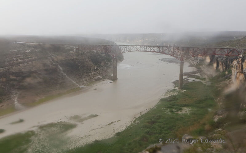
Dryland Rainstorm
A heavy-precipitation, left-moving supercell had crossed the Rio Grande from Mexico, delivering severe wind, hail and flooding rains before merging with growing convection along an old outflow boundary to its east. That resulted in a short-lived but intense little storm complex, sending heavy torrents as temporary waterfalls across the stony countryside near the Pecos High Bridge, and down the … [Read more...]
- « Previous Page
- 1
- …
- 17
- 18
- 19
- 20
- 21
- …
- 413
- Next Page »